Dale Matson

Evolution Basin is located in Eastern Fresno County CA in
Kings Canyon National Park. There are several access points to Evolution Basin.
From Fresno, I was able to make it to Evolution Lake in a single day from the
trailhead at the south end of Florence Lake. I took the first ferry of the
morning to the south end of Florence Lake. I do not recommend this 20 plus mile
hard push from Florence Lake however and most find this to be a two-day hike
with an overnight before the climb to Evolution Valley.
One can also come into the basin from the Maxon trailhead at
Courtright Reservoir but much of this will be off trail. I do not recommend the route over Piute Pass
starting at North Lake or the route over Bishop Pass starting at South Lake unless you are doing the North/South
Lake Loop. Evolution Basin is not to
be confused with Evolution Valley that consists of Evolution Meadow, McClure
Meadow and Colby Meadow.

Evolution Creek In McClure Meadow
Evolution Basin is South of Evolution Valley and about
1,500’ higher in elevation. Evolution Valley is lush and green while Evolution
Basin is above tree line with sparse vegetation. There is a seasonal ranger
station in Evolution Valley at McClure Meadow. The basin begins after about a
1.5 mile 1,000’ climb out of Evolution Meadow and ends about 6 miles further
south before the climb to Muir Pass. After Colby Meadow, the trail can be
somewhat confusing as the water flows across it from several small creeks
flowing down from the north.
The trail climbs through the woods eventually coming out in
Evolution Basin. The trail (John Muir Trail) follows the west shore of Evolution
Lake and the east shore of Sapphire Lake. There is a creek crossing at the
inlet to Evolution Lake where large stones have been placed to help cross. The
trail follows the east shore of Wanda Lake and finally, the west shore of Lake
Mcdermond. You are surrounded by mountains with an average elevation over
13,000’. They include Mts. Mendel, The Hermit, Mt. Darwin, Mt. Goddard, Mt.
Warlow and Mt. Spencer. Theodore Solomons named many of these mountains. He was
a Stanford University math professor and the main visionary for the John Muir
Trail. Mt. Solomons can be seen from Muir Pass.

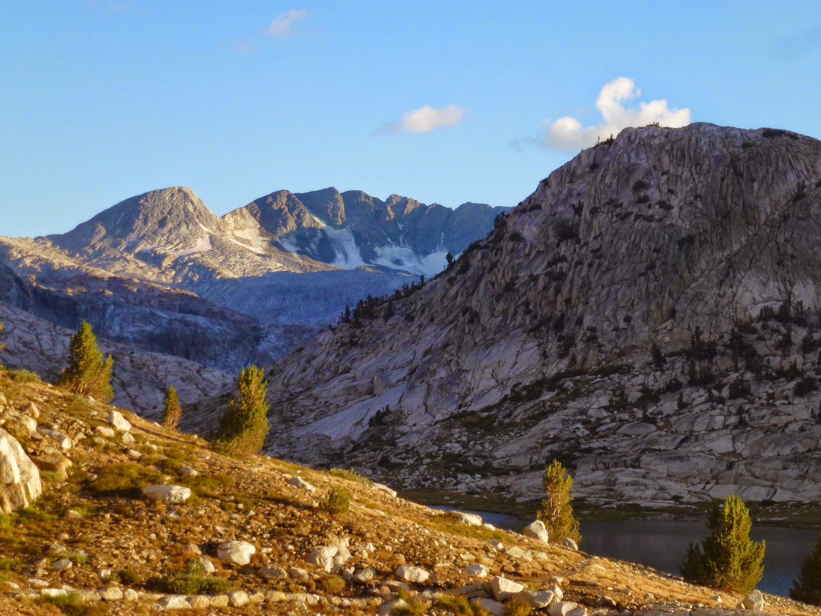
Top Of Climb To Evolution Basin


Dusk At Evolution Lake Time To Pitch My Tent


Dawn The Following Day


Wanda Lake

Telephoto Of Muir Hut From Wanda Lake


Mt Goddard


Evolution Basin Runs parallel to Humphrey’s Basin to the
north and the Ionian Basin to the South. As you head south, you pass Sapphire
Lake, Lake 11,293 and Wanda Lake (named for one of John Muir’s daughters).
Helen Lake on the south side of Muir Pass is named after Muir’s other daughter.
Wanda Lake is the headwaters of Evolution Creek. Evolution creek flows north
and eventually empties into the San Joaquin River. If you look carefully, Muir
Hut can be seen at Muir Pass as you hike along the shore of Wanda Lake. While McClure Meadow is beautiful, I believe the six or so miles of hiking in Evolution Basin is some of the most beautiful views I have ever experienced.
hiking into evolution basin via piute pass. wondering if water is accessible from streams and the san joaquin river. please advise
ReplyDeletethanks
Hi Parker,
ReplyDeleteThere is plenty of water from the North Lake trailhead over Piute Pass and into Humphreys Basin. As you leave Humphreys Basin beyond Hutchinson Meadow and you begin the steep descent to the junction with the JMT, Piute Creek is far below the trail until you are almost at the junction. This is a hot and dry exposed descent so have plenty of water for this section. Resupply below the Piute Creek bridge before you enter Kings Canyon Park. The San Joaquin River travels in a gorge below the JMT and again is not easy to access until a wooded section before a bridge crossing near the trail to Goddard Canyon. Finally, Resupply before the hot dry climb to Evolution Valley. You will eventually follow Evolution Creek and can resupply again. Water will be available except for a short stretch on the climb out of Evolution Valley to Evolution Lake. From there, water is available most of the trip. I assume you are doing a loop hike out of Bishop that will take you from North to South Lake.