Dale Matson
Click On Photographs To Enlarge

Hike Route
Rock Creek Lake is reached off CA Hwy 395 turning at the
sign that reads “Tom’s Place” between Mammoth Lakes and Bishop.
This hike was about 12 miles round trip with an overall
altitude gain of 2,760’ based on my Garmin Map 64 and Suunto Ambit 2. This is
further with more gain than other reports. It took us about 9.5 hours total but
we took lots of photos and I am slow.
Our trailhead elevation at Rock Creek Lake was 9,734’ and
our maximum elevation was 11,674’. We began just before 7am with a cool start
temperature of 32 degrees under a cloudless sky. This does not make for the
best photographs but this time of year clouds could mean an approaching
snowstorm like our previous hike to Lake Genevieve. I wasn’t sure what the
trail conditions would be like so I took micro spikes along. I realized as we
traveled that the trail was clear and hung them on the wilderness sign outbound
to pick up on our return. (Annie remembered to retrieve them for me or they
would still be there). I didn’t want the extra weight since I was already
carrying my 400mm Canon lens with an extender in case we saw some bighorn
sheep. We did see a few tracks and scat on the trail.
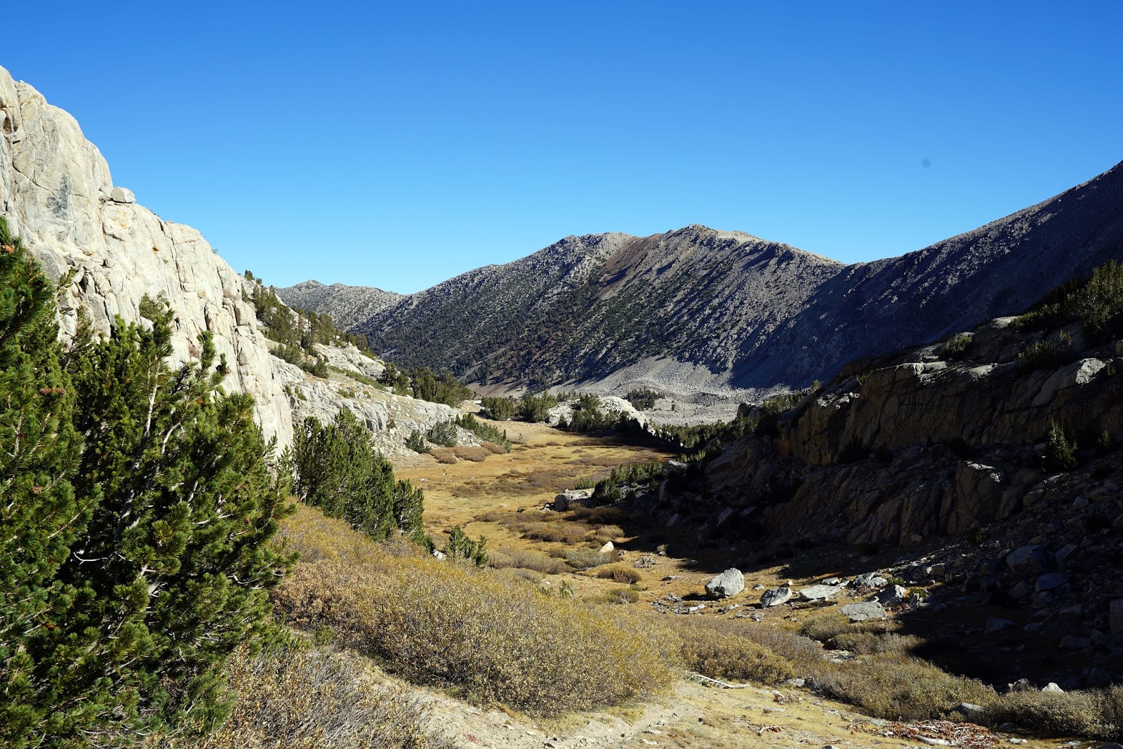
The trail is essentially easy to follow but at the junction
head toward Kenneth Lake to the right. Do
not follow the trail with the sign “Sand Canyon”. Within about 100 yards
you will see the wooden John Muir Wilderness Sign. The trail will initially take
you past Kenneth Lake. There will be another junction that heads to the right
to Francis Lake. After that you will go past the cutoff trail to the left that
will go to Dorothy Lake. After that, there is a sign marking the trail you are
on as the “Tamarack Lakes” Trail. (Tamarack and Buck Lakes).
As you hike, you will have to climb and descend several moraines,
which were a bit of a struggle for me on tired legs inbound. After crossing
these moraines, you will ascend several ledges outbound and think, “Tamarack
Lake must be here.” At that point you are hiking a trail across treeless
granite. Actually you climb above Tamarack Lake and finally descend to it. This
is a high trail with an altitude higher than some of the JMT passes like Selden
and Silver Pass and almost as high as Muir Pass. This is the summer range of
Sierra Nevada Bighorn Sheep that move to the east side of Wheeler Ridge for
their winter range.
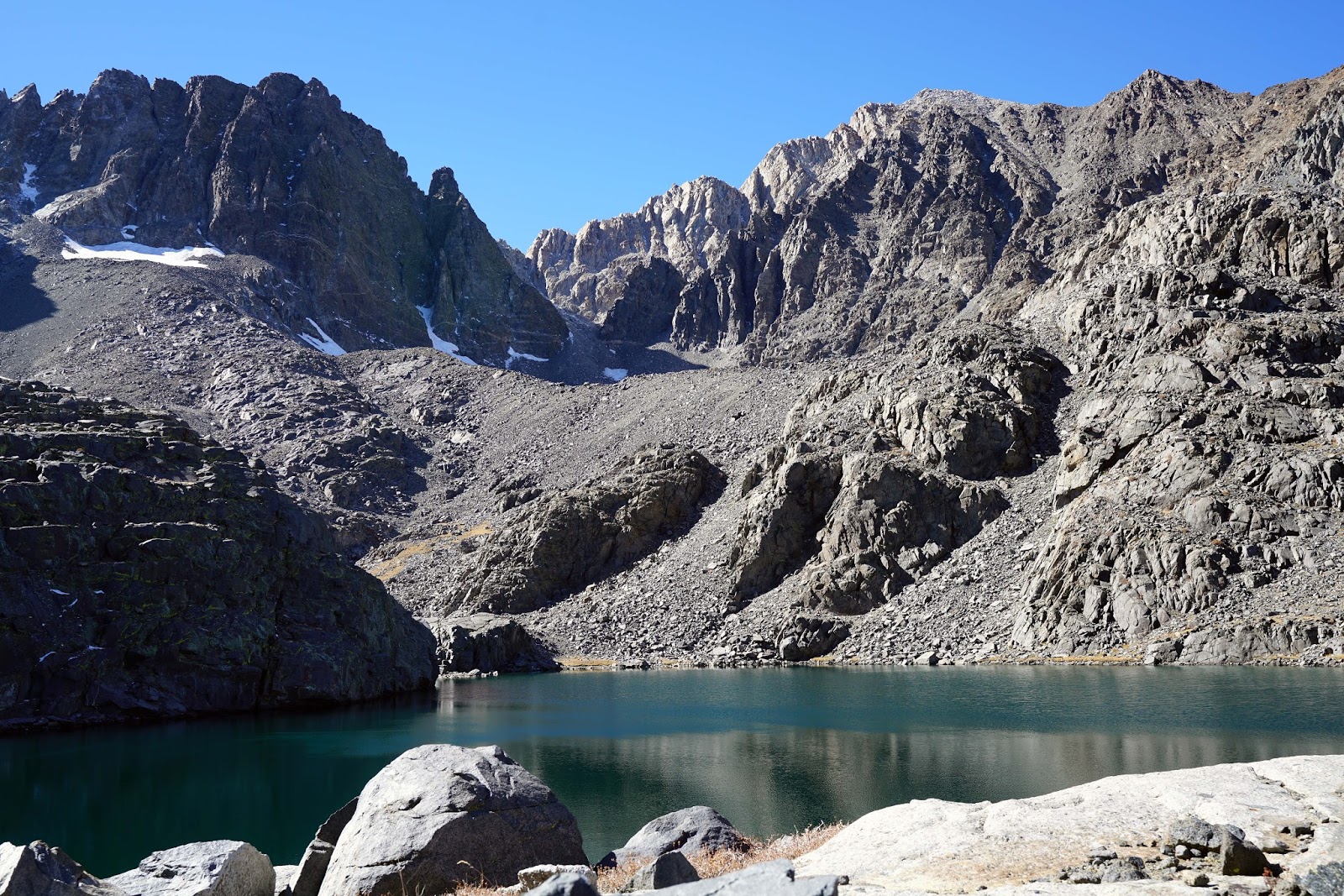
When you get to the shore facing Tamarack Lake it should be
obvious that Buck Lake is just over a ledge around to the left of Tamarack
Lake. There is no trail but staying low and with some boulder hopping you can
get to Buck Lake too. It is worth the extra effort. It is more hidden from the
sun by the surrounding mountains. Even though it is only about 25’ higher than
Tamarack Lake it was half covered in ice the day we arrived.
Both lakes are in what is called a glacial cirque, which
looks like a granite amphitheater. Broken Finger Peak behind the lakes is just
over 13,000’. There is also beautiful coloration in the rocks to the northwest.
Tamarack Lake is the headwaters of the east fork of Rock Creek. It was a
strenuous but rewarding day hike even if we didn’t see sheep.
The Photographs were taken with my Sony A7R2 and 16-35 2.8
GM and my A6000 with the S/Z 16-70mm f4.


Buck Lake


White Mountains Center Top

Kenneth Lake


Sierra Nevada Bighorn Sheep Tracks

Broken Finger Peak


Tamarack Lake


Author


Buck Lake


Sheep Scat

