Monday, April 25, 2016

Sierra Nevada Bighorn Sheep: Not So Close


Dale Matson

Click On Photographs To Enlarge

The day following my close encounter with a group of Bighorn Sheep from the Langley Herd Unit, http://midsierramusing.blogspot.com/2016/04/the-endangered-sierra-nevada-bighorn.html

I had a chance to go out with Steve Yeager, the man with more photographs of Sierra Nevada Bighorn Sheep than any other person. The CDFW uses a lot of his photographs. We headed up Pine Creek Road north of Bishop and did considerable scouting beginning with the area just above the small community of Rovana. These are the bighorn sheep from the Wheeler Ridge Unit.

This area along Pine Creek Road between Rovana and where the road ends in a parking area/trailhead below the closed tungsten mine is where sheep from the Wheeler Ridge Herd Unit can be observed during the winter. I had been along this route on two previous occasions and was able to get photographs both times although the sheep are usually high above the north side of the road.

I noticed more rock climbers parked along Pine Creek Road this time. It was a cool morning and it didn’t take Steve long to locate some sheep with his Swarovski binoculars. There were two adult ewes and two juveniles walking up the bronze colored talus. Because their coats were white, this rock color made them more visible. Most of the time the rocks are white and it is even more difficult to find them unless you notice movement.

These sheep are much further away and essentially invisible to the unaided eye. That is often the main problem with photographing bighorn sheep from a distance. If you need binoculars and/or a spotting scope, even a 600mm camera lens will not give you an up close look at the sheep. I have cropped these photographs to make the sheep appear larger. It is useful however to see the real estate surrounding these sheep. The video slideshow I uploaded to YouTube shows the sheep un-cropped using a 600mm lens. https://www.youtube.com/watch?v=1qJVVQcpFA4

We stayed there for a while and Dennis a professor at the local community college; a Rovana local, stopped his truck to talk to Steve. He has a huge telescope in his backyard and can scan the slopes for quite a distance. I had to laugh at the three dogs inside the cab with him. Dennis and Steve have “Sheep fever” and Dennis keeps daily records of sheep counts and movement.

Eventually the sheep worked their way out of sight and we went elsewhere. After scanning for about 1.5 additional hours and no further sightings, I had to leave for home.

Wildlife photography sure takes more patience than landscape photography. It always seems like the animals want to walk behind something that obscures your viewing them. The photographs were taken with a Sony A7R2 with an adapted Tamron 150-600mm lens. I have also included some mountain scenery from the same area where I photographed the bighorn sheep.


Friday, April 22, 2016

The Endangered Sierra Nevada Bighorn Sheep: Close Up


Dale Matson

Click On Photographs To Enlarge

Ewe
I have been backpacking for three years across and over Bighorn Sheep territory in the Sierra Nevada looking for sheep. I have seen tracks and scat and briefly saw two sheep on the 60 Lake Basin trail. More recently I have had three organized opportunities to photograph sheep from the Mt. Langley and Wheeler Ridge herds. Each of the last three times, on field trips with Dr. Wehausen, The CDFW and finally Steve Yeager, I have had the opportunity to see and photograph sheep.

I have been on a slow learning curve and only gradually upgraded to bigger and bigger telephoto lenses. Actually, the Tamron 150-600mm lens I now have, I bought just before heading back to the Bishop area to look for sheep again this week with Steve Yeager. Go big or go home! He is in a different league when it comes to a 6th sense about where the sheep are. He claims (and I believe him) that he can smell the sheep before he sees them. I believe this Bishop native has more Sierra Nevada Bighorn Sheep photographs than any other person. The late Galen Rowell has a wonderful photograph of a ram in the Mountain Light gallery in Bishop. He set the quality standard and it was Dr. Wehausen that took him to the place where he took the photograph.

As I was heading north on Highway 395 south of Lone Pine, I called Steve to say I was on the way. We were scheduled to look for sheep together the following morning. He told me of a location to check out near Lone Pine and I thought it would make good sense before finishing the drive to Bishop to stay for the night.

Thus began another adventure with me parking my 4X4 Silverado way too soon. I climbed on a trail for another mile but noticed lots of sheep tracks and some mountain lion tracks too. I could see sheep trails running at an angle up the steep canyon sides. Eventually, I could see human boot prints and assumed it was where Steve had begun walking up the trail. I then followed both the sheep and Steve’s tracks. He said I would come to a point where I would look to my right. I was carrying my new lens on a shoulder strap connected to the tripod collar and the climb was becoming warm.

As I looked to my right, I clearly saw a ewe standing on top of a boulder about 300 feet away. It is so different when you are alone and have such a close encounter. I had seen lots of sheep from a distance but this was qualitatively different. I slowly lifted my Sony A7R2, turned it on and took a few photographs thinking at the time, “This may be it”.  As I continued up the trail, there were more sheep, about eight or nine with one young ram a couple of juveniles and ewes.

I spent an hour taking over 100 photographs at various focal lengths. At one point I was able to kneel down and rest the heavy telephoto lens on a boulder to steady it and take the weight off my arms. The problem was that the sheep, which were less than one hundred feet from me, all began to lay down and the thick grass and brush concealed all but their heads.

I got up and took more photographs realizing how much more difficult wildlife photography is than landscape photography. The sheep were comfortable enough to actually walk toward me as they grazed. I did remember the cardinal rule which is get close and then get closer. I had a sense that the distance I had established was at the edge of their comfort zone and as I edged closer they began to move away.


It was a wonderful experience, one that for me may never again be duplicated. I was able to appreciate first hand the harsh environment in which these endangered sheep live out their existence. In summer they are in even harsher, higher and safer (from predators) elevations.  They are rugged yet fragile. I left with thankfulness and respect. I hope you will share in my enjoyment as you view the photographs.


 Juvenile Sheep
Mountain Lion Tattoo On Young Ram

There is a YouTube video here:
https://www.youtube.com/watch?v=JdMdbhOiiuk

Friday, April 15, 2016

A Day In Yosemite


Dale Matson

Click On Photographs To Enlarge


In Fresno we are two hours from Yosemite Valley and it is perhaps one of the easiest trips for us in terms of concentrated beauty. This month 20 years ago, Sharon and I were married at the base of Bridalveil Falls and since our past winter brought an average snowfall, Yosemite Valley is literally bursting forth with life as water seems to be cascading from every high altitude crevice in the surrounding granite walls.

We decided to make a day of it by hitting all the iconic locations beginning with the view from the tunnel. The sky was overcast and the photographs were rather flat and ordinary at first. Some of the photographs were taken again as we headed back out of the valley in sunlight. From there the next stop was Bridal Veil Falls. There was a man taking photographs right in the area we stood when we were married so he took a photograph of us in the same spot. The wind and spray made it seem like a driving rainstorm under the falls so we decided to come back on the way home.


We then took the shuttle bus from Half Dome Village (formerly Curry Village) to the trailhead at Happy Isles. This trailhead leads to several locations in Yosemite and is the beginning of the famous 211-mile John Muir Trail for those hiking the JMT north to south. The trail ends on top of Mt. Whitney, the highest point in the contiguous United States (It is really 10.5 miles additional miles since you have to hike down to a parking area at Whitney Portal).

Most folks only hike about .8 miles up the trail to where a bridge crosses the Merced River, taking the Mist Trail where it departs from the JMT. It is a steep climb of 600’ just to the foot of Vernal Falls from the trailhead. As you climb you can see Illilouette Falls on your far right descending to meet the Merced River. As the trail climbs to the top of the falls, the steps become wet from the heavy spray and the climb can be dangerous on the slippery stone steps. This day we went to a place we call “photography rock” off to the left of the trail just past where the Mist Trail and JMT part. It is a bit of a scramble but the large flat rock provides an excellent photographic opportunity.

After that we took the shuttle to Lower Yosemite Falls and hiked a loop trail to the lower falls. This is a popular destination even on a spring weekday. The trail to the falls is across the road from the Yosemite Lodge and there is limited parking available if you drive there.


We took the shuttle back to Half Dome Village and drove back to Bridalveil Falls for photographs in sunlight on our way home. We also stopped at the tunnel view and did the same. We always stop at the Wawona store on our way home for snacks. In another hour and a half we were back home in Fresno.


 Bridalveil Falls
 Bridalveil Creek


 Yosemite Falls

 Half Dome

 Illilouette Falls
 Vernal Falls From The Bridge

 Yosemite Falls
 Lower Yosemite Falls


   Bridalveil Falls In The Sun
Merced River Below Vernal Falls
There is a YouTube Video of this with additional graphics here:
https://www.youtube.com/watch?v=R7I8PyIW16U

Tuesday, April 12, 2016

The Sony RXIR And The San Joaquin River


Dale Matson

Click On Photographs To Enlarge
Sony RX1R
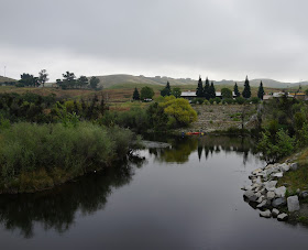
Fresno California area residents are blessed to have the one half million acre-feet capacity Millerton Lake only 15 miles away. It has over 40 miles of shoreline. We are also fortunate to have the San Joaquin River that is the source of Millerton Lake, continue to flow below the dam and through Fresno on its way to the Pacific Ocean.

There are running, walking and mountain biking trails in Woodward Park that run along beside the San Joaquin. With the river comes the wildlife also including coyotes, bobcats, deer and an occasional mountain lion.

I was eager to try out my new (used) Sony RX1R. It was back to a fixed lens 35mm f2.0 camera and some of the shots were cropped to enlarge certain features. The shots, while reduced in size for uploading and occasionally cropped have had little retouching in Photoshop. An ounce counter such as me appreciates the one-pound full frame camera and it will be a great addition to my backpacking gear as a back up camera to my Sony A7R2. The lens also has a macro feature, which I will probably use infrequently in landscape photography.

I wanted to get some photographs near the outlet to the dam. The water is released from the lake in three directions. Some irrigation water heads south in the 152-mile long Friant-Kern Canal. Some irrigation water heads north in the 36-mile Madera Canal and the remainder of the released water goes back into the San Joaquin River. It is hoped that enough water will reenter the San Joaquin to restore Salmon habitation.

Today as I was photographing the area below Friant Dam, I saw four Kayakers putting in below a parking area in Friant. I later learned they were coming out at the “Sportsman’s Club” where they must have placed return transportation. My wife and I have ‘floated’ the section from Lost Lake to the Sportsman’s Club, which is just north of Fresno.

Not long after the San Joaquin begins its flow again below Friant Dam, it widens out and forms what is referred to as “Lost Lake”. The County of Fresno has a park there with an entry fee of $5.00. It is well maintained and heavily used on the weekends and evenings. There are plenty of fishermen, picnickers, and folks wading in the cold river water. Because the water is released from the bottom of the dam, Millerton Lake is actually warmer than Lost Lake.

At the end of the parking area at Lost Lake, there is a nature trail that runs alongside the river as it heads west. The trail is roughly .75 miles outbound and there are opportunities to walk to the river away from the trail. As I walked it today I was impressed with the vast amount of wildlife supported by the river ecosystem. There was some evidence of urban graffiti that I chose to ignore. This being a Monday morning, I had the trail to myself and enjoyed another section of the San Joaquin River, which is an artery that brings life to an arid area and agriculture to the Central Valley.   

 Kayakers Putting In The River In Friant
 Friant Dam


 Hawk In Center Of Picture
 Orchards Above On The Madera County Side Of The River
 Picnic Area
 Duck Trail In Water


 Seasonal Lupine On Hill Above
 We Usually Put Our Kayaks In Below This Rapids

Hike Route


 Here They Are Again

 Look Alert! He's Waiting To Cull The Weak And Injured

On Its Way To The Ocean