Friday, September 16, 2016

20 Lakes Basin


Dale Matson

Click On Photographs To Enlarge

Hike Route

As you drive east through the east gate of Yosemite on Highway 120 (Tioga Pass Road) a few things catch your eyes. There is the steep 11 mile 3,000 plus foot descent to Highway 395. On your right there are two lovely lakes, Tioga Lake and Ellery Lake below it. You can also see Mount Dana on your right (13,061’).

Between Tioga and Ellery Lakes on the north side of the road, there is a sign for Saddlebag Lake. As you glance to the north (don’t take your eyes off the road too long) there are snow-clad mountains that beckon. After 25 years of passing up the opportunity, I made my left turn, drove the slow 4.5 miles to the Saddlebag Trailhead parking area and walked down to the store area to purchase my $15.00 round trip ticket on the pontoon boat water taxi. http://www.saddlebaglakeresort.com/amenities.html

While there is a trail on both sides of the lake, the actual 20 Lakes Basin 6 mile Loop trail starts at the north end of Saddlebag Lake. One can hike the loop trail clockwise or counter clockwise. Most folks opt for the ferry to save 3 miles round trip.

The seasonal ferry runs on a regular basis and you designate a return time when you buy your ticket. I didn’t get started until 11:30am because I couldn’t leave Fresno until 7 am. If you don’t have a map, you can get a hand drawn map from the store for free.

The second issue for me besides the late start was the fact that I also wanted to hike to Conness Lake (not a part of the loop trail), which is accessed by a use trail and has a moderate climb. The reason for the side trip was a photograph I had seen of the lake with beautiful green water caused by glacial melt from the Conness Glacier below Mount Conness. You simply climb following the outlet stream to the first lake. Therefore, I only had time to climb to the first Conness Lake and then hike the west side of the loop trail before taking the final water taxi back to the south end of Saddlebag Lake.

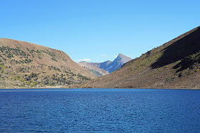
As you head back on the water taxi, there is an excellent view of Mt. Dana from the lake. I would like to go back a second time and hike the east side of the loop and look down into Lundy Canyon. On my hike, I was able to see and photograph Saddlebag, Greenstone, Conness, Wasco and Steelhead lakes. Fellow travelers included backpackers, fishermen and other day hikers.

 Wasco Lake
 Conness Lake
 Conness Lake
 Mount Dana
 Saddlebag Lake Looking Northwest

 Use Trail To Conness Lake
 Conness Lake
 Conness Lake
 Greenstone Lake
 70mm 

 Greenstone lake

 Southern End Steelhead Lake
 Steelhead Lake Looking North


I highly recommend this day hike and an early start including the water taxi should allow one to hike the entire loop in a day. I published a book on Alpine Basins which did not include 20 Lakes Basin but I believe the per mile beauty of this basin hike is as good as any basins I have hiked. https://www.amazon.com/Introduction-Alpine-Basins-Central-Sierra/dp/151768482X

Additionally it doesn’t require going over a high pass to get there. It seems like each trip to the eastern Sierra Nevada provides at least two more reasons to return.


Tuesday, September 13, 2016

The Mono Lake Committee Field Seminar On Sierra Nevada Bighorn Sheep 09/10-09/11 2016


Dale Matson

Click On Photographs To Enlarge
Sierra Nevada Bighorn Sheep Mt. Gibbs Herd Unit

I had the opportunity and honor to attend the two day field seminar on the endangered Sierra Nevada Bighorn Sheep hosted by the Mono Lake Committee http://www.monolake.org/mlc/mlc and promoted by the Sierra Nevada Bighorn Sheep Foundation. http://sierrabighorn.org/

The $165.00 fee was a bargain and I told our instructor Dr. John Wehausen that I would have paid that much if we had only a one-day experience. We couldn’t locate any sheep on day two but had excellent hiking, good instruction and beautiful settings in Lundy Canyon and Virginia Lakes.

I believe it is safe to say that John Wehausen has contributed more to the successful reestablishment of the SNBS than any other person. He has been involved with the bighorn sheep for over 40 years and helped get the sheep included as an endangered species. It was Dr. Wehausen who identified the Sierra Nevada Bighorn Sheep as a distinct subspecies of bighorn sheep with 250 sheep in three remaining herds in 1978. There were only 115 sheep remaining by 1995. In 1999 the Sierra Nevada Bighorn Sheep were listed as endangered. Dr. Wehausen contributed to the recovery plan released in 2007. Since that time additional herd units have been established in their traditional Sierra Nevada range with about 600 sheep by 2014.

This was a rigorous field trip with fast paced hiking on and off trail at high altitude. The 15 or so participants received instruction in various locations along the trail with our highest ‘classroom’ on the southwest slope of Mt. Gibbs (above Mono Pass) at 11,000’. Dr. Wehausen had used radio collar telemetry to determine approximately where the sheep were and we climbed off trail to get a closer look. Having the opportunity to once again see the bighorn sheep (in this case about 11 ewes and lambs) was the best treatment for those of us who suffer from recurring “bighorn fever”.

As an advocate for the sheep, I can understand why the biggest impediment to support is that the sheep are essentially invisible. This is an important defense for them but being invisible is not helpful in raising awareness. Probably the single most helpful thing that can be done for the sheep is more individuals becoming aware of and knowledgeable about their existence. Increased awareness is one of the main goals of the Sierra Nevada Bighorn Sheep Foundation.

The sheep seem to like living near beautiful views since the search for them includes exquisite scenery. It was good weather and an impressive group of supporters with whom to associate. Kudos to board member Dr. Virginia Chadwick in her usual role as expediter, Dr. Wehausen for his exhaustive knowledge about the sheep and their ecological niche and to Andrew Youssef from the Mono Lake Committee who accompanied us on the first day.


 Initial Session With Distinctions Made Between Sierra Nevada and Desert Bighorns
 Regrouping At Mono Pass Trailhead
 Instruction Along The Trail


 "Higher Education" (11,000')


 Summit Lake Mono Pass


Blue Lake (Virginia Lakes)
Lundy Lake Lundy Canyon
Evening Rain Over Mono Lake
Mono Basin Visitor's Center

Friday, September 2, 2016

Tenaya Lake To Curry Village


Dale Matson

Click On Photographs To Enlarge
My Run Route

I was watching a YouTube video of folks who went from Tenaya Lake to Cloud’s Rest and Back. It is the fastest route (14miles) to Cloud’s Rest and one of the best vantage points in Yosemite. The video can be seen here: https://www.youtube.com/watch?v=N5qLVlSzaQ0

I have an older video of the hike I made to Cloud’s Rest from Happy Isles in Yosemite Valley. It is much longer: https://www.youtube.com/watch?v=uprTC3kfsHA

My wife and I tried the route to Cloud’s Rest from Tenaya Lake and both of us were too concerned about crossing the narrow knife-edge approach to get to the wider top in 2006. We turned around defeated only a 100' away.

A year later I investigated taking a Yosemite shuttle bus from Curry Village to Tenaya Lake and running the 17 miles back to Curry Village, which is mostly downhill. On paper it is less labor intensive than hiking to Cloud’s Rest and Back from Happy Isles, which is 4 miles further and 1,000’ higher than Half Dome and back from Happy Isles.

I have even done a more difficult out and back to Cloud’s Rest from Glacier Point. The Panorama trail takes you down to a crossing at Illilouette Creek and then you have to climb back up to join the trail at Nevada Falls. It is a long and exposed climb back up to Glacier Point from the bridge crossing on Illilouette Creek on the return leg.

I talked two of my running friends Terry Nephew and Dan Greer into doing it with me but they opted to take the route that would require them to go over Cloud’s Rest. Both were better runners than me. Terry finished 23rd overall in his first attempt at the Western States 100 mile endurance run. Dan was sub 40:00 10K runner. I knew my limitations from my experience the year before and took the fork in the trail that would join the John Muir Trail heading south from the Sunrise High Sierra Camp. This way I could avoid the narrow ridge leading to the top of Cloud’s Rest by going around it.

We drove to Yosemite that morning from Fresno and bought our tickets for the first shuttle out of the valley that would take us to our starting point by the southwest shore of Tenaya Lake.

We stayed pretty much together till the split in the trail and I was not sure at what point I would see them again or if I would just meet up with them at my truck.
As it turns out we arrived at Nevada Falls at the same time.

The cream always rises to the top and Terry was out of sight within a mile. Dan and I were together for a time and then he eventually pulled out of sight too. We met at the truck and drove back to Fresno with a brief stop for snacks at the Wawona Store. It was one of those runs that seems like it would be difficult but I believe the trail time proved to be fairly reasonable.

 Half Dome From Olmstead Point
 Cloud's Rest From Olmstead Point


 Pond Along The Trail


 Me Nine Years Ago Age 63
 The American River 50 Tee Shirt


 Dan (L) and Terry Look Tired
 Until The Camera Comes Up
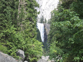
 Nevada Falls


 Large Buck In Curry Village Parking Area