Dale Matson
Click on Photographs To Enlarge
I honored a commitment to drop of a couple of friends at the Taboose Pass Trailhead. They were headed out on a big cross-country trip. You would think that after hiking to Taboose Pass last year I would know better than to drive to the trailhead a second time. The four miles from Highway 395 to the trailhead takes almost an hour one way. This is the worst “road” I have driven in California.
While in the area, my wife and I decided on a day hike from Glacier Lodge Road just north of there out of Big Pine. The route to the trailhead begins as W. Crocker Ave out of Big Pine and quickly becomes Glacier Lodge Road ending about 11 miles further. The hike is in the John Muir Wilderness in the Inyo National Forest. The original Lodge burned down in the 1980’s but cabins and tent cabins remain along with campgrounds along the way. The famous mountaineer Norman Clyde once ran the Lodge at one time.
We made a mistake and parked too far from the end of the road, which meant way too much additional hiking. We parked in the trailhead parking but it is mainly for backpackers, not day hikers. We could have driven much further up the road and begun from that point (see map). I think there may be a small parking charge.
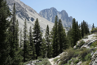
We began our hike at 10:30 am, which was too late and too hot on a mostly exposed trail, to reach the first lake on the north branch trail of Big Pine Creek. We had a turn around time of 3 hours because we had to be back to Fresno (through Yosemite) the same day. I believe with an early start, it could be a tremendous day hike reaching the 3rd lake with a turn around early enough to get down for dinner and a stay-over in Bishop that evening (or Lone Pine if you are headed south).
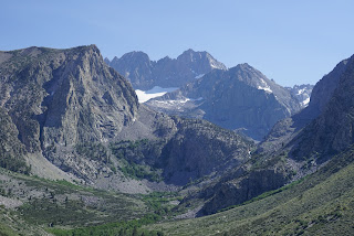
The best view for us was down the south fork of Big Pine Creek before you go around the bend that will take you along the north fork. When you look south you can see the Middle Palisade (14,012’) elevation and it’s glacier.
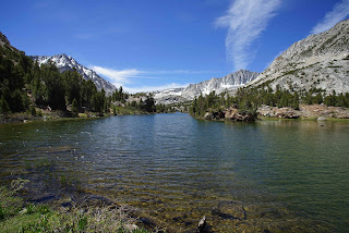
The trail stays on the north side of the creek as it passes 2nd falls. Further on there is a ranger cabin with a nice spot to get wet in the river in front of the cabin. We turned around before 1st lake but had a preliminary view of Temple Crag.
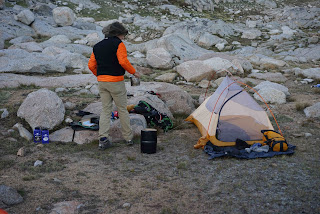
If you had a wilderness permit for an overnight, perhaps a campsite at first lake and some day hiking before packing up and heading back down (or a longer stay).
It seems odd that last week, when I was with friends in Dusy Basin, I was only about 5 miles as the crow flies from where we hiked yesterday. The air yesterday was hazy for quality photographs because of several fires that are burning near Oakhurst, Bass Lake and elsewhere. I found my Sony G 70-200mm F4 to be my most useful lens for this hike.


