Translate

Monday, February 27, 2017

Water Search And Rescue Training At Millerton Lake


Dale Matson

Click On Photographs To Enlarge


Well, I headed to Millerton Lake today for another opportunity to photograph eagles and other birds. This is an unintended story of photographing another kind of “bird”.
I was up by the Historic Millerton Lake Courthouse when a giant orange and white helicopter from the Lemoore Naval Air Station began to hover above what initially looked like a boat full of fishermen. I thought at the time that someone was in trouble and they were there to help.
As it turned out it was the Navy Search And Rescue team practicing water extraction with the boat group as a part of the team. It seemed like a good opportunity to take some photographs with the lens I usually use for birds.
As someone retired from the Fresno County Search And Rescue Mountaineering Unit, I was quite interested in the process and of course disappointed that this activity was for much younger men than me. We swim 6 months out of the year at Millerton Lake and I can appreciate the fact that the water temperature was about 55 degrees.
I guessed they might be done around noon and saw the helicopter land on the former dam parking area. Their truck and boat trailer was up at the top of the boat ramp so I knew the group in the boat would be coming up from that direction.
I drove down to the dock area and greeted the men and told them that I had photographed them and would it be OK to put the photographs on my blog. I nervously laughed when they said that now that I had photographs, they would have to kill me. Actually the thought had already crossed my mind thinking they might be members of a secret SEAL team practicing. I also offered them copies of the photographs and I got contact information from Zachary.
They don’t just serve as a Search and Rescue team for Naval operations. They are involved in rescues statewide. I remember them being at one of our Fresno County searches near Wishon Reservoir. Zach mentioned they had airlifted an injured firefighter out of there more recently.

Thanks men, I enjoyed watching the practice, display of teamwork and skills and hopefully many more will now enjoy it via the photographs. 


Saturday, February 25, 2017

Sierra Nevada Bighorn Sheep And The Eastern Sierra Landscape Winter 2017


Dale Matson

Click On Photographs To Enlarge

Four Rams Cropped

Sharon and I headed to the east side of the snow-laden Sierra Nevada for some winter scenery and possible SNBS photographs. We had a two-day break in the weather and while cold and windy near Bishop CA, the air was clear and weather good. I must say that I get as excited each time at the prospect of seeing Sierra Bighorn sheep as the very first time. I think those of the SNBS Foundation all suffer from sheep fever.
Dr. John Wehausen, Dr. Virginia Chadwick and the CDFW had a field trip scheduled for Friday the 23rd of February so Sharon and I headed over Thursday after noon for an overnight in Bishop.
After taking our winter Trans Sierra Nevada route over Tehachapi, we stopped occasionally for photographs and had a long stay southwest of Aberdeen looking in vain for sheep. Finding these sheep is for younger more experienced eyes than ours.
Steve Yeager (AKA “The sheep whisperer”) and I arranged to meet at his place early Friday morning for coffee. Our two Sharon’s chatted also. Then we headed up Pine Creek Road to look for sheep. The field trip group was meeting nearby north of Rovana later. Steve was able to spot a group of about 6 Ewes and a juvenile and young ram. There was also a more mature ram to the left by himself. All the sheep seemed disturbed by something and kept moving which made it harder to keep track in the rocks and boulders.
Sharon and I and Steve then went over to the field trip group. They had receivers to locate some of the sheep they were viewing however the sheep were too far for me to get good photographs. Most folks were looking through spotting scopes. Steve and a friend walked in a ways and Steve recovered a game camera to review. There were three dead mule deer that had been killed by mountain lions. They loaded one on the friend’s truck to take to the CDFW for an autopsy.
It was getting toward afternoon and Sharon and I wanted to try once more by Aberdeen on the way home. Steve told us friends of his, McKenzie and Mark were on site viewing sheep so we didn’t stop for lunch and headed directly there. Sure enough, they were still there and we drove directly to where they had parked. They located two groups of sheep for us that were the closest we had come across in the two days. One group was a large group of Ewes with juveniles who were mixed in with mule deer. We had seen and photographed this large group of mule deer the day before when we were there.
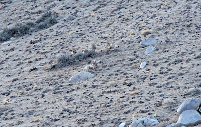
The second group consisted in four rams that were feeding as they worked their way up a long open slope to our left. Mark and McKenzie who work for the Rock Creek Pack Station in Bishop, had to leave and Mark told us the rams had gotten along up to the crest of the slope. We had enough photographs of the ewes and drove about a half mile to where Sharon thought we might be directly below them. She spotted them bedded down in a large patch of grass and boulders and we spent the next hour photographing them. The sun began to set which is earlier in the shadow of the Sierra. As the light began to fade, the temperature began to drop and we decided it was time to leave.
We had a lunch/dinner in Lone Pine in a nice place with lots of photographs of Western Movie stars who had filmed in the Alabama Hills nearby. We had one more stop for fuel in Tehachapi and pulled in the driveway in Fresno at 9pm. Needless to say we had to download the 300 or so photographs to my computer and view them before bedtime. It was once again, a special experience to spend time with friends and to view both the sheep and the wonderful eastern Sierra Nevada Mountains. I used a Sony A7R2 and Zeiss Batis 85mm 1.8 lens for the landscape photographs. I used my Sony with an adapted Canon 400mm f4 lens with a 1.4X extender (580mm) for the sheep.       


Pine Creek Road
Follow The Leader
Sheep With Mule Deer On Far Right

Solitary Ram Center Pine Creek Road
Rams Working Their Way Up The Hill. I Don't Know Where The 4th Ram Came From

 L to R Mt. Humphreys, Basin, Tom
 Mt. Tom
 Mt. Williamson 2nd Highest In The Sierra Nevada
 Near Aberdeen CA
 White Mountains From The Sierra Slopes
Mt Whitney Center Right Lone Pine Peak Left Of Center

Sunday, February 19, 2017

Millerton Lake Bald Eagle Tours


Dale Matson

Click On Photographs To Enlarge

Note: These trips will only be available until March 12th. They are scheduled for Saturday and Sunday mornings at 8am by reservation. (559) 822-2332 Ext. #104 http://www.parks.ca.gov/millertonlake It is $20.00 per person and about 4 hours.
Sharon and I had the privilege and pleasure to take the Bald Eagle boat tour yesterday morning. I have taken several eagle photographs from places along the shore but this is the first opportunity to see them near their nests. My GPS watch had the total out and back distance at about 20 miles. Because it was a small group yesterday, we took the smaller boat.
We met at 8am in the historic Millerton Courthouse and viewed a one-hour video on the history of the restoration of the bald eagle population and the migratory flight path that takes them from Millerton Lake to as far away as Great Slave Lake in the Canadian Northwest Territories for the summer. Most of Millerton Lake eagles are migratory and have established “Housekeeping Nests”. There are two pair of bald eagles that are year round residents and breed their young at Millerton Lake. We were able to see two breeding nests. There is also a pair of resident Golden Eagles.
It was not just the opportunity to see eagles, ospreys, hawks and other water birds; we were able to see locations far ‘upstream’ past Finegold Creek, Big Bend nearly to the Temperance Flat area. This is the proposed spot for a new larger reservoir upstream from Millerton Lake. We had close up views of the ancient McKenzie Table Mountain and Big Table Mountain. The tabletop area high above us is the original level of San Joaquin River bed.
We could also see some of the route of the San Joaquin River Trail along the shore. When this trail is completed, it will be almost 100 miles long terminating in the High Sierra, which is the source of the San Joaquin River’s three branches. I have mountain biked the 15 mile section from the Finegold Day Use Area at the end of Sky Harbor Road to the San Joaquin River Gorge recreation area.
We were forced to turn back as the increasing amount of floating debris from the shore became too hazardous. The debris was a result of record rainfall and the lake rising.
Mike Smith our knowledgeable and experienced tour guide and our helmsman Sgt. Steve both did wonderful jobs navigating through the debris and the history of the eagles and of the area. Steve even brought us hot chocolate at one of the Millerton Lake floating ‘pit stops’. Although we were close enough to see the birds with unaided eyes, my photographs with a 400mm lens were a bit small. I recommend at least 8 power binoculars to enhance the view.


 Hawk Courtship


 Osprey

 Eagle Nest
 Trail Along Lake


 Finegold Creek Junction

 2nd Eagle Nest
 Eagle To Right Of Nest
 Runoff Debris
 San Joaquin River Trail
 Table Top Mountain


 Hawks
 Pincushion Mountain With A Hiker On Top

 Sgt. Steve At The Helm
 Mike Smith 
 Courthouse And Dam At Return
Osprey