Dale Matson
Click On Images To Englarge
The trailhead to Nellie Lake is at the west end of
Huntington Lake out of the Billy Creek Campground. There are not potties at the
trailhead. At this point, Huntington Lake Road is called Big Creek Road. The
hike is about 10 miles round trip with most of the 2,000’ of elevation gain
outbound. Think of the hike to the Nellie Lake in thirds*. The first third is
1,000’ of gain. The second third is mostly flat with some rollers. The final
third is another 1,000’ of gain. The final short section is a drop to the lake.The lake elevation is approximately 8,900’For additional information I have previous postings here: http://midsierramusing.blogspot.com/2014/05/day-hike-to-nellie-lake.html
The
trail was uncluttered and free of bugs, snow and deadfalls. However, I would recommend that you include insect repellent in
your daypack. It is better to have it and not need it. This year there were
still two seasonal creeks to cross that also could be a source of water
resupply if purified. There is also the lake as a water source. Sharon and I
each drank a liter and a half of water on a day with a high of 75 degrees. The
hike duration was 6 hours of hike time with one half hour of lunch break at the
lake. Younger/fitter hikers will hike much faster.
The
photographs are similar to previous years but this year I used the Zeiss Batis
18mm 2.8 and Batis 85mm 1.8. I think these are my best photographs of the same
things over the last three years.
As
Sharon and I were taking a lunch break, Terry Miller and his dog arrived and we
chatted for a time. He has a cabin near Huntington Lake. He is a couple of
years older than me but started hiking over an hour after we did and arrived
only 15 minutes after we did. He caught up with us on the return leg and seemed
to know about as much as Sharon about the wildflowers along the way. *He also showed us a village area that had
been used by Native Americans just west of the trail before we arrived at the
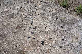
Mary’s Meadow trail junction. It is waypoint #3. There were pieces of obsidian
scattered about which are not native to the area. The obsidian was brought over
Mono Pass from the east side of the Sierra Nevada by the Native Americans and
used to make arrow and spear heads. There were also several Mountain Mule Ear
plants used by the Native Americans as medicine. If you find this area I would
ask that you respect the sanctity and history of the site.
I
was amazed that I had hiked past this ancient village site for the last 20
years and not known that it was there. There is a creek that flows southward on
the west side of the village site. It is near but quite a bit below the site.
There are boulders with several holes where the acorns were ground for food.
* Terry said we could include his
hike description and the whereabouts of the encampment if we gave him credit.
He has been hiking in this area since he was a boy.
Map At Trailhead
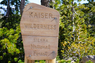
New Signs This Year
Snowpack Measurement Site
Trail Marker
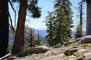
Sierra View Above Trail On West Side Looking South
Terry Back At His Cabin


