Translate

Thursday, June 19, 2014

A Race Vest As A Day Pack

 Dale Matson

Fluid Race VestPack by Mountain Hardwear

Author with VestPack At Devil's Bathtub
Ansel Adams Wilderness

Mountain Hardwear has a couple of lightweight vests that it has introduced for trail running. I am always looking for clothing with lots of pockets…especially zippered pockets, which are more secure. Although I am a retired trail runner, I am an avid mountain day hiker and photographer. My biggest concern as someone who of necessity often hikes alone is personal safety. It is only too easy for day hikes to accidently become an overnight and that is why the list of ten essentials was constructed. As a volunteer member of our Fresno County search and rescue team, most of our searches involve lost day hikers.

Although the “VestPack” is marketed as a race item, I think it is also a useful as daypack with its large 6-liter zippered pouch on the back that could easily accommodate the essentials of a day hike. It is lightweight at 8.8 ounces (M/L). The heaviest item in a daypack is usually extra water but where I hike in the Sierras, there is plenty of water available that can be treated or filtered.

Perhaps the primary feature of this vest/pack is the versatility. There are plenty of pockets (I count 6 pockets on the front (3 zippered) and a large zippered pouch on the back. There is a zippered mesh pouch inside of the back pouch. You can load it with your particulars and most of the weight is in the items not the pack. It also does a better job of weight distribution than a fanny pack with less storage capacity. It also has a mini haul strap at the top on the back. Think, “Quick access”.

I have used this vest/pack on two; day hikes that lasted over 6 hours each with no problems with the shoulder straps or heat build up from the extra layer. For what it is worth, I carried a hooded rain jacket, Satellite Phone, headlamp, orange flagging tape, and a compass in the back pocket. In the right front area I had bug spray in the zippered pouch and energy bars and gels in the larger pouch. In the left front, I had a map and glasses in the zippered pouch and a pocket zoom camera in the bigger pouch. My keys were in the top right zippered pocket.

The large pouch was made to accommodate a bladder but I am not a fan of the leaky bladder concept. Bottles could be also accommodated in the back of the pack as I have described it but I have a different arrangement in addition. First, I use a utility belt that accommodates a larger camera, filter water bottle and GPS (Yes, I am a belt and suspender kind of person). My cargo shorts are also great for hikes since they also have 7 pockets. You simply can’t have too many pockets if you also have a good memory. You can read more about the vest/pack here:

Wednesday, June 18, 2014

Edison Lake CA Loop Hike


Dale Matson

Loop Begins At East End Of Edison Lake

Sometimes I get these ambitious ideas about what can be done in a day. I watched a YouTube video https://www.youtube.com/watch?v=RodOaVO2ev8 about a 25 mile loop hike some folks had taken out of Edison Lake. It looks like they spent two nights out on the trail and I thought to myself that even going over two passes (Silver and Goodale) I could do it in a day if I traveled light.

Contacting the remote Vermilion Resort at Edison Lake by phone is difficult since they only have satellite phone communication. They also generate their own electricity. I wanted to take the water taxi to the east end of the lake to start the loop but they only have two trips a day with the first trip at 9am. This would give me a late start for the hike. Special trips can be arranged for larger fares. I took a chance and headed to Edison Lake at 4am from Fresno. It is about a three-hour drive with the final 14 miles taking about an hour. I got to the Vermilion Resort about 7am and could hear the resort generator fire up for the day. The store opened up soon after that and I put out forty dollars for an early water taxi ride. I was the only passenger. The pilot had breakfast first and we headed out. The water was already down a bit and we rode a four-wheeler to where the boat had been relocated from the previous week.

Because the water level in Edison Lake was still relatively high, the trail at the end of the lake joined the John Muir Trail (JMT) in about a mile and a half. When the water level is down, it can be a much longer walk to the JMT from the taxi drop off point.

Water Taxi Ride


The hike up to Silver Pass is not too steep at about 8 miles with about 3,000’ of altitude gain. The view opens up and the mountains begin to appear.  I was amazed when three Pacific Crest Trail (PCT) Hikers passed me on the trail with full packs. It must be nice to be that young but they had already come all the way from the border with Mexico so they were very fit by this time.


Author At Silver Pass


After summiting Silver Pass the trail continued north as it also began a descent. After about a mile there is a junction with the JMT continuing north and the trail to Goodale pass climbing southeast. It is another good climb passing between Papoose Lake and Lake of the Lone Indian. Goodale Pass is a tad under 11,000’. After this the trail continues descending and passes through Upper Graveyard Meadows, Graveyard Meadows and begins to parallel Edison Lake.


Goodale Pass


The good news in this counterclockwise loop trail route, is that you don't have to worry about catching the afternoon water taxi back to the Vermilion Resort. I found that there were plenty of places along the trail to resupply with water and my GPS had the route at about 21 miles. I was back by about 5pm and home by 8pm. It was a long but worthwhile day.

There is a video with more photographs here:


Tuesday, June 17, 2014

Day Hike To Devil’s Bathtub


Dale Matson

This hike is not to be confused with the “Devil’s Bathtub” in Yosemite.


The hike is about 10 miles round trip in the Ansel Adams Wilderness of the Sierra National Forest with about 1,600’ of altitude gain outbound. The altitude of Devil’s Bathtub is about 9,200’. It is about 2.5 hours up and 2 hours back down hiking time.
    
Ok, so some of these hikes take longer to get to and home again than the actual hike. We set out from Fresno at 6am and arrived at Edison Lake at 9am. The final hour was brutal and is only about 14 miles. The fresh asphalt patches (on patches) on a narrow one-lane road made a slow go of it. I suppose it would have been better with a vehicle with softer suspension. The view of the central Sierras was splendid but I was the driver and had to keep my eyes on the road. Meeting another vehicle can be a bit of a challenge if neither has the room to pull over and someone has to back up. There is a sign by the resort that says, “Freeway ends one half mile” (Not really funny at that point).

After passing the Vermilion Valley Resort (“VVR” on the signs), we continued to the parking area for the trailhead. As we headed out, we ran into U.S. Forest Service workers who had been assigned to clear the deadfalls from the trails. The young ladies with us said some of the trail workers looked like “Hipsters”, whatever that is.


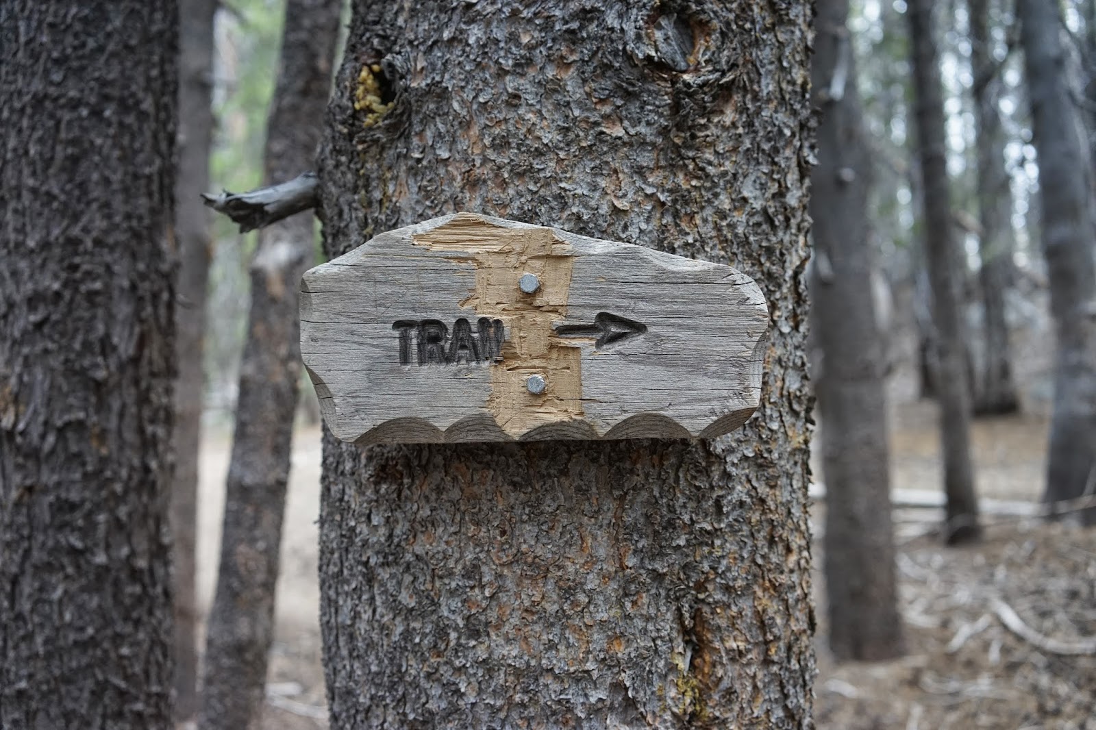
Follow The Arrow On This Sign

Follow This Sign

Panorama Of Devil's Bathtub

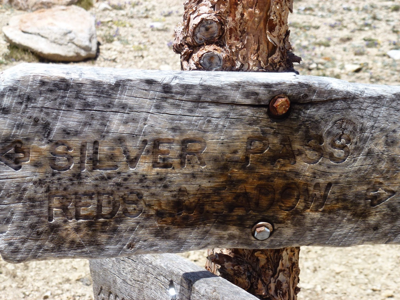
The Tom Harrison Map puts the trail junction for heading north to Devil’s Bathtub at about 2.5 miles but my GPS had it further along. The reason I say this is the sign that reads, “Trail” with an arrow pointing to the right at what looks like where you head north but that is too soon. Follow the signs. Keep going in the direction the sign is pointing. The trail at what appears to be a junction heading north only goes to a campsite. You will come to a sign that indicates the place to head north for Devil’s Bathtub.


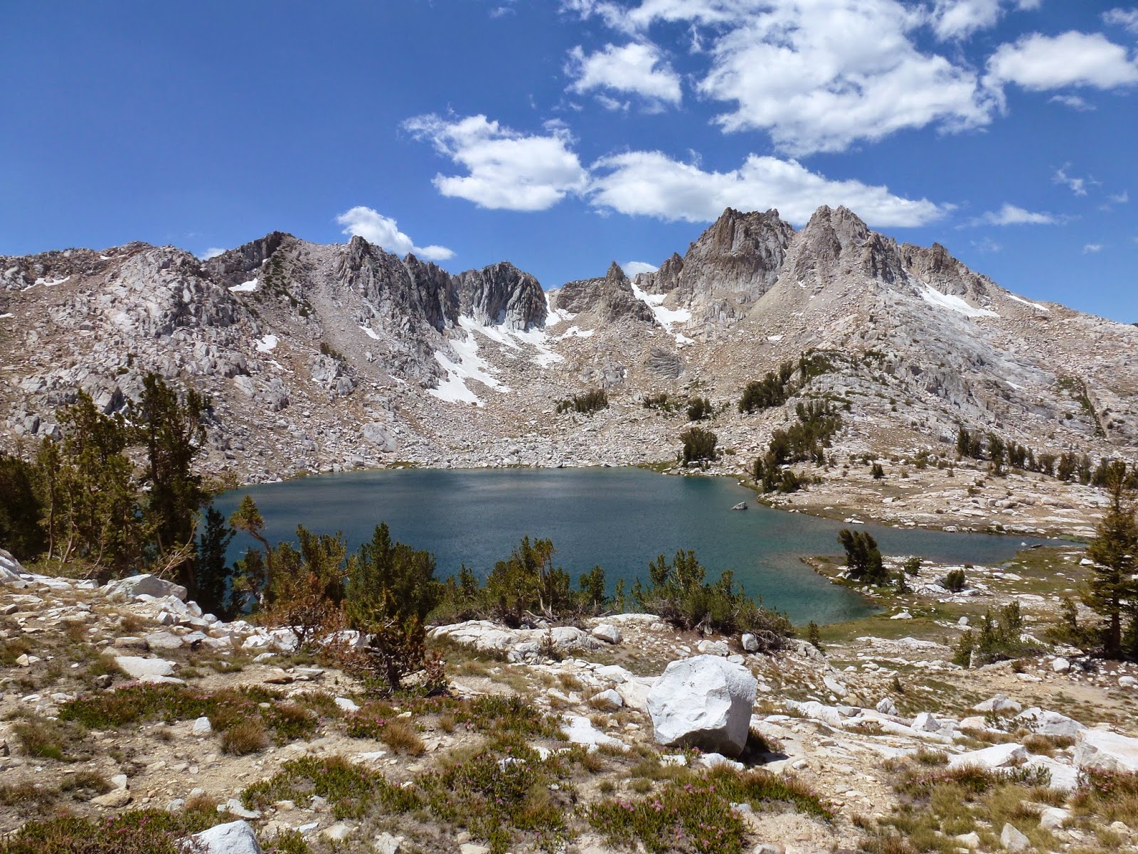
The final portion of the hike is mostly climbing but it is not bad if you are fit and traveling light. Most of the hike is in the woods and things did not open up until we reached the lake. We reached the lake at about 5 miles on my GPS. It is a splendid sight and secluded in a bowl with mountains to the north. The water temperature near shore was about 60 degrees and two brave souls decided to jump in.

Graveyard Peak On Right And Silver Peak Center

The return hike is easy and goes fast. It was nice to stop in the VVR and buy some well-earned treats for the trip home. Some of the PCT thru hikers were there to pick up supplies mailed there earlier and clean off some of the trail dirt in the available showers. Most of the JMT folks resupply near Florence Lake at Muir Camp. When you are driving back toward Kaiser Pass the area you hiked to can be seen quite clearly but the lake is hidden in the bowl. This is a tough drive but a sweet hike.

Dale (Trail name “Padre”)


Friday, June 13, 2014

Overnight Hike to Graveyard Lakes


Dale Matson


A friend and I got together for an overnight hike to Graveyard Lakes. The Trailhead is about three hours from Fresno taking Highway 168 to the Kaiser Pass Road turnoff. From Kaiser Pass it is about another hour to go the final 14 miles. You don't need four-wheel drive but a high ground clearance vehicle is preferred. There is an intersection with seven miles remaining. To the left is Edison Lake and to the right is Florence Lake. It is not necessary to take the water taxi to the east end of Edison Lake since the trailhead for the hike begins just out of the parking area at the Vermilion Resort.


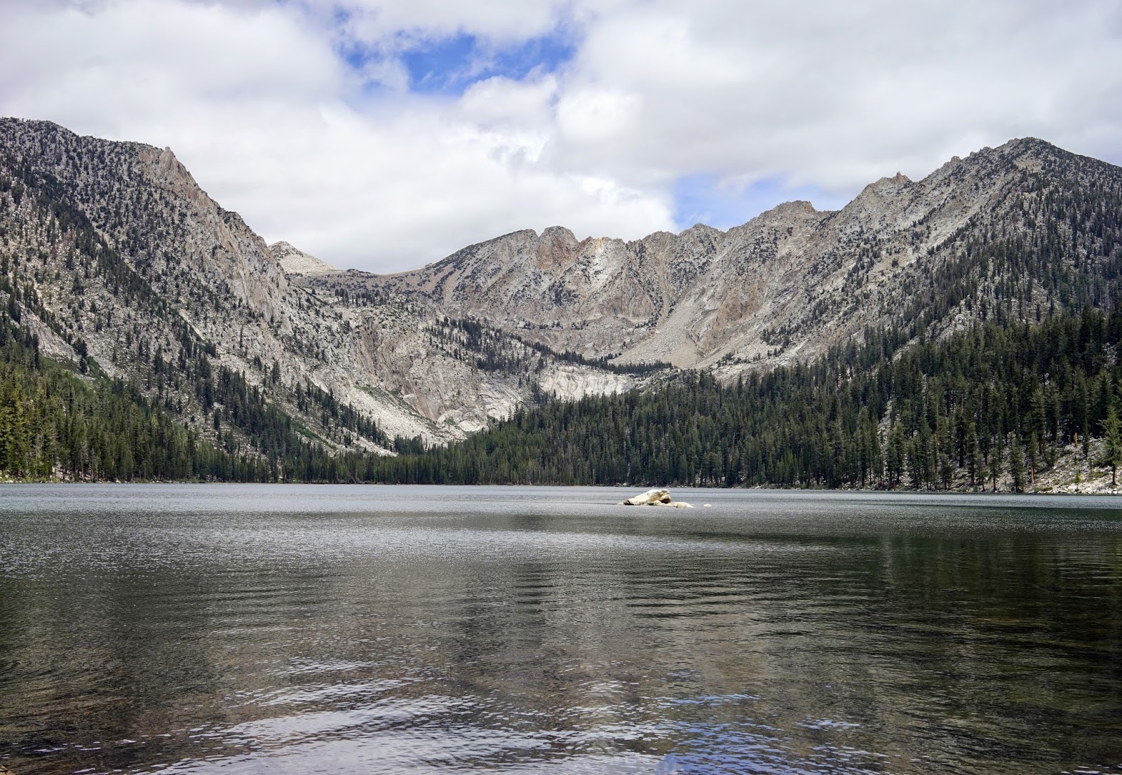
The hike is in the John Muir Wilderness and is about 18 miles round trip with the trail ending just after the first lake. There is a trail junction in upper graveyard meadow where the trail goes northwest to Graveyard Lakes and northeast to Goodale Pass. At this junction there is still about 1,000’ of climb before reaching Graveyard Lakes.


Climbing and scrambling above the lakes gave us quite a view of the surrounding area. There is about 3,000’ of elevation gain to the highest lake outbound. In the two days we were out, we did not see any other hikers.    Graveyard Lakes Video