Translate

Monday, March 23, 2015

Ancient Bristlecone Pine Forest


Dale Matson

Click On Photographs To Enlarge
Bristlecone Pine

We made time for a visit to the Ancient Bristlecone Pine Forest on our way back to Fresno from Mammoth CA. The Bristlecone Pines are considered to be the oldest species of trees on earth. There was a second and unexpected benefit on our one-mile Discovery Trail loop tour above 10,000’. We had a spectacular view of the eastern Sierra Nevada Mountains from the White Mountains where the pines are located. It was wonderful to see the Sierras white with snow during this extended California draught. The directions are here. http://www.fs.usda.gov/detail/inyo/specialplaces/?cid=stelprdb5129900

We were fortunate to be able to view them this time of year. I suppose in a normal snow year at that elevation, the road would be closed to the site. The weather was clear, cool but comfortable and traffic light. For a more detailed background on the Bristlecone Pines view this link. http://en.wikipedia.org/wiki/Ancient_Bristlecone_Pine_Forest


There is something almost mystical about touching a tree with such a long history. It appeared to me that one of the biggest dangers to a tree with such longevity is erosion. Many pines had the surrounding soil layers partially washed and/or blown away from the roots. The photographs were taken with an older Contax/Yashica Zeiss 28-70 lens adapted to my Sony A7R.


Thursday, March 19, 2015

Views Of Mt. Whitney And Mammoth Lakes Area


Dale Matson

Click On Photographs To Enlarge
 Mt Whitney is In Right Third Of View- 70mm


18mm


To get to the eastern side of the Sierras from Fresno CA in the winter, we go south to Bakersfield, east over Tehachapi Pass and back north on Highways 14 and 395. I always stop in Lone Pine and photograph Mt. Whitney across from the wilderness permit station and visitors center. It is always meaningful for me since I summited Whitney on three separate day hikes with the last summit last fall after turning age 70.

 Lake Mary


 Mammoth Mountain From Lake Mary Road
 Crystal Crag From Lake George 
 Horseshoe Lake

Twin Lakes From Lake Mary Road Looking Below And North

My wife and I arrived in Mammoth in about 6 hours and spent three days in the Mammoth Lakes area. Normally, I would be cross-country skiing the Tamarack trails but the snow season ended Sunday and the ski center was closed. My wife and in-laws were able to ski on the Mammoth slopes on adequate snow. I walked much of the trail I usually ski. The Lake Mary Road, especially Lake Mary has exceptional views. Horseshoe Lake has warning about C02 emissions. Mammoth Mountain (11,053') is a dormant not an extinct volcano.


Route Including George Lake Day 2

It is sad to see how the ongoing drought has harmed the economy of the Mammoth Mountain community. The drought has not just damaged our California agriculture. It has damaged the ski resorts as tourist destinations. This time of year, there were few people on the ski trails and I can only imagine what a busy place the lakes area must be in the summer with all the lodges, campgrounds and hiking trails.

 Convict Lake In The Afternoon
Just After Sunrise

Additionally, I had a chance to photograph Convict Lake south of Mammoth both during the day and the following morning. The effort is easy. Convict Lake is two miles west of Highway 395 at a turn off just south of the Mammoth airport. There is a ramp down to the shore below the parking area. The light was not ideal but it is hard not to get a good photograph of Convict Lake. Unlike the higher elevation Mammoth Lakes (e.g. Lake George at 9,010’) Convict Lake (7,851’) was free of ice. There is a sad story of seven folks who drowned there falling through the ice in 1990. http://articles.latimes.com/1990-02-20/news/mn-1121_1_holiday-skating-party.

Note: The light was flat much of the time and I converted some photographs to Black and White.


Friday, March 13, 2015

Evolution Basin Kings Canyon National Park


Dale Matson

Click On Photographs To Enlarge


Evolution Basin is located in Eastern Fresno County CA in Kings Canyon National Park. There are several access points to Evolution Basin. From Fresno, I was able to make it to Evolution Lake in a single day from the trailhead at the south end of Florence Lake. I took the first ferry of the morning to the south end of Florence Lake. I do not recommend this 20 plus mile hard push from Florence Lake however and most find this to be a two-day hike with an overnight before the climb to Evolution Valley.

One can also come into the basin from the Maxon trailhead at Courtright Reservoir but much of this will be off trail.  I do not recommend the route over Piute Pass starting at North Lake or the route over Bishop Pass starting at South Lake unless you are doing the North/South Lake Loop. Evolution Basin is not to be confused with Evolution Valley that consists of Evolution Meadow, McClure Meadow and Colby Meadow.

Evolution Creek In McClure Meadow

Evolution Basin is South of Evolution Valley and about 1,500’ higher in elevation. Evolution Valley is lush and green while Evolution Basin is above tree line with sparse vegetation. There is a seasonal ranger station in Evolution Valley at McClure Meadow. The basin begins after about a 1.5 mile 1,000’ climb out of Evolution Meadow and ends about 6 miles further south before the climb to Muir Pass. After Colby Meadow, the trail can be somewhat confusing as the water flows across it from several small creeks flowing down from the north.

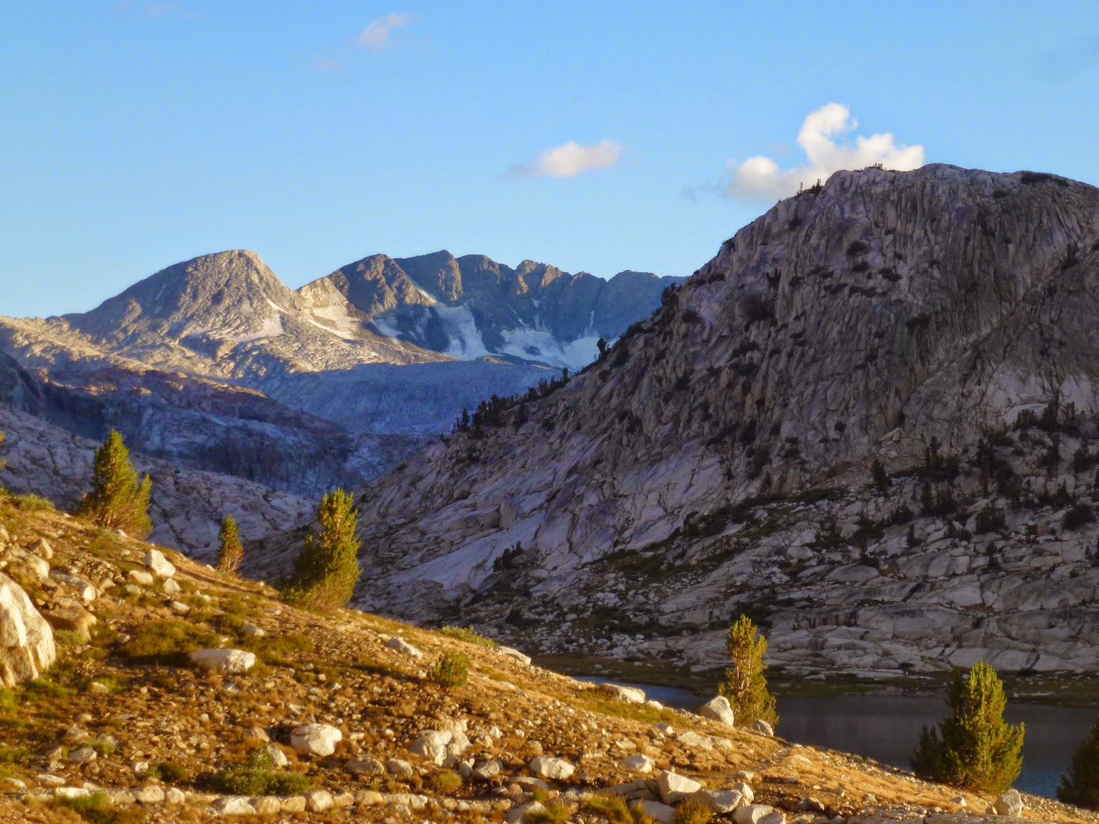
The trail climbs through the woods eventually coming out in Evolution Basin. The trail (John Muir Trail) follows the west shore of Evolution Lake and the east shore of Sapphire Lake. There is a creek crossing at the inlet to Evolution Lake where large stones have been placed to help cross. The trail follows the east shore of Wanda Lake and finally, the west shore of Lake Mcdermond. You are surrounded by mountains with an average elevation over 13,000’. They include Mts. Mendel, The Hermit, Mt. Darwin, Mt. Goddard, Mt. Warlow and Mt. Spencer. Theodore Solomons named many of these mountains. He was a Stanford University math professor and the main visionary for the John Muir Trail. Mt. Solomons can be seen from Muir Pass.

 Top Of Climb To Evolution Basin


 Dusk At Evolution Lake Time To Pitch My Tent


 Dawn The Following Day


 Wanda Lake
 Telephoto Of Muir Hut From Wanda Lake


Mt Goddard


Evolution Basin Runs parallel to Humphrey’s Basin to the north and the Ionian Basin to the South. As you head south, you pass Sapphire Lake, Lake 11,293 and Wanda Lake (named for one of John Muir’s daughters). Helen Lake on the south side of Muir Pass is named after Muir’s other daughter. Wanda Lake is the headwaters of Evolution Creek. Evolution creek flows north and eventually empties into the San Joaquin River. If you look carefully, Muir Hut can be seen at Muir Pass as you hike along the shore of Wanda Lake. While McClure Meadow is beautiful, I believe the six or so miles of hiking in Evolution Basin is some of the most beautiful views I have ever experienced.