Translate

Wednesday, January 13, 2016

Snow In The Sierras From Fresno


Dale Matson

We appear to be having a winter with above average snow and rainfall. Fresno is transformed into another city in winter. Though we are considered a city in the Central part of California in the Central Valley, we are nearly up against the foothills of the western slope of the Sierra Nevada Mountains.

When a normal winter arrives, the golden hills become green; the air is cleansed by the rain and snow. The mountains appear as if out of nowhere. They are made visible above the foothills by the new snow and cleaner air. As one drives along some of our elevated expressways, Highway 41 towards Yosemite, Highway 168 towards Shaver Lake and Highway 180 towards Kings Canyon, the mountains form a beautiful ribbon stretching from north to south as we look to the east. One can see a view of the mountains looking east on many of Fresno’s city streets also. The cleaner air brings the mountains closer.

I went out yesterday with only “moderate” air quality and took some photographs from the eastern edge of Fresno and northeastern Fresno. There are intervening utility lines on many of the shots but once you are east far enough to be in the sparsely populated foothills, the mountains disappear. They reappear at about 4,000’ to the east of Highway 168 as you climb toward Shaver Lake.

Click On Photographs To Enlarge
 From Highway 168 Note The Brown Trees

This Shot Is From My Cabin Porch Looking SSE At 4,300'


Who would imagine Fresno as a gateway to the Sierra Nevada? Actually, Theodore Solomons, the visionary architect of the John Muir Trail imagined it from Fresno. Clarence King the first head of the USGS admired the mountains from the Fresno area also.

 Kaiser Peak (10,300')


 Shuteye Peak (8,358)


I used a Sony A7R2 with an adapted Sony A Mount 70-400mm lens. Most shots were from 90-400mm. Yes, I noticed the spots on the photograph and had my sensor cleaned at Horn Photo in Fresno. Thanks Aaron!

Saturday, December 26, 2015

Orland Bartholomew (1899-1957)

Dale Matson

The early-recorded exploration and courageous efforts in the Sierra Nevada are populated with names like Muir, King, Solomons, Brewer and iconic landmarks bear their names as a tribute to their presence and descriptive reports. Their accounts not only provided geological and geographic data, their journals beckoned others to explore the trails, passes, basins and peaks of what John Muir called “The Range Of Light”. Their experiences in the Sierra Nevada transformed them and in reading their accounts we too became captivated, inspired and became pilgrims ourselves.

There are two more contemporary men of the Sierra. Norman Clyde was an amazing mountaineer with the most first ascents of the Sierra peaks. A spire in the Minarets, a peak in the Palisades and a Glacier bear his name. There is another individual who was the first to ski the John Muir Trail including ascending Mt. Whitney in 1928.

Bartholomew knew the Sierra as you would know your own back yard.  He was familiar via his work as a stream guager for Southern California Edison. He was a mountain man made by trade and a mountain man at heart. He carefully planned his winter ski by placing catches of food and supplies along the route the summer before. This successful 300 mile unaccompanied and unsupported journey was monumental in scope and heroic in effort.

Gene Rose a writer for the Fresno Bee recorded his effort and life in the book High Odyssey (1974). http://www.amazon.com/s/ref=nb_sb_noss?url=search-alias%3Daps&field-keywords=gene+rose+orland+bartholomew
There was an effort made to name a mountain peak after Bartholomew in 2004 and the Los Angeles Times had an article about this. http://articles.latimes.com/2004/apr/24/opinion/ed-bart24
There is also an excellent background post by William Tweed, former Superintendent of SeKi here: http://www.sequoiaparksfoundation.org/2012/historic-people-and-places-orland-bartholomew/

The request was made to the U. S. Bureau of Geographic Names (BGN) and an exception was not granted because of the policy that the spire to bear his name was in the Ansel Adams Wilderness. The spirit of the Wilderness Act of 1964 was a “leave no trace” policy and this included naming locations.  I received an email from the BGN stating the following: “There was a proposal submitted by Orlando Bartholomew's son to name a summit along the Ritter Range in the Sierra National Forest/Ansel Adams Wilderness. The proposal was not supported by the California Advisory Committee on Geographic Names and the U.S. Forest Service both citing a lack of evidence that naming the feature warrants an exception to the Board on Geographic Names' Wilderness Policy. Policies used by the BGN may be found at: http://geonames.usgs.gov, click on Domestic Names and then Principles, Policies, and Procedures. The minutes from the meeting where the proposal was discussed may be found under Minutes. Click on the 669th Meeting, located on page 5.”

Maria McCormick from the BGN was also encouraging and wrote that I could re-submit Bartholomew’s name for another feature in a non-wilderness area, which would be less of a hurdle. I have offered an unnamed peak in the Sierra National Forest South of Huntington Lake and am in the middle of the nominating process. To me, it is an honor to submit Orland Bartholomew’s name.

This is Orland's Son Phil With A Presentation On His Father

05-31-17 I received a letter today from the Board Of Geographic Names selecting a Sierra Nevada Peak to be named "Barholomew Peak".


Monday, December 21, 2015

Band Of Brothers: The Fresno Old Farts


Dale Matson

At age 71, I am the youngest member of a group of Fresno California men who have regularly met on Thursday mornings for over 20 years. I am certain that every city and town in America has a group of men who regularly meet for morning coffee and chat. Traditionally we have followed our meet up with a bike ride. It is shorter and less ambitious than it used to be and some of us no longer do the ride part of our ritual. I was never a big fan of a cold weather bicycle ride. Isn’t that why they have exercycles at the fitness center?

What is different about this group is our common continuing involvement in sports competition in general and triathlons in particular. Most members are also long time members of the Fresno Joggers. The Fresno Joggers as a group has aged and their weekly Saturday morning meet up at Woodward Park now means one lap around the park at a brisk walk. The breakfast following remains an important part of the ritual.

The Thursday morning group originally met at Chuck Freuler’s house for coffee and a ride but now meet at a local restaurant called Batter Up. We usually try to avoid discussing religion and politics because firmly held opinions have led to sharp disagreements. The main topic of conversation is the most recent competition results and “war stories” from ancient and distant competitions. We also offer up the “organ recital” of ongoing physical maladies and health emergencies.

Some in our group were also race organizers and directors. Chuck’s opening question to me is always, “What’s your next event?” Most of my events require a backpack and not a race number these days. This is a group of men who are still very much in the hunt when it comes to age group victories in this or that event.

Chuck not only was a Hawaii Ironman finisher in his late 50’s, he won the 85-year-old age group in the sprint triathlon world championships in London. He was also one of the original organizers of the Two Cities Half Marathon. Franz Weinschank was the race director for the popular Shaver Lake Triathlon and was the first 90 year old to finish the annual Merced Triathlon. Chris Denny has completed over 200 triathlons, finished the grueling 155-mile Climb To Kaiser bike race in his 60’s and the Boston Marathon in his 70’s. As a younger man, he competed in both the 2-mile and 10K Woodward Park races on the same day and won both in his age group. Mark Hayman completed the Western States 100 Mile Endurance Run, earning a silver buckle for a sub 24-hour finish. He and Chris have also been involved in rock climbing. Warren Rosenbaum accomplished the California Triple Crown (3-200mile bike rides in one year) in his mid 60’s.  Others of us, like Bruce McKee, Walt Brown, while less skilled have similar accomplishments. Franz, Chris and I have completed the 211-mile John Muir Trail. (They did it as thru hikers and I did it as a section hiker.)

Perhaps as noteworthy is the fact that while all of us have had health challenges, we remain engaged in the life of our Fresno community. Bruce still teaches at Fresno State. Franz finally retired from teaching at Fresno Community College last year and will have a story published in a national journal next year. Chuck and Joy are still world travelers as well as Bruce and his wife. Walt continues to be the editor of the Jogger Newsletter and keeps up with the latest computer hardware and software innovations. I became an Anglican Priest following my retirement as a professor.

Chuck hosted his annual Christmas week luncheon get together for our group and many more who are long time Fresno competitors. There are less of us than there used to be but most of us stubbornly continue to ‘…run the good race’.   

Click On Photographs To Enlarge
 (L To R) Chris and Dale
 (LTo R) Mark, Dan, Chris
 Warren With Back To Window
 (L To R) Bruce, Franz, Phil and Walt
 (L To R) Bruce and Chuck  
This Photo (Courtesy of Bruce who took the photo) is at our weekly Thursday morning coffee klatch
Left to Right is Franz, Chuck, Dale, Walt, Mark and Chris 


Wednesday, December 16, 2015

Yosemite CC Ski: Glacier Point Road To The Clark Range Overlook

Dale Matson

Click On Photographs To Enlarge
Suunto Ambit2 Route

12.35 miles round trip with 1,135’ of gain overall. 5 hours total time out.
Maximum Elevation 7,425'

* Note: Yosemite Park requires all vehicles to carry chains in the winter and this includes 4 wheel drive vehicles.

It is a promising beginning to the winter ski season with Badger Pass opening on December 12th this year. The Nordic Holiday Ski Race was cancelled the last two years for lack of snow. I didn’t ski in Yosemite at all last year. I have one caveat about skiing on Glacier Point Road. If you are a novice skier, and the surface is icy, rent snowshoes instead.

My son Ben and I drove up to the Badger Pass ski area from Fresno in about two hours. For those who have a longer commute, there is also lodging nearby by the Chinquapin turn off to Glacier Point at Yosemite West.  I called ahead of time to the cc ski center (209) 372-8444 to ensure Glacier Point Road from the downhill ski area to Glacier Point had been groomed since the last snowfall. Snow reports updated daily are available usually here: http://www.yosemitepark.com/DailySnowReport.aspx

The road from the Highway 41 Yosemite gate to Badger Pass (25 miles) was slow because it was snow covered and slippery. Well, yes Glacier Point Road had been groomed but there were no tracks laid for track skiing by the grooming machine. (I was informed today that parts have been ordered and hopefully the machine will be ready to go soon.) Glacier Point Road is not just hilly; it has severe slopes to accommodate the curves. Without tracks, track skis slide unmercifully toward the low side of the road making the route more difficult. Skate skiers had a good surface. The snow was cold and squeaky and there was no difficulty with sticky transitional snow. It is always a good practice to put a fresh coat of glide wax on skis to avoid snow build up as you ski. The temperature remained in the low 20s under clear skies for our ski.

There is an initial quick curved descent from the Badger Pass parking area to Glacier Point Ski Trail. From there it is about a .75-mile climb that crests before a short descent to Summit Meadow. There is a pottie located there. Folks heading to Dewey Point usually depart at this point. Most use snowshoes since this is a difficult ski.

From here it is downhill to where Glacier Point Road intersects with the road to the Bridalveil Campground trail. It is downhill to where Bridalveil Creek crosses under the road also. The route then begins to climb in earnest for about 1.5 miles until you reach the Clark Range Overlook. At this point you’re a tad past 6 miles from the trailhead and facing an initial long descent followed by a long climb back to the trailhead on tired legs.

When I was younger and fitter, the Clark Range Overlook was just a stop on the day ski to Glacier Point and back (21 miles round trip). Actually, you can get as good a photograph from Washburn Point as Glacier Point and save about 45 minutes and a long steep climb out from Glacier Point. Here is a video I did of the full trip about 6 years ago. https://www.youtube.com/watch?v=O76s7-xy6P0

Badger Pass Parking By Trailhead
 Ben Adjusting His Daypack


 Bridalveil Campground Junction About 2.5 Miles From Trailhead
 Bridalveil Creek With Headwaters At Ostrander Lake
 Ridge Above Ostrander Lake
 This Is A Gutbuster Of A Day Ski. Most Stay Overnight At The Ski Hut
Here Is A Video I Posted Of The Ostrander Day Ski In 2010
https://www.youtube.com/watch?v=_KM6bhClokw


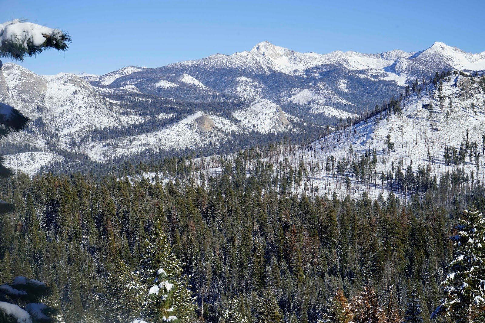
 Clark Range Overlook Cloud's Rest Far Left