Translate

Monday, February 15, 2016

The Sony A7R2 And C/Y Zeiss 100mm f3.5

Dale Matson

Click On Photographs To Enlarge

 Sony With Adapted C/Y Zeiss 100mm F3.5

Adding The C/Y Zeiss Mutar 1 2X teleconverter

As a mountain photographer who often has to carry my camera, lenses and backpack over high Sierra Nevada passes, I am always looking for a good combination of lens quality and weight.

I am primarily a landscape photographer and am only willing to haul a heavy telephoto lens when I am in possible Sierra Nevada Bighorn Sheep territory. My adapted Sony 70-400mm lens weighs more than my tent! What I wanted was a short telephoto option for when I am not in Bighorn Sheep territory. I considered the expensive Zeiss Batis 85mm 1.8 lens. However, my carry lens is the Sony Zeiss 55mm f1.8 and I really don’t gain that much reach over my 55mm lens with a 85mm lens. Yes, I know the Batis is faster and has AF but this is landscape photography not sports or wildlife. My C/Y Zeiss 100mm lens including the adapter is 4.5 inches long and actually weighs in at 15 ounces versus 16 ounces for the Batis. My other mountain lens is the Sony Zeiss 16-35mm f4 when I need ultrawide.


Now you are saying, “Yes I know but what about picture quality?” That is a fair question so I have included both photographs using the 100mm lens and the 100mm lens with the 9 ounce C/Y Zeiss Mutar 1 2X teleconverter making it a 24 ounce 6 inch long 200mm lens. All of my shots were handheld using focus peaking. The Sony A7R2 IBIS makes this possible. The photographs were as they came out of the camera. The 100mm shots at actual size were tack sharp. The actual size shot using the 2X teleconverter was not sharp but acceptable quality as posted.

Lone Pine Peak With Mt. Whitney On Right
   Four Gables With Sony Zeiss 24-70mm f4 At 70mm For Comparison
Four Gables With C/Y Zeiss 100mm F3.5
C/Y Zeiss 100mm F3.5


C/Y Zeiss 100mm cropped
C/Y Zeiss 100mm 3.5 With Mutar 1 2X Teleconverter

Saturday, February 13, 2016

Sierra Nevada Bighorn Sheep Fieldtrip 02-12-16


Dale Matson

Click On Photographs To Enlarge

Bighorn Sheep
The Sierra Nevada Bighorn Sheep population is estimated at about 600 and spread mostly along the crest of the Sierra from north Yosemite to Olancha Peak in the south.  In an area this large a sighting of Bighorn Sheep is almost always accidental. Dr. John Wehausen, long associated with the SNBSF is often quoted as saying, “Look for rocks with legs.” There is no better way to portray the sheep blending in with their alpine habitat.

As someone who spent many hours actually looking for the sheep, I can honestly say that only trained eyes using spotting scopes or binoculars will reveal their whereabouts. I accidently encountered two sheep on the trail to 60-Lake Basin but was not able to photograph them before they were gone.

I had an opportunity to spend time with John again as a part of a field trip jointly sponsored by the Sierra Nevada Bighorn Sheep Foundation and the California Department of Fish and Wildlife on Friday February 12th. It was a perfect winter morning in Bishop CA as we gathered below the offices of the CDFW for a briefing. There were about 20 individuals in all who were briefed by John and SNBSF board member Virginia Chadwick. John stated, “This time of year, the sheep come to us in February and March. They come down to avoid the mountain snow and to eat the emergent vegetation. It is also this time of year that the sheep are most vulnerable to mountain lion predation.”

The day before the field trip, I drove the observation route along Pine Creek Road above Rovana CA. This road dead-ends at a trailhead and tungsten mine. If deer were sheep, I could have gone home with plenty of wonderful photographs the following morning. I looked as I drove which is a fool’s errand.

Two Bucks
 Bighorn Sheep
Bighorn Sheep
We arrived and parked off the road about 10:00am at the area the CDFW folks had located via a GPS tracking collar on the sheep. Even when we were directly below the sheep, it was quite difficult to actually spot them, although the trained unaided eyes of John Wehausen were able to spot them. The rest of us used high-powered camera lenses and spotting scopes. I used a 400mm telephoto lens on a tripod. Unfortunately they were too far above us for even a 400mm lens, which is equal to 8X binoculars and even a cropped photograph barely showed the sheep that blended so well with their surroundings. I think if I had used this lens last fall near Mt. Langley, my photographs of sheep there would have been much better than the 200mm lens I backpacked in with. John and I were closer there. I think when it comes to lenses for photographing sheep, go big or go home.

The White Mountain Range To Our East

I Think This Is Four Gables Above Us Looking Up Pine Creek Road

It was a long trip back to Fresno following this but a rewarding experience non the less.The other folks were cordial, helpful and fully committed to the restoration of the Sierra Nevada Bighorn Sheep. Thanks again to the SNBSF and the CDFW. If you are interested in finding out more or joining the SNBSF clink this link. http://sierrabighorn.org/

*Note: I have permission from each of the participants to use photographs that include their faces. [It was much easier to get their photograph than the sheep].  


Saturday, February 6, 2016

Views Of Millerton Lake Winter 2016


Dale Matson

Click On Images To Enlarge
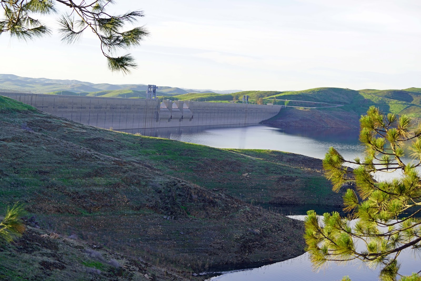
Looking At The Madera Side Of Millerton Lake

Many Fresnans probably don’t know that there is a half million-acre feet reservoir less than a half hour from the center of Fresno. Millerton Lake was created by damming the San Joaquin River as a means of flood control and water containment for agriculture.

Millerton Lake is named after the town of Millerton, which was the original county seat for a much larger Fresno County. Millerton was situated along the San Joaquin River. After a flood, it never recovered and the county seat was moved to Fresno.
Other than the courthouse, which was moved to higher ground, the town of Millerton is now under Millerton Lake.

Clarence King was an early California state geologist and the first head of the USGS. Two desperados, who saw him pocket a pouch with gold in it, once chased him starting in the village of Visalia. He rode his fast steed Kaweah to Millerton on his way to Mariposa and lost them on the way.

There is a large state recreation area on the north side in Madera County and on the south side in Fresno County. The annual state park pass fee is now over $100.00 but worth the money if you are at the park regularly. There are various boat ramps available on both the Madera and Fresno sides. It is a popular summer place for boating, water skiing and fishing. There are also lots of picnic areas and an area for camping near the boat ramp on the Madera side.

My friends and I swim there once a week from late spring to early fall. I have also kayaked there and ran with friends for years on a trail along the shore that leads to Winchell Cove. This trail has the typical wilderness sightings of Bald Eagles, Hawks, Mountain Lions, Bobcats and Rattlesnakes.

The lake is usually low this time of year in anticipation of spring runoff. This year it is not painful to see the low lake level knowing that we have lots of snow again in the Sierra Nevada Mountains, which translates to a good water year. At this point we only need two more inches of rain in Fresno to equal our yearly average amount. China Peak, our local ski resort near Huntington Lake has already received 255 inches of snowfall. Green is not the usual color one sees around the lake. Rather it is a golden brown most of the year.

These Photographs were taken with a Sony A7R2 with an Adapted Sony a-mount 70-400mm lens, a native Sony Zeiss 24-70mm f4 and a native Sony Zeiss 16-35mm f4


 Trail To Winchell Cove
 Shuteye Peak (8,358')

 High Sierra Further East
 Kaiser Peak (10,300')

 Millerton Courthouse


 Water Level Rings On Island


Wednesday, February 3, 2016

Sony: Where Are You Going With E-Mount?


Dale Matson

Sony made a real breakthrough in camera design with the mirrorless full frame camera. They achieved their goal of a high quality, lightweight full frame camera. I have owned the 24mp A7, the 36mp A7R and the 42mp A7R2.

Much of the criticism has been that there have not been enough native lenses to select from but adapters have helped fill the initial gap with Canon and Sony a mount lenses. It seems to me that the lens roadmap would run from ultra wide to super telephoto. My question to Sony would be, “Are you trying to compete head to head with Nikon and Canon or are you looking at a narrower niche where a smaller lighter camera is more well suited?

Let me now focus on an area of interest for me with the full frame mirrorless camera where Sony is more competitive. I am a mountain backpacker and began with point and shoot cameras. I bought the Sony A7 with the Sony Zeiss 35mm f2.8 lens and used it in the mountains along with a point and shoot superzoom for a year. Two years ago I bought the A7R because it would give me better photographs and traded my 35mm for the Sony Zeiss 55mm 1.8. Each decision meant more weight but photography was becoming as important as backpacking in the mountains.

Both lenses are light and small and consistent with the size and weight of the A7 series of cameras. I bought the A7R2 when it became available mainly because of the IBIS. I also decided to go with more variability at the cost of even more weight. The Sony Zeiss 16-35 f4 and 24-70 f4 are great lenses, made even better by the A7R2. Neither lens goes much over a pound however.

Sony recently came out with e-mount teleconverters (1.4x and 2.0x). This will help those who want a longer reach wildlife lens. They also came out with a 24-70 f2.8 (1.95 lbs.) and a 70-200 f2.8 (3.26 lbs.). What market is being addressed with these bulky and heavy lenses? Both Canon and Sony a mount make excellent 70-200mm lenses that are lighter.

The new Sony G 85mm 1.4 weighs 1.8 pounds and costs nearly $1,800.00 while the existing Zeiss Batis 85mm 1.8 weighs about a pound and costs $1,200.00. Guess which lens I will buy for my short telephoto?

Why can’t Sony make a compact G lens for the e mount like the a mount 70-300mm which weighs less than half of the new 70-200 f2.8

Here is my hope. I believe Zeiss better understands where Sony should be going with the e mount lenses. That is why Zeiss has the Loxia and Batis lens series for Sony. They are good prime lenses in the Zeiss tradition and help make Sony competitive with Canon and Nikon. Sony, stop making heavy lenses for a lightweight camera!     

Thursday, January 28, 2016

Yosemite: Snowshoe To Dewey Point


Dale Matson

Click On Photographs To Enlarge
View From Dewey Point

Trailhead Badger Pass, Beginning altitude about 7,200’, 750’ ascent, distance about 8 miles round trip, 5-6 hours

This trip can be done faster on c.c. Skis but it is not a trip I would recommend for a novice skier. The last 1.5 miles to Dewey Point has some steep ups and downs. Dewey Point was named after Admiral George Dewey the only person ever named “Admiral of the Navy”.

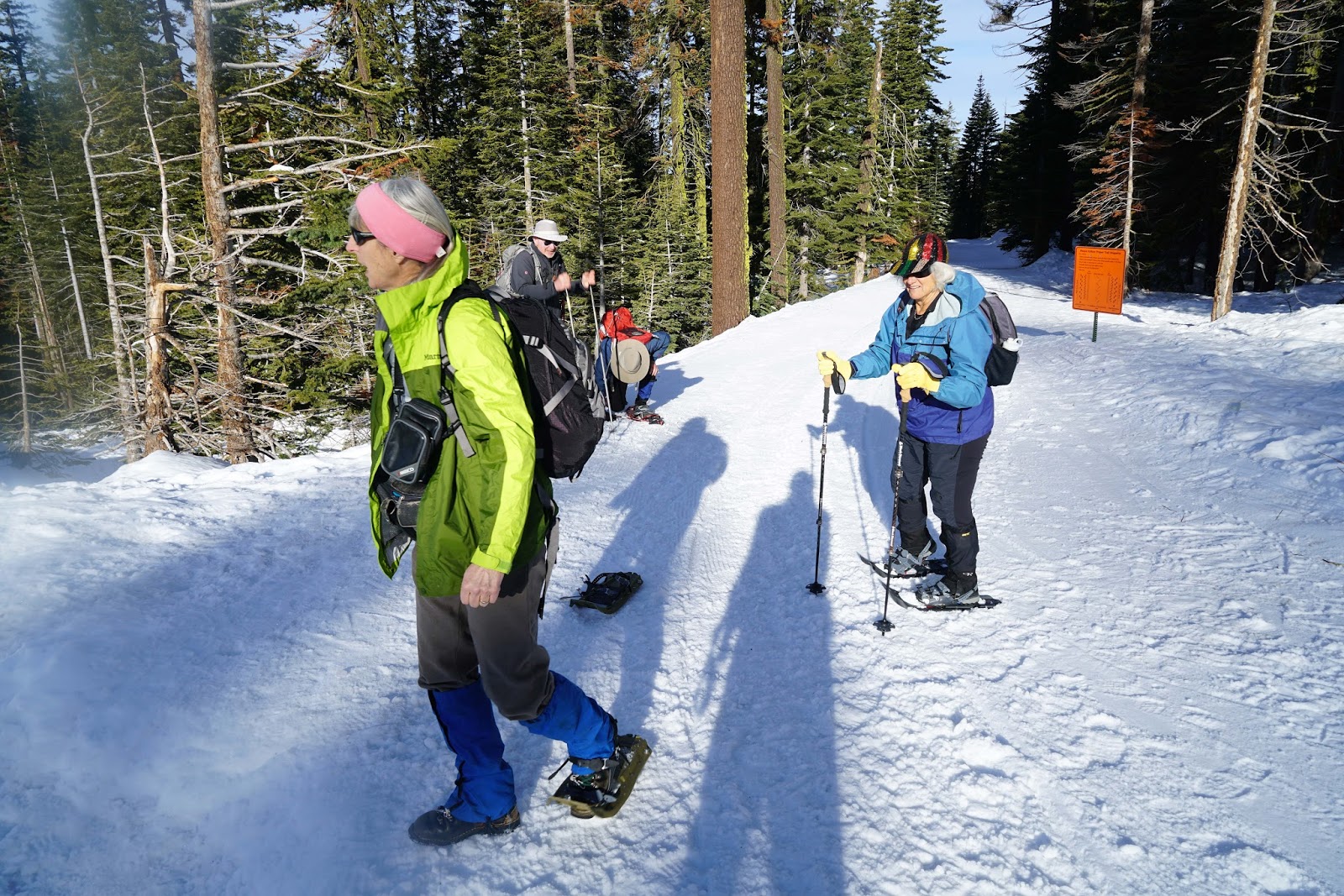
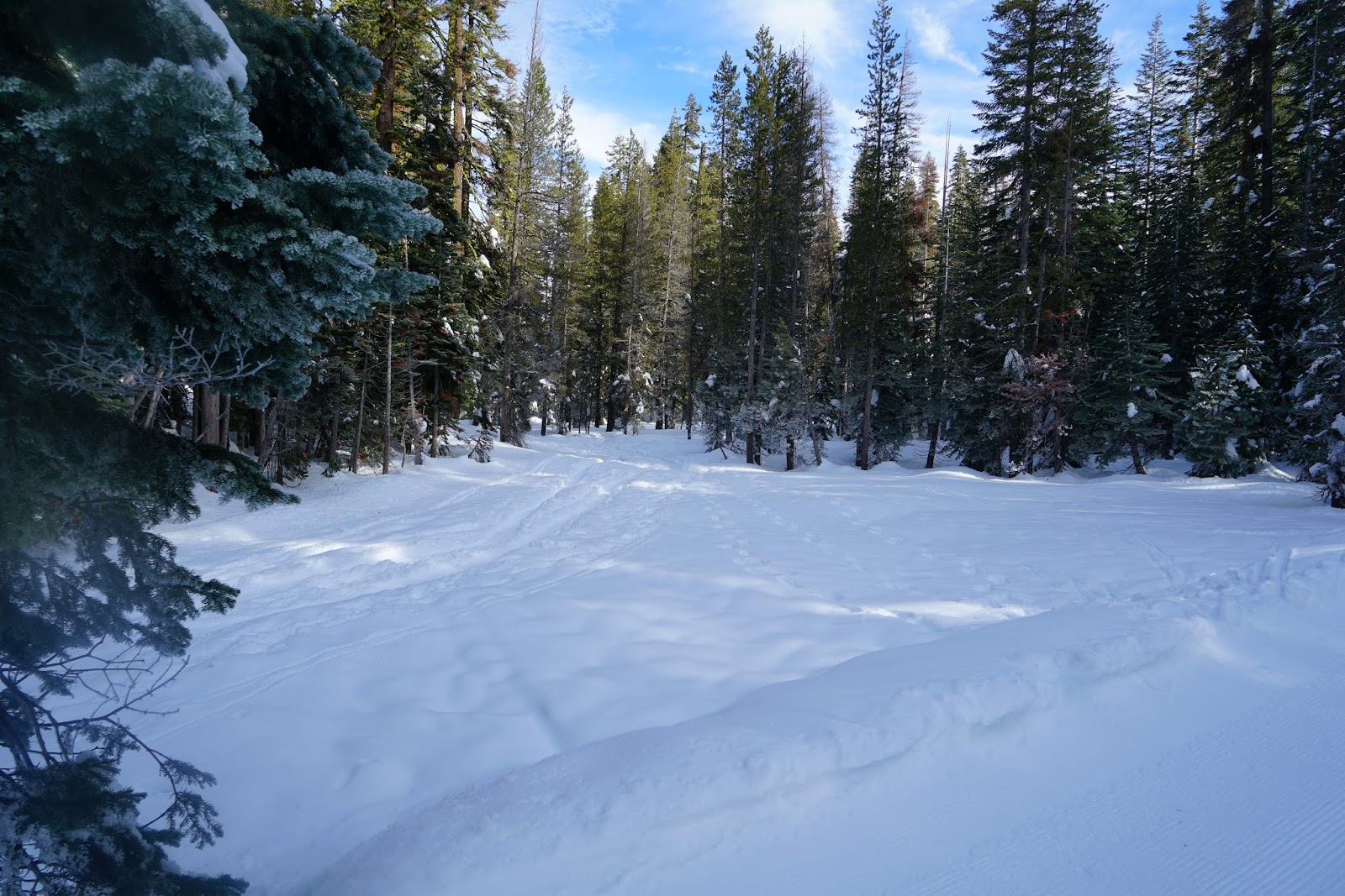
We did this as a day trip from Fresno, which made for a long 10-hour day. The first mile is on the groomed snow of Glacier Point Road. Dewey Point can be done as a loop hike combining the more difficult trail #14 and trail #18. We chose to hike trail #18 as an out and back. Trail #14 begins near the top of the first climb before Summit Meadow. Trail #18 begins just past the potties on the other side of Summit Meadow. The initial part of the route is through beautiful meadows and crosses an unnamed creek.

The temperature was moderate but the light was flat, which made for poor photographs of even the view from the point. It was fortunate for us that several pilgrims had preceded us. The trail was packed and evident. This is not an official mapped trail on topographical maps but the route is marked with yellow metal flags and triangles on the trees.

The #18 trail eventually joins the #14 trail before reaching Dewey Point. The trail actually crosses the mapped Pohono Trail (14 miles), which runs along the south rim of the canyon from the Wawona Tunnel to Glacier Point. As we were about to leave the flat meadow area, Josh Helling came flying by on backcountry skis. He is a Yosemite guide, adventurer and cinematographer. I usually see him at the beginning of the annual Nordic Holiday race. I introduced him to my wife and friends. He is the usual winner of the 17K classic on Saturday. Here is a little more about him. https://www.youtube.com/watch?v=JHcK4LREijM

When we arrived, the vista was as wonderful as I remembered it on two previous visits. I used a Sony A7R2 with Sony Zeiss 24-70mm f4 and 16-35mm f4 lenses. The 16-35 lens was probably a bad choice because I was not close enough to the features. Perhaps a 70-200mm lens would have been a better choice. The light was poor and flat but the lunch break had a world-class view. Since this was during the week, we only had a few other folks there.

On the trip back, once we got back to the flatter part of the return trail, we lashed our snowshoes to the back of our daypacks and walked the trail using our trekking poles. It was easier on tired legs with less weight on our boots.
Of course, we had to stop at the Wawona Store for treats on the way back to Fresno, after a 3,500-calorie effort!

 Trailhead

 The Ladies By The Beginning Of Trail #14
 It Is So Good To See This Amount Of Snow Again
 Leaving Glacier Point Road


 Half Dome And Cloud's Rest Top And Left Of Center

 El Capitan
 Merced River And Road
Crop


 Lunch Break
 Author

Map Of Route From Suunto Ambit 2
There is a YouTube version here:
https://www.youtube.com/edit?video_id=c1G2KvomhhM