Translate

Monday, April 17, 2017

The Kings River And Pine Flat Lake


Dale Matson


Click On Photographs To Enlarge

Two of the major rivers of western slopes of the Central Sierra Nevada watershed are the San Joaquin River and to the south, the Kings River. I have devoted a considerable amount of time and space to the San Joaquin and nearly nothing on the Kings River. It, like the San Joaquin has a north, middle and south fork with headwaters in the high sierra. Actually, the Middle Fork of the Kings and the South fork of the San Joaquin have headwaters less than five miles apart. The Middle Fork of the Kings River begins at Helen Lake in Evolution Basin in Kings Canyon Park. I have walked along it in LeConte Canyon as it travels along the JMT. The South Fork of the San Joaquin begins in Goddard Canyon at Martha Lake in Kings Canyon Park.
I have crossed three of the major tributary streams for the Kings; Bubb’s Creek, Woods Creek and Dinkey Creek. All three are really rivers after heavy snow years like this winter. Dinkey and Woods have bridges but Bubb’s does not and it can be very dangerous to ford. The JMT crosses Woods Creek via a suspension bridge that only accommodates one person at a time.
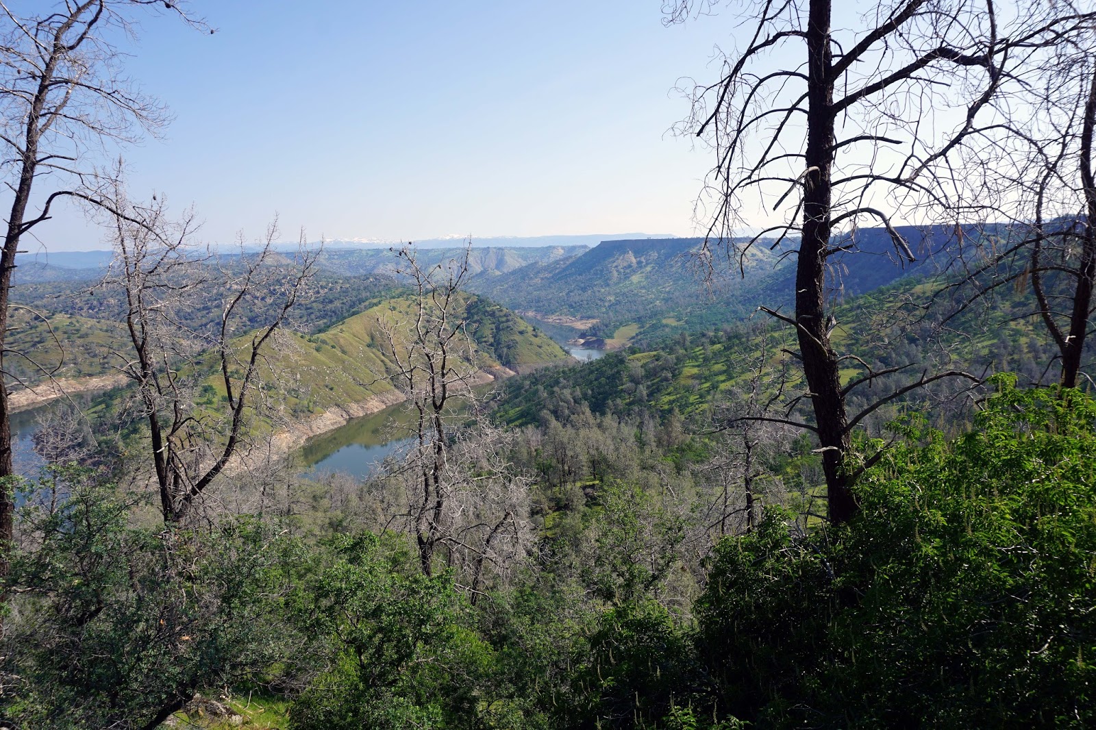
As you will see in the photographs, Pine Flat Lake is only about 50 percent of its one million acre foot capacity and is being emptied to make room for the expected massive snow melt this year. The dam was completed in 1954, is 20 miles long and has 67 miles of shoreline. In addition to irrigation, recreation and electricity generation, Pine Flat also was built for flood control.
It was a drizzly overcast day but I enjoyed the vast expanse of beauty before me. The foothills are still green with splashes of wildflowers. I used four lenses on my Sony A7R2 since I was driving along the river in my truck on Trimmer Springs Road and not backpacking the weight.
I used my Sony A7R2 and an adapted Canon 70-200 2.8, an adapted Leica Elmarit 28mm 2.8, a Batis 18mm 2.8 and 85mm 1.8. The wider lenses were more useful. Both the Leica and 18mm Batis have wonderful color.    
I have a short YouTube slide show of the photographs with included video clips here:  https://www.youtube.com/watch?v=4D5h6BfAaOE


 River Headed Toward Highway 180 Kings Canyon Road


 Pine Flat Dam

 Kings River Immediately Below The Dam


 Bridge Over Rancheria Creek
 Rancheria Creek


 Bridge Over The Kings River


Tuesday, April 11, 2017

San Joaquin River: Hiking On And Off Trail Near Big Bend


Dale Matson

Click On Photographs To Enlarge

Loop Hike Route

I had an opportunity to hike with Sharon and our patient friend Mike. We went from the “Cattle Shoot” area along Sky Harbor Road. We began there and immediately climbed about 500’ uphill till we met the trail that follows along the base of the lava table. As we continued east, the trail split and the narrower trail headed toward the top of the table. We continued on a rather wide trail. This trail is not located on my software topographic maps but is indicated on the Suunto Ambit download map on Movescount. We had somewhat tricky footing since a herd of cows had gone before us after one inch of rain recently and it was slow going, slogging through the wet cattle prints until the cattle decided to leave the trail. Not long after that, the trail left us as we continued through the woods far above the river. I dropped my plastic water bottle on a rock. The thin walls could not withstand the fall and began to leak. I had to pour the remaining water into Sharon’s bottle.  
We could not find the trail again and decided to drop down to the San Joaquin River Trail, which runs along above the edge of the river to Temperance Flat and beyond that to the River Gorge. It was a steep and slow descent in the wet grass. We were glad to have trekking poles. Young Michael descended as gracefully as Jean Butler moved across the stage in River Dance.
Michael spotted the trail and gave a holler up to us. We heaved a sigh of relief and got to the trail without incident. There were other folks on the trail and we were happy to make way for them. One fellow had a full pack and was practicing for the high country when the snow melts. We climbed back up as we headed west toward Pincushion Mountain. We could see folks standing on top as we turned up and left to meet our original trail. We made our final descent to our vehicle and finished the five-mile loop in a little over 4 hours. Mike cheered that we had a ‘finishing kick’ to get us to over a one mile an hour pace. Our total ascent was 1,227’. We burned enough calories to warrant a stop for ice cream treats in Friant.  

I used my Sony A6000 with the 16-50mm kit lens exclusively for this hike and was glad for the weight reduction from my usual gear. I have a used Sony Zeiss 16-70mm f4 lens that arrived today that I believe will improve the already good quality shots from this ASP-C sensor camera.