Dale Matson
Click On Photographs To Enlarge
Hike Route
Rock Creek Road is located at the Tom’s Place turnoff from CA
Highway 395 south of Mammoth Lakes. The Rock Creek Trail begins at the end of
Rock Creek Road south of the Mosquito Flat campground. The starting elevation
of 10,300’ may be the highest trailhead in the Sierra Nevada and makes for a
gradual uphill hike. The trail is understandably popular because it begins
above tree line and the beautiful views are immediately evident. As you hike by
the lakes, Mack, Marsh, Heart, Box, Long and Gem Lakes there is also a view of
several 13,000’ peaks to the south (Mt. Abbot, Mt. Dade and Bear Creek Spire)
and massive Mt. Morgan to the east. I did not include Chickenfoot Lake, which
is accessed by a sometimes-confusing use trail and has 300’ of additional
climb.
Box Lake
Long Lake
Fisherman In Rock Creek
This trail, located in the John Muir Wilderness is well
suited to fishermen, day hikers and backpackers. Backpackers will need a
wilderness permit, which can be obtained at the White Mountain Ranger Station
in Bishop. The round trip distance from the trailhead to Gem Lakes is about
seven miles with about 1,000’ of altitude gain. The trail has the most per mile
wow factor and even hiking to one or two lakes for the less fit is adequate.
Upper Morgan Lake
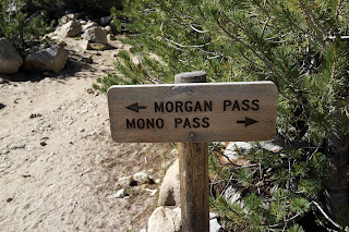
I chose to include the climb to and over Morgan Pass to
Upper Morgan Lake. I was looking for Sierra Nevada Bighorn Sheep to
no avail once again. My round trip distance was about 10 miles and took me
about 7 hours. It was a long day since I drove over from Fresno through
Yosemite (Highway 120) to the trailhead that morning. The drive was about 5
hours including stops for photographs at Tenaya Lake and Tuolumne Meadows. I
was glad to have an overnight reservation in Bishop at the end of the day.
If you are driving Highway 395 and have a day for hiking, I
believe this is the best one-day hike on a well-established and maintained
trail that you will encounter. The only other trail that surpasses the Rock
Creek trail for beauty in the eastern Sierra Nevada is the trail that follows
the North Fork of Big Pine Creek off Glacier Lodge Road out of Big Pine. This
trail is more difficult and labor intensive however with an early start
recommend. http://midsierramusing.blogspot.com/2015/07/big-pine-lakes-basin.html
Here is a video slideshow of the hike on YouTube with more graphics.
https://www.youtube.com/watch?v=C-i8-1mAxU0&feature=youtu.be
Here is a video slideshow of the hike on YouTube with more graphics.
https://www.youtube.com/watch?v=C-i8-1mAxU0&feature=youtu.be
I used a Sony A7R2 with a Zeiss Batis 85mm and 18mm lens plus the Sony RX1R for the photographs.


No comments:
Post a Comment