Translate

Thursday, August 20, 2015

60 Lake Basin: Kings Canyon National Park


Dale Matson

About 35-40 Miles Round Trip From Onion Valley 

Click On Photographs To Enlarge

60 Lake Basin is a less accessible and thus less popular destination than the Rae Lakes Basin which is adjacent to it to the east. The entry point via a trail is off the John Muir Trail at the southern end of Rae Lakes. The most direct but brutal access route is over Baxter Pass from the town of Independence off Highway 395.
The Sign Means What It Says

This is an area where the Mt. Baxter unit of Sierra Nevada Bighorn Sheep may be spotted. This is not a well-used or maintained trail however. After reaching the pass, the trail descends past Baxter Lake to meet the John Muir Trail at the north end of Rae lakes Basin just north of Dollar Lake. I guarantee you that there is absolutely no trail that you can see leading away from the Baxter Pass trail junction sign on the JMT. From there, the trail to 60 Lake Basin is south on the JMT to the Junction where the sign indicates the trail.

I suppose if one were traveling north or south on the JMT, one could visit 60 Lake Basin as a side trip but for me, the best route from where I live in Fresno is to Come over Tehachapi Pass east of Bakersfield and come north to the town of Lone Pine. I pick up my wilderness permit at the Visitor’s center and head to the trailhead at Onion Valley. From there I climb over Kearsarge Pass and take the northern route that meets the JMT. It is also possible to spot Bighorn sheep in this area since the Mt. Baxter herd can be found this far south. Once you join the northbound JMT, you go over Glen Pass and shortly after you reach Rae Lakes, you will see the trail sign indication 60 Lake Basin.

There are some nice established campsites soon after you turn off the JMT with access to and slightly above Rae Lakes. There is a two-night limit for camping at Rae Lakes and I think this area would not be strictly considered “Rae Lakes”. From here I have done two day trips into 60 Lakes Basin. Rae Lakes and 60 Lakes are also ‘hotspots’ for seeing the endangered Bighorn Sheep.

There is an initial climb on the trail to 60 Lake Basin which takes you over 11,200’ of elevation. As you pass a small lake, the trail begins to top out and then descend to the basin. Actually Rae Lakes and 60 Lakes are similar elevations running in parallel with a ridge in between the two of them. As I descended to the basin near a sign that states, “No stock beyond this point”, I saw two bighorn sheep but they ran off above me before I could photograph them.

On this two night three day trip, my intent on my day trip (2nd day) was to get to Gardiner Basin and in a sense; I was just passing through the basin. The trail through the basin initially travels west-northwest and then north. At the point the trail heads north, I left the trail heading southwest around the north end of Lake 3304 (also called Long Lake by some). From there I began to climb off trail traversing toward Cotter Col. which is a gap in a ridgeline descending south from Mt. Cotter (12,713’). It is a difficult climb and I didn’t pick the best route outbound. From Cotter Col, one can see into Gardiner Basin. I had seen all I wanted to see for that 2nd attempt and headed back to my tent near Rae Lakes.


On my return, I followed the trail north for a time but it soon becomes a maze of smaller use trails and is no longer dependable as a trail. I needed to use “Track Back” on my GPS to find and retrace my steps to a more dependable part of the trail back to the Rae Lakes Area. 

  Trailhead At Onion Valley

 Kearsarge Pass
Upper Trail Joins Northbound JMT


Kearsarge Pinacles And Kearsarge Lakes
Bullfrog Lake From Trail With East Vidette On Far Left

Charlotte Dome Telephoto

Glenn Pass Looking North Toward Rae Lakes
Camp Near JMT Trail Junction With 60 Lake Basin
Painted Lady Above Right 
 First Lake On Climb Up 60 Lake Basin Trail
 Looking Down On Rae Lakes From 60 Lake Trail

Author

 One Of The Lakes In 60 Lake Basin

Mt Clarence King

 Long Lake And West Side Of Fin Dome
 Mt. Clarence King
Off Trail Climb To Cotter Col

Mt. Cotter And Gardiner Basin
Looking North In Gardiner Basin

Wednesday, August 19, 2015

Mt. Givens Day Hike 2015


Dale Matson

Click On Photographs To Enlarge

So why am I posting another hike to Mt. Givens?
1.     I have different camera lenses this time around and…
2.     I want to talk a bit about off trail navigation required by this hike.

Lenses
Last time (2014) I used a 35mm f2.8 Zeiss lens with my Sony A7 and a Sony Point and shoot, 30X zoom for the photographs. This time I used an adapted Canon 17-40mm f4, a Zeiss 55mm f1.8 and the Sony G 70-200mm f4 lens. Unfortunately, there was considerable smoke from fires to the north and the “Rough Fire” to the south in Kings Canyon. There is an obvious smoke layer in some of the photographs.

I was happy with the Zeiss 55mm lens BUT it is possible to get blurry shots hand held even with a lens this fast. I took a 55mm shot of Mt. Givens from White bark and was able to blow it up big enough to make out the radio antenna on top. I have ordered the A7RII, which has in body image stabilization, which will bring out the full potential of this lens.

I continue to be happy with the Canon Lens, which I bought used. I don't see myself replacing it with the Sony Zeiss 16-35mm lens especially since I will soon have image stabilization for that lens with the new camera. The Canon lens has autofocus with the Sony through the adapter.

The 70-200 lens is heavy to carry on the mountain trails and sometimes I wonder if it is worth the bother carrying it with me. The results are spotty with some great shots and others that are not sharp at all. Yes, I know that even with optical steady shot (OSS) I should be using a tripod with this lens. The tripod is another heavy item on mountain trails. Other than wildlife, I think it may be better to go with the new Zeiss Batis 85mm 1.8 in the mountains. It is lighter and smaller. I'll keep the 70-200mm lens for places I can drive to.

Navigation
If you notice on the map, the last half mile outbound is an off trail climb. There are assorted Cairns which tend to disappear about half way up. I set some waypoints beginning with my truck. My second waypoint was where I followed a more direct use trail, which led off the main Dusy Ershim trail. Eventually this trail comes back to the Dusy Ershim Trail before the off trail climb begins. There is a cairn at this location to mark where the climb departs from the main trail. I set another waypoint at this spot and about half way up the climb. The Garmin Oregon GPS allowed me to select Mt. Givens as a “Go To” location and it helped me pick the most direct route when I selected the electronic compass. My climb off trail was fairly direct.

Once I decided to leave Mt. Givens, I selected my mid climb waypoint and again selected the electronic compass which continually monitored the direction of my descent. As you can see, I hit the exact spot midway down the descent and the alarm rang to inform me of that fact. As I continued to descend, you can see I drifted pretty far off my outbound trail to the east. At some point I remember being almost 500’ off course to the east for the next waypoint. I eventually headed west far enough to hit that waypoint also (The spot by the cairn). What I had failed to do outbound was set a waypoint where the use trail rejoined the Dusy Ershim Trail. I couldn’t find this spot inbound and had to stay on the longer, rockier and dustier main trail.

I know some of you folks have an excellent sense about where you are but I have to rely on instruments. In fact, I wear “a belt and suspenders” by carrying a compass also. My Suunto watch also has “track back” and “find back” features. I noticed the photo of my Ambit shows the altitude about 100’ less than the actual altitude of Mt. Givens. The overall distance on the Ambit was about a mile less than my Garmin Oregon also. I have a word of caution about the Oregon however. After resetting the trip distance and routes prior to heading out on a new hike, recheck the trip computer a couple of hundred yards down the trail. Sometime my GPS adds the driving distance from my home and averages the speed too!

The Photographs are from 17mm to 200mm

 Edison Lake In Center


 33 Miles Of Hell To Courtright Reservoir
 I would Rather Walk Than Drive This
 Deer Lake In Front With Huntington Lake In Background

 Free Range Cattle I Saw Tracks Almost To The Top Of Mt. Givens
 Cairn Marking Where Climb Depart Main Trail
 First Sight Of Radio Tower
 Locator Spotting Scope On Top Of Mt. Givens


 Time Out/Distance/Altitude


Mt. Givens From Whitebark Vista


Trail name Padre    

Friday, August 14, 2015

Yosemite: Day Hike To Lower Cathedral Lake


Dale Matson

About 9 miles round trip

Click On Photographs To Enlarge
Hike Route From Ambit2 Movescount Download

Yes, it is “Doable” even for senior citizens to drive from Fresno (starting at 5am) to the trailhead in Tuolumne Meadows (about 3 hours), hike three and a half hours, eat lunch, hike back and drive home in a single day. We arrived home about 6pm.

Eight years ago a couple of friends and I backpacked the final 50 miles of the John Muir Trail from Red’s Meadows to Happy Isles. We passed Upper Cathedral Lake and I took a nice photograph on our way to an overnight at the backpacker’s area of Sunrise High Sierra Camp. The clouds changed to rain as we went over Cathedral Pass. Upper Cathedral Lake (about 9,600’) is where Ansel Adams took his iconic photograph of Cathedral Peak. I want to make that clear since most of the Internet information is hazy about this. If you want a photograph of the classic view of Cathedral Peak, then you want the trail to Upper Cathedral Lake. This is the same trail as the John Muir Trail but the second trail sign (beyond the junction) does not indicate “Upper Cathedral Lake”.

Upper Cathedral Lake From 2008 Hike

I believe there is about an equal amount of energy required for either of the lakes since there is about a 300-foot drop from the main trail to get to Lower Cathedral Lake. Of course this means a 300’ climb inbound just to get back to the trail junction. The total altitude gain for our hike was about 1,700’.

The first trail sign at the trail junction does indicate Lower Cathedral Lake and that was our destination since I had never been to Lower Cathedral Lake. In addition to the swarms of people on the trail, we also saw a ranger on horseback, which is the first time I have ever seen one on a Yosemite trail at all.

There are portable toilets and bear boxes at the trailhead. Much of the trail from the trailhead at Tuolumne Meadows is in the woods with the steepest part of the climb during the first part of the trail.

We met a young climber named Luke from the Bay area and we chatted about ultra running, climbing and Yosemite history as long as I was willing to travel faster and he was willing to travel slower.

As you travel outbound, you will eventually see what appears to be a dome on your left (to the east). That is actually the beginning of an elongated ridge that will become Cathedral Peak. The peak is also a popular destination for rock climbers. There is an interesting but tragic story about a climber who died of exposure in 2007 here: http://www.friendsofyosar.org/rescues/missions/11-11-07_Cathedral_Fatality.html

Inbound we were met by a young man in a YOSAR shirt who was turning JMT folks back because of a lightning strike fire that was being allowed to burn but was growing.

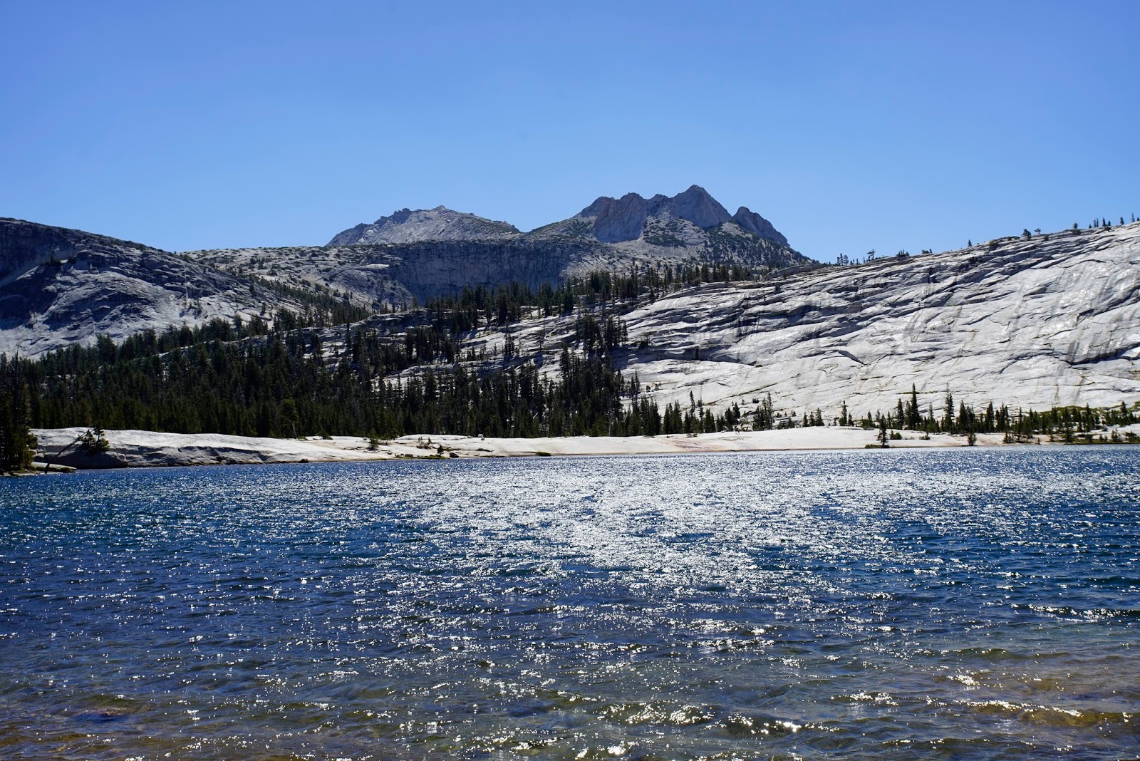
We enjoyed our stay at this beautiful lake with crystal clear water. It is the larger of the two Cathedral Lakes but the view of Cathedral Peak is less iconic. Sharon went for her usual alpine (about 9,300’) lake swim. I asked her to wade into the lake with my camera and take some shots, which turned out to be the best framed of the photographs. In this case I chose much of the lake as the primary focus with Cathedral Peak in the background. Sorry to say there were no clouds this day.


 Sign For Lower Cathedral Lake

 JMT Trail Sign Beyond Trail Junction That Does Not Include Upper Cathedral Lake
 Dry Stream Bed
 Meadow Before Lower Cathedral Lake


 Cathedral Peak


 Beauty All Around Me


 Author


Beginning Of Ridge That Becomes Cathedral Peak On East Side Of Trail