Translate

Tuesday, August 27, 2013

Potter Pass


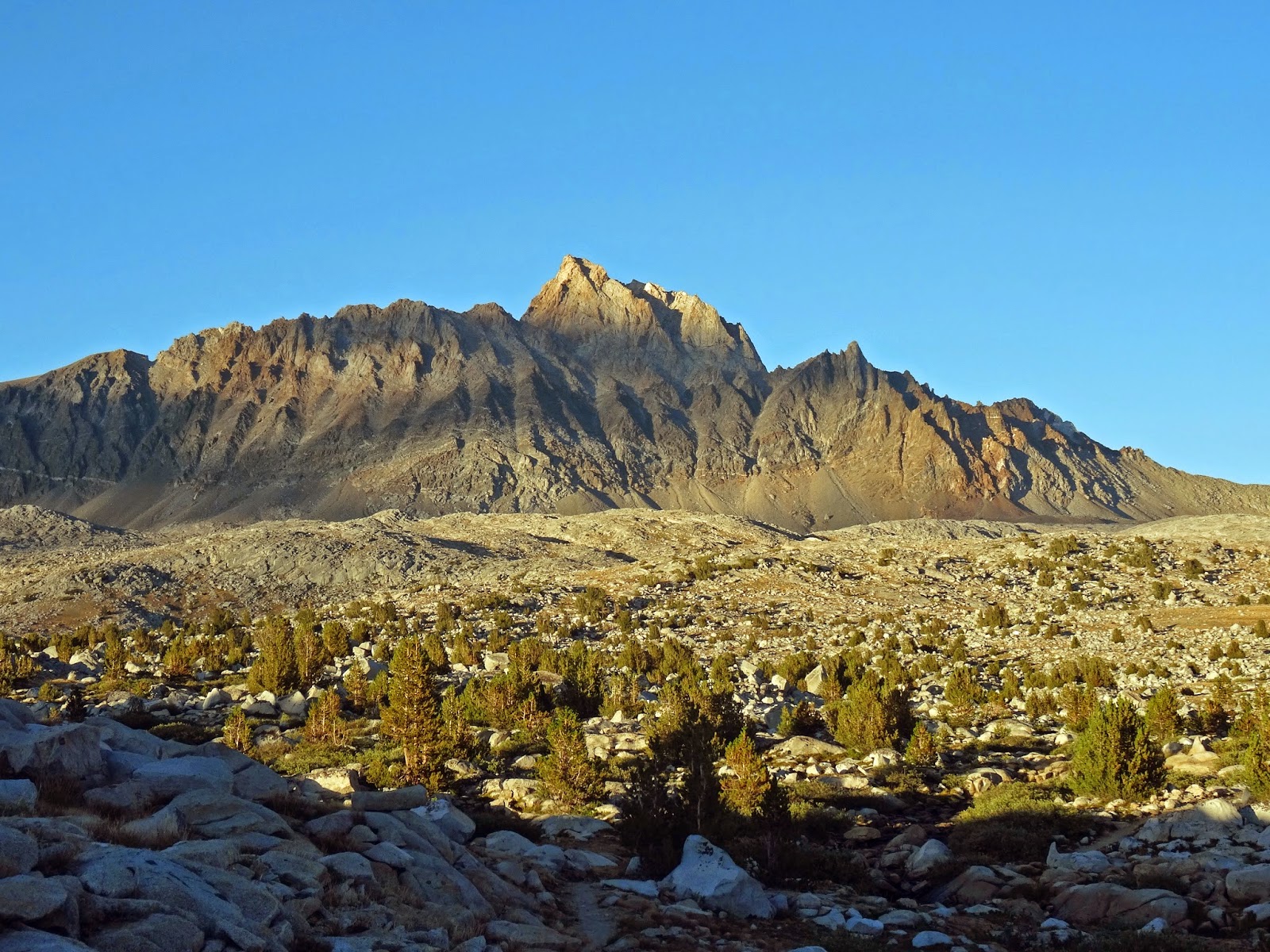
View of Mts. Banner and Rittter from Potter Pass


Lower Twin Lake

Elevation:                                            8,980’
Location:                                            37 17’ 14.5” N 119 08’ 23” W
Trailhead Distance from Fresno:       3.0 hours
Distance to pass from trailhead:         2.2 miles
Elevation gain:                                    680’
Degree of difficulty                             day hiker must be fit and sound

Directions to trailhead: From Fresno, take Highway 168 east to Kaiser Pass Road (near Huntington Lake). Turn right on Kaiser Pass Road and drive about 20 minutes to the Badger Flat parking area on right. There is a potty by the parking. The trailhead is on the other side of the road.

For those who live in Fresno, the closest pass with a view is Potter Pass. There are two access points off Kaiser Pass Road. The trail out of Badger Flat has less altitude gain. When hiking, I either like to hike to a view or to water. The Potter Pass trail can provide both if you go beyond the pass to Twin lakes and further to George Lake. There is also a variety of wildflowers along the trail. After Potter Pass, Twin lakes are about 1.5 miles further and George Lake is an additional mile with a climb to about 9,100’. I think the view at George Lake is worth the extra effort. You can see Kaiser Peak (10,310) above from George Lake.


Upper Twin Lake

While there is no view to the south, the pass itself provides a wonderful and unobstructed view to the north for a distance of about 30 miles. In the view, you may be surprised to see the Ritter Range including Banner Peak and Mt. Ritter. Also, don’t be surprised to see cattle grazing in the meadow below Potter Pass. My wife Sharon likes to swim to the island in Upper Twin Lake.


George Lake with Kaiser Peak in the background

Lower Twin Lake 2014

Upper Twin Lake Panorama 2014

George Lake 2014

Tom Harrison Maps recently (2013) published a map of the “Kaiser Wilderness” which is quite helpful and provides distances at trail junctions. One can hike to the pass and head back to the trail-head or go all the way to George Lake depending on one’s ability and fitness. If you resupply your water in the lakes, have a means with you to purify the water. There is a YouTube video of the hike here:
https://www.youtube.com/watch?v=rHELSpxQkhA&feature=youtu.be

Saturday, August 24, 2013

Mountain Passes and Fresno County California


Fresno County


View East From Kaiser Peak

Wait a minute! I thought Fresno County was known for its agriculture; its fruit and nuts. Well, the western half of the county is known for agriculture. Fresno County is the sixth largest county in California and the forty third largest county in the U.S. with an area of nearly 6,000 square miles. The Eastern third of Fresno County is wilderness and high Sierras.   Those who backpack here from around the world are aware of this more than most of the half million folks who reside in the city of Fresno.

I have had the privilege of being a civilian on the Fresno County Sheriffs Search and Rescue (SAR) Team for nearly a decade. It has allowed me to travel in and appreciate most of the Fresno County wilderness areas. These areas include the John Muir Wilderness, the Sierra National Forest, Kaiser Wilderness and much of Kings Canyon National Park. There are small herds of Sierra Nevada Bighorn Sheep in Fresno County. They are endangered but making a comeback with human help. I briefly spotted two sheep in Sixty lakes Basin this summer.  The John Muir Trail (JMT) begins in Yosemite Park to the north and runs through the Sierra National Forest and Kings Canyon National Park, both of which are in Fresno County. The third highest mountain in California is in Fresno County. North Palisade is 13,249’ and a favorite of mountaineers.

As someone who has been fortunate enough to section hike the John Muir Trail, be flown into other wilderness areas by Eagle One the SAR helicopter, backpack remote areas of Fresno County like the Sixty Lakes Basin and Humphreys’ Basin, there is no other area I have visited with any more beauty than Eastern Fresno County.

So, yes the answer is that Fresno County is known for agriculture and for wilderness activities. It has more lakes than any other California County. I have always been an outdoorsman and was a member of the forestry club in my high school back in Michigan. I once said to a trail running friend, “I wish I had been born here in California.” He responded, “You don’t have to be born here but it’s important to get here as soon as possible.” I agree.

Mountain Passes

Mountain peaks and passes have one major thing in common. They provide a unique perspective; a singular view. Peak bagging has a singular mission to reach the top. I have done some peak bagging but the peaks are what can be termed “walk ups”. There are no mountaineering skills required. Being an average person, Peaks like Kaiser, Half dome, Cloud’s Rest, Mitchell, Alta, Givens and even Mt. Whitney have been conquered as day hikes.


Glen Pass Looking North

Mountain passes are different than peaks because they are traversed as a means to get to another place. It also means that the pass can be approached from more than one direction. For example, most of the passes on the JMT can be crossed from south to north or north to south. In fact, mountain passes can actually be higher than many mountain peaks. Glen Pass (11,978’) is higher than Kaiser Peak (10,320’). Passes are high altitude ‘assurance markers’. Often there is a sign denoting the pass name and altitude. Passes are also used as boundaries between Counties or Parks. Kearsarge Pass (11,760’) is an east- west boundary between Inyo and Fresno Counties. Forester Pass (13,200’) is a boundary between Kings Canyon to the north and Sequoia National Park to the south.

This is about mountain passes but it is also about a portion of Fresno County that even residents are generally unaware of. I am an adopted son of Fresno County having lived here only my last twenty two years. Those years have been filled with personal growth and a spiritual joy that is enhanced by being in the mountains. Is it any wonder that the Israelites received God’s words from the mountains in the wilderness?       


Friday, August 23, 2013

Sierra Storms: The Mountains Make Their Own Weather

Dale Matson


View East to Humphrey's Basin from Piute Pass

I was like a dog on a bone with the idea of crossing over Piute Pass. In three separate trips to the area, I had still not crossed over it. This week my wife Sharon and I traveled to the East side of the Sierras again and stayed overnight in Bishop, getting a walk in permit for the following day. We drove up to the trail head near North Lake (9,356’) and began climbing about 7:30am. We had backpacks for an overnight on the West side of the pass.


Muriel Peak

Once you climb above tree line, the sights are remarkable. Muriel Peak (12,937’) is to the South and Mt Emerson (13,204’) is to the North. Loch Leven and Piute lakes are great places to rest and take in the surrounding sights. We arrived at Piute Pass at 11:30am. We took the trail that skirts the North shore of Summit Lake and found a suitable place to pitch our tent and stow our gear while we “day hiked” to Desolation Lake (11,375').

All of this time, the sky showed signs of storm especially to our East. The “use” trail to Lower Desolation and Desolation Lakes headed Northwest off the Piute Creek trail. It was spotty at times but navigation was easy above tree line. As we climbed toward Desolation Lake, Mt. Humphreys (13,986’) was in full view directly East of us.


Desolation Lake with Pilot Knob left of center


Sharon looking toward the approaching storm

We reached Desolation Lake about 2:30pm and the name became obvious. There is only a large lake surrounded by granite. As we took a bit to rest before our hike back to where we had set up our tent, it began to rain. We had been hiking in a corridor of sun surrounded by rain and storm. Now, in order to get back to our tent, we would have to walk into the storm. We both had hooded rain shells but my rain pants were in the tent and Sharon didn’t want to put on her poncho that she had with her. As we continued back to the tent the thunder and lightning got closer together and closer to us. It poured off and on for the entire return trip to the tent. The pea sized hail hurt our bare hands. We saw three men standing under some scrub evergreens but decided our best course of action was to keep moving to keep warm. The temperature had dropped by at least 20 degrees.


Meanwhile, the skies in Bishop to the east and Fresno to the west were clear and cloudless. The mountains make their own weather. By the time we reached our tent, it was covered in hail. Sharon quickly climbed inside and handed me a down sweater to wear under my rain parka. I went down to Summit Lake for water and treated it after I got into the tent. I put on dry pants, light gloves and my balaclava. Thank God for bringing a 15 degree down bag to warm up my legs. It rained off and on with a weather window for cooking dinner outside the tent. We both slept warmly and broke camp after breakfast at about 6:30am. It still took about four hours to hike back to the trail head once we were at Piute Pass. Tired legs don’t go downhill any faster than fresh legs go uphill.


This is a cautionary tale about mountain hiking. Storms can come up with the hiker far from the trail head. Always have the proper gear including shelter if you are more than a day’s hike from the trail head and your car. Along with injuries and dehydration, avoiding hypothermia is a must. I always carry a Satellite phone also when hiking in the mountains.

Here is a link to the YouTube video of our hike. http://www.youtube.com/watch?v=4s2SPsuaqH0&feature=c4-overview&list=UU0G3jx2PLv6FOw2NM5Aa6Yw

Saturday, August 17, 2013

Piute Creek Revisited


Evening At Mt. Humphreys 
It has been about seven years since I was dropped off by Eagle One on the Piute Pass Trail. The altitude was near the altitude limit for the helicopter. The crew chief took off the doors to lighten the load. It was less than 30 minutes by helicopter. On foot, it took me over ten hours of hiking to get near the same location from the trailhead at the South end of Florence Lake.

The perspective is interesting. Once above tree line (about 10,800’) the view changes dramatically. Even at 11,000’ the mountains seem high. Mt. Humphrys is nearly 14,000’. There is a kind of drama in the basins, canyons and valleys carved out by glaciers and rivers. There is a strip of green on either side of the waterway and rocks beyond that. Is it any wonder that most trails follow water courses? I find that I need to drink a liter of water every couple of miles on a hot day. The sun is intense at 10,000’. 70 degrees at that altitude in such low humidity sucks water out of you like 100 degrees in Fresno.

As I carefully tread my way up and down the tails, I unconsciously remain aware of the sometimes elusive path. This frequently occurs when the trail crosses smooth granite or at stream crossings. In spring, at the time of high water flow, sometimes the best place to cross a stream is above or below where the trail crosses the water. Picking up the trail on the other side can be a problem. When trees fall on an established trail, sometimes a new “use” trail forms around the tree. It is all too easy to follow a water diversion path off the trail.


How many people west of the foothills in Fresno County have been to this part of the county? How many even know about it? Here is a Youtube link to my video of the trip.

http://www.youtube.com/watch?v=LjokobJXmsk&feature=c4-overview&list=UU0G3jx2PLv6FOw2NM5Aa6Yw  

Tuesday, August 13, 2013

Fresno County California


A few years ago I was whisked out of Florence Lake by the Search and Rescue Helicopter for Fresno County, Eagle One. In about a half an hour, I was dropped off along the Piute Creek trail at about 11,000’. I joined the search team near Piute Pass which is the border between Fresno and Inyo Counties. We located the missing subject in late afternoon and reunited him with his backpacking group. Because of the late hour, we camped along Piute Creek overnight and were flown back to Florence Lake the next day.

As I reflect on the experience now, it was an epiphany of sorts. It was a turning point that pulled my attention and focus away from Yosemite to the Sierra National Forest and later to Sequoia Kings Canyon (SeKi). I could not believe how beautiful and rugged the area was that I had just left. It burned an image on my mind that remains today. After spending years on the trails of Yosemite, I realized that there was a beauty and solitude in the mid Sierras that is not surpassed anywhere that I have ever been.

As a Fresno California resident for over 20 years, it had not occurred to me that the heart of the Sierra Nevada Mountains is contained in Fresno County. The largest section of the John Muir Trail is in Fresno County. The third highest mountain in the Sierras, North Palisade is also in Fresno County and there are Bighorn Sheep in Fresno County. The McKinley Grove of Giant Sequoias is in Fresno County also. It's still a big secret.
Mount Humphreys

I have written for the Anglican Diocese of San Joaquin for seven years as a Deacon and now a Priest. I believe there are aspects of my writing that do not apply to the diocese website and limit what I could post. It is for this reason that I have begun my own blogsite. So....God willing, this will be productive.
* note: The photographs are from my book "Seeking The Lost: Stories Of Search And Rescue" and were taken by Deputy David Rippe of the Fresno County Sheriff's SAR Team.
   
 This Is A Shot I Took Last Year