The Sierra Nevada
Mountains: The Palisades
Dale Matson
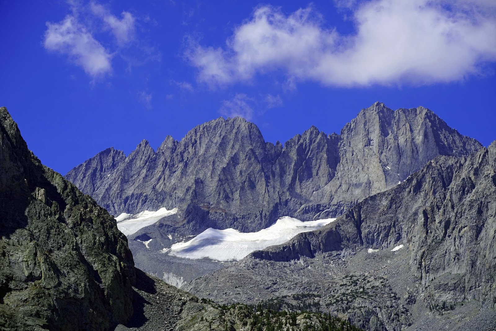
Clyde and Middle Palisade Glaciers
If it isn’t the sheep or the
eagles, it seems like the mountain/lakes in general draw me back again and
again to the Sierra Nevada Mountains. In particular, I love the Palisades and
saw and photographed them from a number of different locations each with its
own perspective. I am a hiker and backpacker with only a few mountain peaks
“bagged”, however I have no photographs of the Palisades from one of the peaks.
The Palisades were named by Josiah
Whitney, the chief of the California Geological Survey and are the highest
stretch along the entire Sierra range with several “14ers”. North Palisade in the 3rd highest in the Sierra and 4th highest mountain in CA at 14,249'. The mountains
separate the California Central Valley watershed to the west from the Owen
Valley watershed to the east. The Palisades contain most of the what remains of
the Sierra Glaciers.
I viewed them from the south and
southwest along the John Muir Trail (JMT) a few years ago when I had no idea
what mountains I was looking at. It rained overnight at my campsite in Deer
Meadow. As I began my morning climb there was a crispness and clarity to the
air with a fog shrouding the Palisades. It was a mystical experience to climb
up the “Golden Staircase”, the area above Palisade Lakes, climb over Mather
Pass and view them from upper Basin. It was some of the most beautiful and
rugged views I experienced along the John Muir Trail which I have hiked in
sections over the years.
More recently I photographed them
from over Bishop Pass, from the west in Dusy Basin. I have visited Dusy Basin
twice now and was not disappointed either time in the views of the Palisades
from the west. The 11,000’ basin provides a relatively treeless and
uninterrupted granite viewing platform.
The last two years I have had an
opportunity to photograph them from the North and South forks of Big Pine Creek.
I included a photo from my Brainerd Lake hike along the south fork this past
week. The string of beautiful green lakes in the Big Pine Creek Basin are fed
by glacial runoff. Temple Craig, a
favorite of alpinists, above Second Lake, remains one of my favorite
photographs and requires an ultrawide lens to capture the total beauty. A
telephoto shot of the Clyde and Middle Palisade Glaciers is available along the
north fork trail before it turns north. There are wonderful views along Glacier
Lodge Road and McMurray Meadows Road also.
There is an
opportunity for “drive-bys” from California Highway 395 between Big Pine and
Bishop CA. Depending on the viewing angle, Split Mountain is mostly hidden by
Mt. Tinemaha or very evident as one drives along Highway 395. Most of the
Palisade shots along Highway 395 require a minimum of a 135mm lens and are best
taken in morning light. Finally, on a clear day, there is an excellent pull out
viewing vista from the White Mountains to the east of the Sierra as one climbs
the highway that takes you to the Bristlecone Pines. I would recommend a
tripod, big lens to bring the Palisades closer. The vista also is a good video
candidate.
I think the
Palisades look their best when adorned with just enough snow to accent their
lines but not enough snow to diminish the colors of the granite. I love the
color in Split Mountain in particular. It was a difficult day hike that took us
to the pond below Split Mountain last year. My best photo there required an ultrawide
lens. I hope you will enjoy my photos of one of my favorite Sierra locations.

Left Split Mtn, Center Left Birch Far Right Mt. Jepson

Split, Tinemaha and Birch Mtns.

Split Mtn. Southernmost Of The Palisades

Temple Crag Above 2nd Lake North Fork Big Pine Creek

Northernmost Palisade Mt. Agassiz Dusy Basin


Mt. Galey Left Mount Sill Right

Mt Sill Left Palemonium Peak Far Right Above Palisade Glacier


Palisade Crest left and Mt. Jepson Right

Following Photographs From JMT


Lower Palisade Lake


North Fork Big Pine Creek Trail Clyde and Middle Palisade Glaciers

JMT Near Mather Pass Upper Palisade Lake

JMT Near Deer Creek Campsite

Dusy Basin

Split Mountain Above Pond
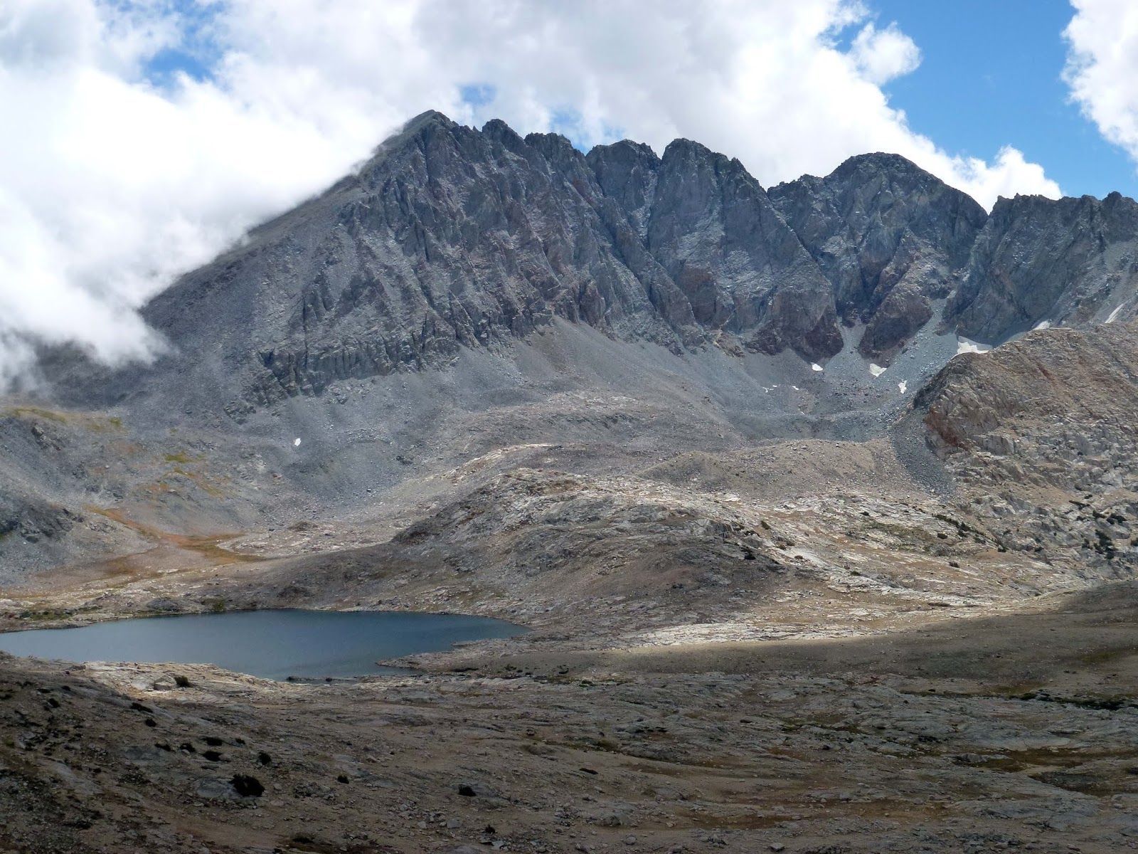
Split Mountain JMT Upper Basin


The Thumb Far Left Middle Palisade Right Of Center And Clyde Peak Further Right
To leave a legacy of beauty for posterity is a lesser gospel but a gospel none the less. Dale+
I have a Kindle Book on the Palisades here: https://www.amazon.com/Palisades-Sierra-Nevada-Mountains-ebook/dp/B07K5RQC73/ref=sr_1_fkmr0_1?s=books&ie=UTF8&qid=1545395154&sr=1-1-fkmr0&keywords=the+palisades+date+matson
To leave a legacy of beauty for posterity is a lesser gospel but a gospel none the less. Dale+


