Birch Lake II: A
Bridge Too Far
Dale Matson
Click On Photos To Enlarge

Suunto Ambit 3 Download

Garmin GPS Route Download To Topo Map
My first attempt at reaching Birch
Lake below Birch Mountain (13,609’) can be found here along with the
particulars of getting to the trailhead. https://midsierramusing.blogspot.com/2018/08/the-birch-lake-trail-on-and-off.html
Sharon and I
got an early start at 7:30am and made a valiant effort to get to Birch Lake.
Unfortunately, after 7 hours of outbound hiking, we realized that we would have
to turn back with our goal nearly in sight because we needed to finish in
daylight. We were able to return to the truck before it was dark but after
sundown. It was that close. Fortunately, we were able to hike back to the truck
in 4 hours and 45 minutes. It is indeed sad that one must be at Birch Lake to
see it. We were actually above it by about 80’ at one point.
I believe
there are three important things to pass along that could be helpful for those
attempting Birch Lake as a 12-mile round trip day hike with over 4,500’ of
gain. If I ever do this hike again, it will be an overnight hike.
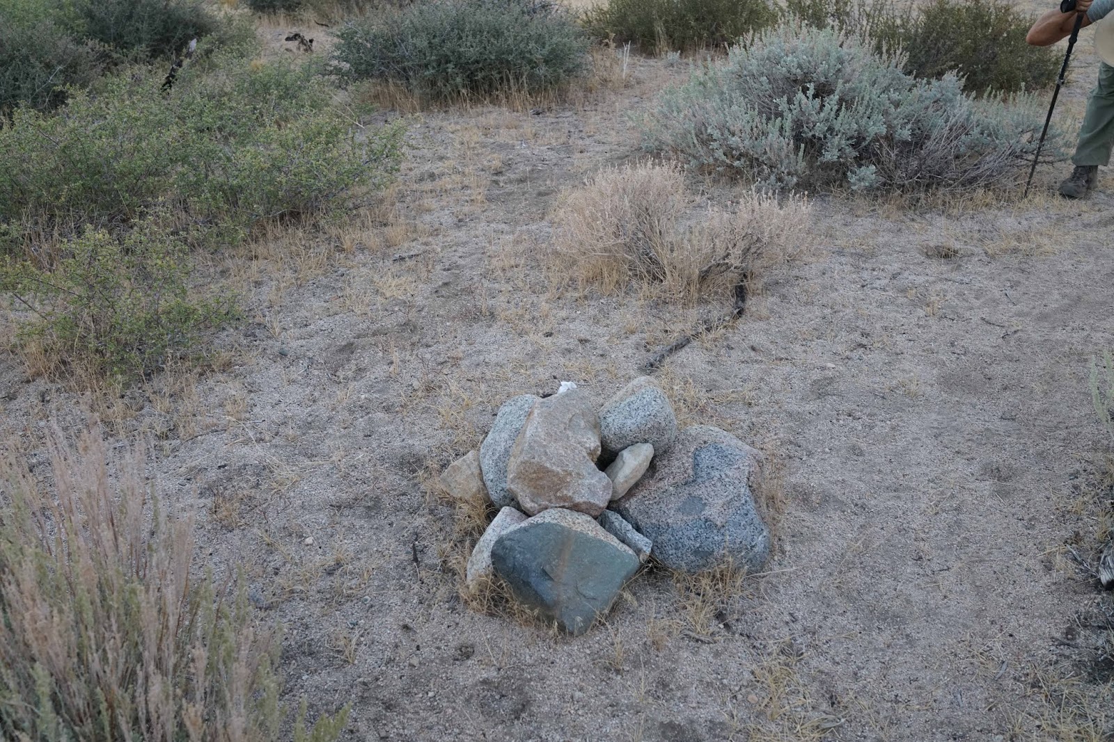
First, a common mistake (not only
me on my first attempt, but others as well) is to take the left fork in the
trail which leads to Birch Creek instead of taking the right fork which is the
real trail. There is a pile of rocks on the north side of the trail by the
junction and white flagging tape. (see photo)
Second, there
is no water available this time of year until the trail runs into a creek at about
5 miles outbound. The springs before that have no water for resupply. Thirdly, when
you reach the creek, follow the trail on the near side of the creek climbing
about another quarter mile before crossing the creek. There is a cairn to mark
that crossing location and several along the trail following that.
We stopped
short of the willows but some have said there is a trail through the willows
and another person said to just dive through the willows.
This is a day hike only for young and fit individuals.
We saw some young hunters and older fishermen along the trail. I am nearly 74
years old and even though I am fit, my wife and I could not beat the daylight
clock and made a good decision to turn around when we did to allow enough
daylight to return to our vehicle. I do not recommend trying to find your vehicle
in the dark even if you have a headlamp. The beginning of the trail is simply a
maze of possible routes. You can see by the map that even at dusk, we were off
the trail on our return.
My photos were
taken with the Sony A7R3, Batis 135mm 2.8 and Batis 25mm 2.0 plus the Sony RX1R2.
The mountain I labeled “Ed Lane Peak” is only labeled on the USGS topo map as
an altitude.

Mt. Tinemaha Left And Split Mountain Right At Sunrise From McMurray Meadows Road


Green Spot Center Is Where Vehicle Is Parked 5 Miles Away

Crop of Above Photo Showing White Vehicle (Center) And Trail Sign At End Of Road


The Thumb On Right (13,388')


Ed Lane Peak At 200mm (cropped 135mm)

Birch Mountain

Take The Trail That Goes North At This Junction


Altitude and Ascent Part Way Outbound

Owens Valley Below With Inyo Mountains Beyond

Ed Lane Peak Center

Hunters
 Tired!


I Made It!
https://midsierramusing.blogspot.com/2020/06/birch-lake-third-times-charm.html
No comments:
Post a Comment