Translate

Friday, August 29, 2014

Day Hike To Granite Basin Kings Canyon


Dale Matson


Click On Photographs To Enlarge

The trailhead for this hike on the Copper Creek Trail is a two and a half hour drive from Fresno on Highway 180. At “Roads End” (5 miles past Cedar Grove) there is a one-way loop with the trail beginning at the north end of the loop, which is the longer-term parking area. The length of this hike depends on where you chose to turn back. I followed the trail down about halfway into Granite Basin in order to see the smaller lakes and that route was about 19 miles round trip. Because the total elevation gain is almost 6,000’, I would not recommend this distance as a day hike for most folks. The trail is well engineered and maintained so that while there is considerable climb, the grade is not severe compared to the Taboose Pass Trail. My hike was 5 hours outbound and 4 hours return.


 Looking East Up King's Canyon
 Looking West Down Kings Canyon
 Avalanche Peak And The Sentinel To The South


 Rear Paw Of Bear In Center

 The Sphinx


An early start is recommended to avoid the sections of switchbacks that are exposed. Much of the trail is through the woods, which provides some shade. As you climb, the mountains to the south begin to appear. Avalanche Peak and The Sentinel are due south. Water resupply is not dependable along the way this time of year. Resupply at each opportunity and expect no water above lower tent meadow. The early outbound views extend both west and east along King’s Canyon.

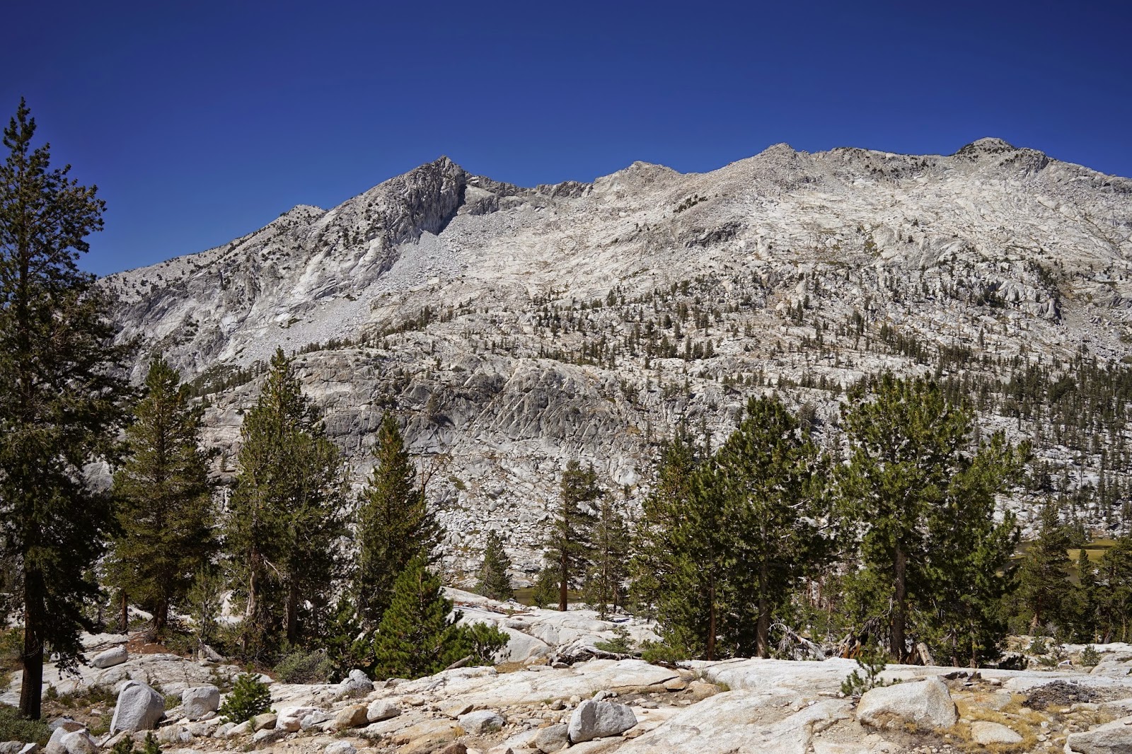
Granite Basin is aptly named with the initial view being a vast expanse of granite surrounding small alpine lakes. The initial view of the smaller lakes is not available until you begin to drop down into the basin. While this trail is more labor intensive than the same distance on the Bubb’s Creek Trail, I believe the views are worth the extra effort.


As usual, I did see a bear from the trail that walked away from me as I headed the opposite direction because of the switchbacks. I looked down but the bear was not to be seen again. I did see the bear tracks on the trail for quite some time as I ascended. I think bears prefer the trails also. I found the Tom Harrison Map Kings Canyon High Country to be a bit short on the mileage according to my GPS, but useful. I used my GPS to mark the water supply places (filtered) outbound and could then anticipate where they were on the inbound leg.

More graphics can be seen here:
https://www.youtube.com/watch?v=9LefNhe8S18&list=UU0G3jx2PLv6FOw2NM5Aa6Yw

Thursday, August 28, 2014

Sleeping Bag Considerations In The High Sierras


Dale Matson

Campsite Near Summit Lake East Of Piute Pass 11,300'
Sharon Bracing Against The Wind

A friend once observed, “You have an amazing ability to discern the obvious.” My obvious conclusion it that in the high Sierras backpackers have to consider and pack for the fourth season year round. I have viewed many YouTube articles by various self appointed gurus on lightweight and ultralight backpacking. The next worst thing other than having to stay overnight as a day hiker is finding yourself in the ‘fourth season’ with three-season equipment. The fourth season in the Sierras is based on elevation and the inevitability of storms.

For example, I often hear on YouTube that a 40-degree sleeping bag is both lightweight and adequate. I assume bag ratings are arrived at near sea level. 40 degrees is not the same at 11,000’. The human body does not process oxygen as well and the blood does not circulate as well. Oxygen saturation in the blood drops and heart rate and respiration increase in response. This serves to bring even more cold air into the body.

I was part of a SAR search party dropped off by helicopter in Crabtree Meadows along the JMT in October a few years ago. We slept on the ground in bivys with pads and sleeping bags in addition to the rest of our gear. The temperature dropped to below freezing that night. One deputy told me in the morning that he was cold during the night in a zero degree bag. I had two 32-degree bags (one inside the other) and was warm but not toasty warm. Others complained of the same problems.

Our Transportation To Crabtree Meadows
Helipad At SeKi Headquarters Near Three Rivers

I was stationed in Fairbanks Alaska in the Army and had to undergo winter indoctrination with a maximum overnight temperature of minus 25 degrees required (below zero!). We used double mummy bags and slept warm.  My son had a 32F degree bag in McClure Meadow (9,700’) and slept cold at the end of June.

Sierra Storms can come up at any time and they can move in fast. The next thing you know is that the shirtsleeve weather you were hiking in is cold and the trail is covered in 4 inches of hail. Being wet and cold in the high Sierra can quickly lead to hypothermia. It takes a warmer bag to warm up again than it takes to stay warm when you are dry.

My point is simply this. High altitude affects the body and makes cold conditions worse. Storms at high altitude can bring about rapid temperature drops. In the interest of safety, accept the additional weight of a warmer sleeping bag IF you plan on sleeping at higher elevations. I have a Mountain Hardwear Phantom 45 degree bag for summer at low altitude but I use a Phantom 15 degree bag for summer at high altitude. Ice formed on my bear canister last week overnight in Center Basin (11,200’).


I am not suggesting that you carry crampons in summer but consider how the altitude negatively affects the body and the possible stormy weather too. Some consider a 15-degree bag at the low temperature end of the three-season bags but it is a good ‘winter’ bag in the summer in the Sierras.  

Saturday, August 23, 2014

Overnight Hike To Center Basin From Onion Valley


Dale Matson


Click on photographs for a larger view
Perhaps the hardest part of getting to Center Basin is finding the junction where it departs from the John Muir Trail. The Center Basin trail travels along the eastern side of Center Peak and the JMT travels along the western side. The route to Center Basin and Golden Bear Lake from Onion Valley is definitely not the shortest but the route into Center Basin past Robinson Lake over University Pass is mostly off trail and I was by myself. The Onion Valley route round trip is about 33 miles with about 7,600’ of altitude gain overall. One of the most discouraging locations on the JMT is where the Bubb’s Creek Trail joins the JMT. From that point it is climb, climb, climb heading north or south. You could also do this from Road’s End but after several trips ascending the Bubb’s creek trail I would rather drive to the east side and climb over Kearsarge Pass.


 Heart Lake
 Big Pothole Lake
Kearsarge Lakes And Pinnacles
 Bullfrog Lake In Distance

Bullfrog Lake

The Kearsarge Pass trail is about the most merciful ascent you will find from east to west over the Sierras. The trailhead is above 9,000’ and the trail itself is well maintained and gradual. There are several lakes along the way but resupply water before Heart Lake. The pass has a wonderful view to the east that includes the Pinnacles, Kearsarge Lakes and Bullfrog Lake. Bullfrog Lake has been closed to camping for many years because of overuse.

 Center Peak In Center And East Vidette On Right
 Bubbs Creek

 Approaching Center Peak 
 Junction Peak In Distance
Center Basin Crags

This is the first time I had taken the trail past Kearsarge and Bullfrog Lakes to join the JMT to head south. You descend from the junction another 1,000’ until the junction with the Bubb’s Creek Trail then begin climbing again heading toward Forester Pass.

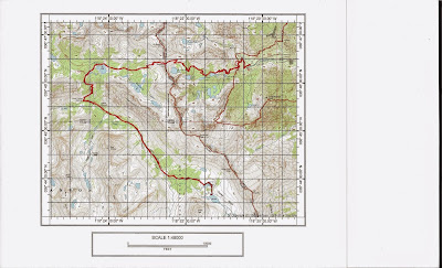
Map Route Versus Actual Trail Into Center Basin
 Center Basin
 Campsite By Center Peak
 Golden Bear Lake


 Sunrise At Center Basin Crags
Center Basin Junction Markings


 Flower Lake
 Kearsarge In The Afternoon Light On The Return
 Bullfrog Lake Panorama


Here are some hints at where the Junction with the Center Basin Trail can be located. My GPS (NAD 27) gave the location as N 36°44.054’ W 118° 22.474’. The altitude was 10,474’. About 20’ south of the junction is a use trail leading west and down to an established campsite with a bear box near Bubb’s Creek. If you come to this trail, you have already passed the junction on the east side of the trail between two trees marked with Cairns at the foot of both trees (See included photographs).

There is a caveat to maps when the maps note that a particular trail is an approximate location. I found the trail to Center Basin sketchy at times but not hard to follow if you pay attention. When I downloaded my route, it was more direct to the first two lakes than the map indicated. Yes, there is a marshy area before reaching Golden Bear Lake but I lost the trail skirting the marsh and took a more direct route. It rests on an obvious ledge about 40’ above the two smaller lakes.

Was the trip worth the effort? Yes, if I had it to do over again, I would spend an additional night in Center Basin, follow the trail south as a day hike and return to the first lake for the final night.

Note: It took me just over four hours to get to Lone Pine from Fresno going over Tehachapi. It took me over five hours returning to Fresno over Tioga Pass through Yosemite. Both routes are about 260 miles.
Note II: There is a YouTube video of this with additional graphics here:
https://www.youtube.com/watch?v=c0-AdgoNPU4&feature=youtu.be