Translate

Thursday, November 19, 2015

Tamarack Ski 2015 II


Dale Matson

Click on Photographs To Enlarge
Route From Tamarack Trailhead To Overlook

For additional information on this ski, see an earlier article. http://midsierramusing.blogspot.com/2015/11/tamarack-ski-2015.html

Well, we got another 10 inches of snow and the best time for backcountry skiing is within two days of the storm. This is because the daytime sun melts the snow, which then freezes at night, and an icy crust begins to develop on top of the powder. That is not good skiing.

This time out we had our two Airedales and a friend Carol who is an accomplished skier. As we headed down the Raven trail once again it became evident that our bigger male Airedale was post holing too much and needed to turn around about a mile and a half outbound. A Fresno friend Walt and 5 of his friends started about a half an hour earlier and broke trail ahead of us. Thanks Walt!

My wife Sharon went back to the vehicle with Duke and Carol and I reached the overlook in a little over an hour. We had a comfortable sunny lunch break and headed back to the vehicle. Our total time out was about 2.5 hours. Mission accomplished.


We stopped at the Shaver Lake Deli on the way down and loaded up with treats. The owner Norm Kato was more than accommodating and friendly as usual.

 Photos From A Turnout along Highway 168

 Heading Out From The Traihead


 Duke Waiting For Me
 Carol Basking In The Sun
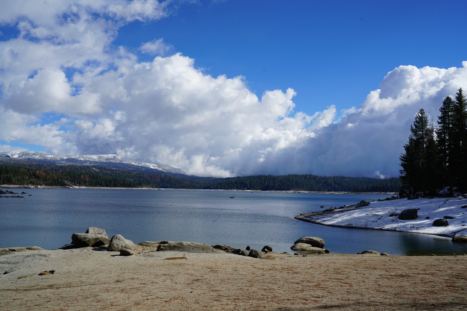
 70mm Shot Of Shaver Lake
 24mm Shot


 Susie Cooling Down


Looking Down The Squirrel Trail At Red Mountain 
300mm Shot Of Sierra Crest Taken From Along HIghway 168

Thursday, November 12, 2015

Coyote Ski 2015


Dale Matson

Click On Photographs To Enlarge
Route

5.4 miles round trip, 7,740’ maximum altitude, and 968’ ascent. 3:15 total time out. [For directions see previous article on Tamarack]

With an additional 7 inches of snow since the last effort, the powder was again ready for another ski. This time it was on the Eagle Trail to the Shaver Lake overlook out of the Coyote Snow Park. Being Veteran’s day, the parking already had several cars when Susie and I arrived. I was surprised to see Bill and his black lab Mather and another group of three folks I know from Fresno at the trailhead starting about the same time. Ruth and her two friends were doing the same route on snowshoes. Bill and Mather opted for the Marmot Trail and I never saw them again.

One of the positives of the Coyote Snow Park is that all the trails are Nordic or snowshoe only, with no snowmobiles allowed. The Eagle trail is uphill most of the way outbound and some sections of the trail are steep. This requires herringbone climbing which consumes a lot of energy and requires stopping to get the heart rate down a bit.

There are four trails. The Eagle, Marmot, Coyote and Grizzly. None are marked that entire well and it is nice when someone has already broken the trail, which also provides a route to follow. It is possible to continue on beyond the cut off to the vista and you will eventually ski to an overlook of Huntington Lake. In mid winter there is not much to see since Huntington Lake [7,200’) freezes over. It looks like a huge snow covered meadow.

By the time you reach the overlook, the hat and gloves are off and stuffed in a pocket. The sun makes the overlook an excellent place to sit. This time of year there is exposed granite, which is not to sit on. The view this time included smoke from a brush fire down by Shaver Lake. We could also see the Forebay above the lake. The trip back down was somewhat sketchy with the snow melted down to the dirt and rocks in places.

For the initial outbound photographs, I used my Sony A7R2 with the Zeiss 16-35mm f4 lens. Many of the shots were into the sun and some had flares that rendered those photographs unsuitable. After a few shots with the 16-35mm at the overlook, I switched to the Zeiss 24-70mm f4 lens. Both lenses hand held, when viewed “actual size” were sharp as a tack. The camera gear amounted to about 4 additional pounds, which is good considering they are full frame lenses.

By the time Susie and I got back to the parking area, it was nearly full of cars. Parents and their children were sledding down the hillside into the parking area and cooking meals on barbeques brought up from home. There is a toilet by the parking area. The fatigue you feel after a ski like that is a good kind of tired.  


 Parking Area With Toilet Top Right


 Final Approach To Overlook

 Shaver Lake Below


 Forebay With Smoke Drifting Above


Fresno Associates With Coastal Range Just Below Clouds


Thursday, November 5, 2015

Tamarack Ski 2015


Dale Matson

Click On Photographs To Enlarge
Route
Well, we are ahead of our seasonal average for rain and snow so here’s hoping that this will continue. I noticed today in my journal that my first ski last year was not until mid December. While this latest storm brought snow as low as 5,000’, there was not significant snow until about 7,000’, which is above the first snow park at the Balsam Forebay trailhead along highway 168 (Tamarack is about 1.5 hours out of Fresno CA). This is an easier 2-mile total out and back trail to the Balsam Forebay. There was more than a foot of snow in places heading out of the Tamarack Trailhead, which is just below 7,600’. I didn’t check out the Coyote Snow Park trailhead just beyond and somewhat below Tamarack on the opposite side of the road but assume this Nordic ski and snowshoe only trail also had plenty of snow.

My trail companion of 10 years is my Airedale Susie and she was already anticipating a trip up to the snow before the rain in Fresno had subsided. I usually prepare the truck when she is outside because she gets too wound up. Her younger brother does not go when I am skiing by myself because the two dogs together are too much for me to handle. Winter is the only time either dog is off leash since they prefer to let us break trail for them following behind us.

The first order of business each season is to buy the annual Snow Park Pass in Shaver Lake on the way up to the snow parks. It is still $25.00 for a seasonal pass that ends May 1st. there are also day passes available for $5.00. Be sure you ask for a free trail map of the winter trails that goes with the snow parks in the area. You may be fined without a pass displayed on your window. These passes are also available online. https://secure.kinsail.com/results.asp?p=casno&pt=parks

Tamarack Snow Park is a popular destination for both folks on snow machines and on foot. The main trail out of the snow park is unrestricted and all must share this trail. In about a quarter mile the 4.1-mile loop Raven Trail heads off to the right and eventually rejoins the Tamarack Trail. Lots of luck finding your way around this loop with a steep descent just before rejoining the Tamarack Trail. The southernmost leg of the loop is not adequately marked. We generally just use the Raven Trail as an out and back to get to the Shaver Lake overlook about 2.5 miles from the trailhead. This also minimizes meeting a snow machine.

I was the initial trailbreaker this year and even though the trail is flat and then a gradual descent before it ascends to the overlook (The trail is about the same elevation at the overlook as the trailhead), breaking trail is hard work. I only got out about 1.25 miles breaking trail and turned back. Susie was glad for this short distance too since she is getting long in the tooth too. It was about 1 hour outbound and about the same uphill inbound.

 Susie Impatiently Waiting For Me At The Trailhead Parking Area
 Main Trail Sign At Junction
 Raven Trail


 Shaver Lake From A Turnout On Highway 168
 Storm Clouds Gathering Above Shaver Lake

Photographs were taken with Sony A7R2 and Sony Zeiss 24-70mm F4 lens.