Translate

Sunday, June 29, 2014

Reflections On A Mutual Aid SAR


Dale Matson

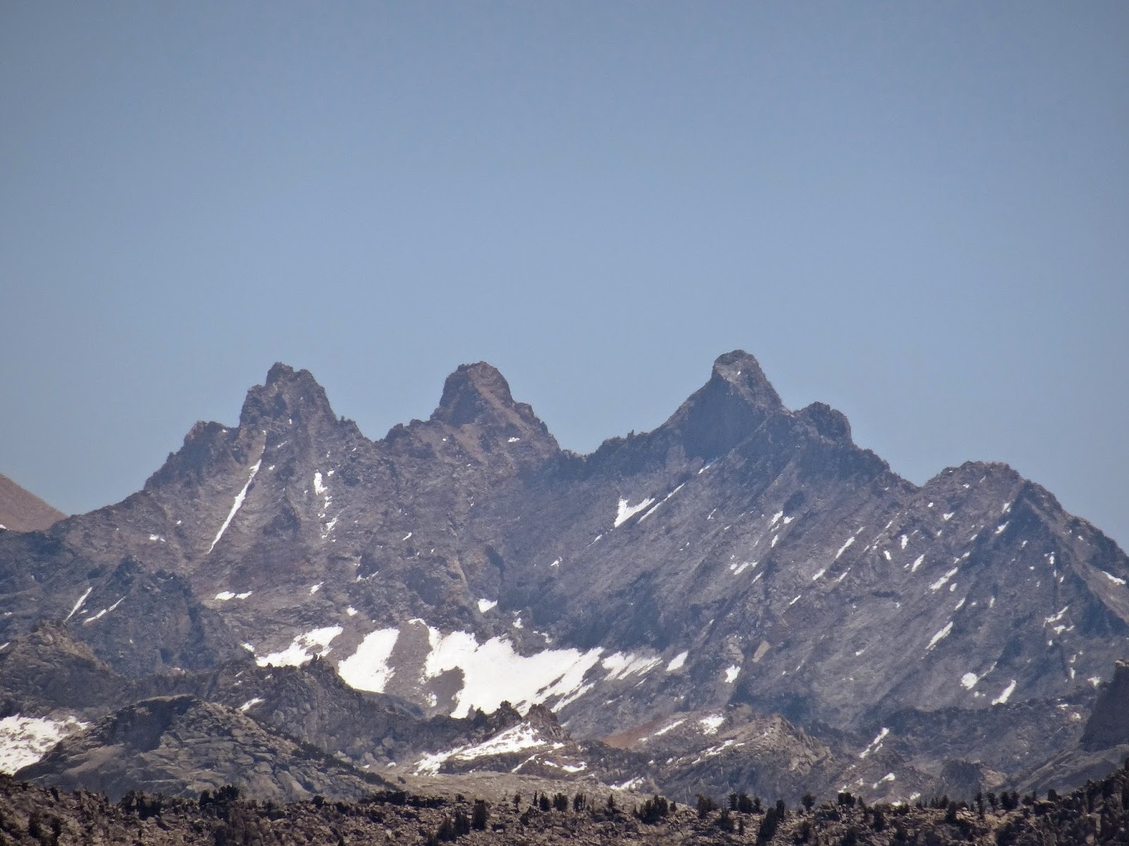
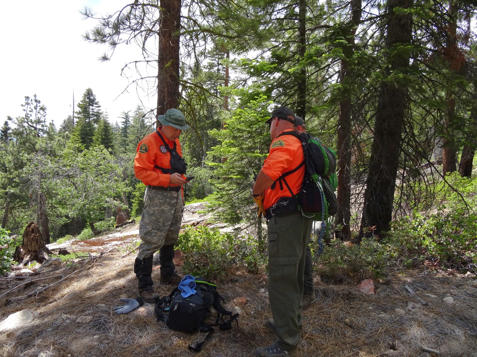
Searchers went to the mutual aid search in Southern California for missing firefighter Mike Herdman. There are a number of factors that led to the tragic outcome. There has been quite a bit written about lost person behavior but this is not just a case of what Mr. Herdman did or did not do. The person hiking with Mr. Herdman began searching for him in the middle of the night and in the process became lost also. Had he not come across a couple of fisherman two days later, he may have perished also. http://www.latimes.com/local/lanow/la-me-ln-firefighters-body-found--20140627-story.html

I lay no blame on Mr. Herdman’s companion who gave a valiant effort to find his missing friend but there is too often an inherent problem when the group leader/navigator becomes incapacitated. Also, even with a navigator/leader, people may become separated from a group and are immediately lost because they have little or no navigational skills. I would like to make the case for everyone being a navigator. If the group leader becomes incapacitated, what is plan B?

A few years ago two men were backpacking in the Sierras when the leader fell and was knocked unconscious. His companion went for help. The injured man’s companion was lost for two days and eventually spotted by a sheriff’s helicopter. Unfortunately, by the time he returned with the helicopter, his injured and confused friend had crawled off the edge of the cliff and fallen to his death.

There are certain things that could be done before a hike that would help to avoid some of these situations. Ideally all hikers would have a copy of the topographical map with the route outlined and there would be a briefing by the leader to orient the hikers. Each hiker should have a compass and know the direction to head to get back to the trail, trail head or a main road. If all else fails wait on or near the trail until the group returns.  Keep in mind that a group is only as fast as its slowest hiker. The plan should be that the group would reassemble at all trail junctions.

Each hiker must realize that he or she is ultimately responsible for their own safety. Know where you are, where you are headed and which way to go to get back. Everyone should have some basic navigational skills. Navigating in the wilderness, like swimming is a basic life skill and could be taught in school. Also if there is someone in the group with connectivity and another person in the group has gone missing, don’t be shy about contacting the local sheriff’s office. The sooner an organized search begins, the more likely someone will be found.   


Saturday, June 28, 2014

Hydration


Dale Matson

Hydration is one of the most important considerations in the wilderness. Water is also one of the heaviest items to carry. One pint is one pound. In the most extreme cases one must carry all of the water needed for the course of the trip. Dehydration should be avoided at all costs and along with hypothermia or altitude sickness can be life threatening in the wilderness. In the dry and warm mountain air, combined with the effort required by backpacking, it is possible to lose water without even being aware of it. If you are thirsty, drink water. Have it in a convenient location to encourage drinking. I have helped search for older folks who perished after wandering off trail. Some have attributed it to high altitude dementia but I believe dehydration played a role.

When I consider a backpacking trip or even a day hike, I look at a topographical map to see if there are water sources along the way for resupply. Know where there is water along the way! Often a hike is to a lake where resupply is guaranteed. What I don’t want is to carry more water than I need or to run out of water too soon. Additionally because a creek is indicated on a map does not mean that it will be there in late summer. Some creeks are year round even in dry years however.

There are two main considerations for me. The first is what containers I will use and the second is what filtration I will need. Let me begin with containers. For years as a trail runner, I went with plastic bottles with pop tops on top of screw on lids. I used a double bottle fanny pack. When I ski the back-country I still stay with this combination. One thing that can happen in cold weather is the pop tops freeze. You can bang the bottle against a tree and unscrew the lid to drink. Even insulated hoses on bladders can freeze up.

I am still partial to bottles. Nalgene bottles seal well and are almost leak and bullet proof. I always carry two brightly colored bottles on backpacking trips. If one winds up getting lost, left behind or rolls down a cliff, you will always have a backup bottle. When there is easy access to water (trails that follow creeks), I only fill one bottle to save on weight. I use one bottle with a filter in the cap. This allows me to quickly resupply and move on with potable water immediately. I also carry chlorine tablets for the other bottle. Having two bottles also allows for a chlorine pill to do its work in a fresh resupply bottle while you drink out of the other bottle if you don’t have a filter bottle.

There are other means to carry water and perhaps bladders are one of the most popular. Most packs today are designed for bladders with a separate pocket inside the pack. I have backpacked with a few folks who swore by bladders. IF the bladder develops a leak or is improperly sealed, guess how long it will take to notice? Your gear may be wet by the time you feel the water dripping down your backside. Also, one is usually committed to filling the bladder once your pack is off your back. This may mean two plus liters of water added just before a big climb at altitude.


There are additional means for water purification like a pump with a filter, ultraviolet pen, and iodine pills. I have used these methods and each works better than boiling. What I do recommend is filtering or purifying your resupply water. There are bacteria and viruses even in a fast flowing mountain stream.    

Wednesday, June 25, 2014

Mitchell Peak: Kings Canyon National Park

Dale Matson

Click On Graphics To Enlarge

The Mitchell Peak trailhead is about 2 hours from Fresno CA. The route begins on Highway 180 and once in the park it is a south turn on the General’s Highway into Sequoia Park. After a drive south, turn left on Big Meadows/Horse Corral Road. Stay on the paved road until you see a sign that says, “SHSC” to your right. Turn right and you will soon see a road marker (Forest Route) “13S12”. Follow it until it turns into a dirt road. Eventually, you will end at the trailhead for Marvin Pass. I think the directions can be confusing and my GPS will clarify the trailhead and route to Mitchell Peak.


There is a cutoff trail on the left outbound that leads to the Sequoia High Sierra Camp. There is another signed trail junction further out.


Mitchell Peak (elevation 10,365’) is in the Jennie Lakes Wilderness of Sequoia National Forest/Kings Canyon National Park and is an out and back hike of seven miles. It has about 2,000’ of elevation gain in the 3.5 miles of outbound trail. The trail is almost entirely through the forest until you are above 10,000’ of elevation. There is a concrete slab on top where there once was a lookout tower. We found that the outbound hike was about 2.5 hours and the descent back to the trailhead was faster at about 1.5 hours. There is no water source of consequence so take plenty of water with you on this hike. There is a bit of boulder hopping at the end but it is not too difficult. Younger folks would call it a “walk up”.

The view is one of the best in the Sierras since it is 360 degrees and well worth the climb. Most of the photographs were with a 35mm prime lens on a clear day and attest to the view.


Panorama
Panorama

Telephoto 

Telephoto

Here is an August 2017 Video of this hike. 

Tuesday, June 24, 2014

Why I Went Back To The Track


Dale Matson

Why in the world would a man in his 70th year want to return to the track after leaving it behind 20 years ago? As any “runner” (and for me, I have to put that concept in quotes) knows, the legs need to be trained to run fast. Track interval training is one of the best ways to do this. Some folks use quarter mile intervals while most distance runners use longer intervals such as a mile. But is that really what I am after? No, I want to increase my average pace by working on my maximum pace. What I mean by an average pace is my “cruising speed” on long runs and average pace hiking in the mountains.

Perhaps the most precipitous decline for me and others as they approach their 70’s is the onset of what I would call “rigamortis of the legs”. Two things led me to the epiphany about this malady. Folks would pass me on the Eaton Trail and exclaim, “Hi Dale, I didn't know you were into speed walking.” The second thing was watching the shadow of a bent over old man moving at a rather awkward gait. I have seen this again and again with my older friends who remain competitive in their respective age groups. The legs just don't seem to move nearly as fast. We look at each other and say, “What happened?”

I think there are a number of factors including the decline of VO2max with aging and loss of skeletal muscle strength. There is also a decrease in heart stroke volume. My current VO2 max is good and consistent with my age of 69 at about 40, which seems rather low compared to elite athletes who regularly perform above 65 for a VO2 max.

Another factor is form and running efficiency. This is something that can be lost even when one continues running into the senior years. Speed work forces one into a better, more erect posture and increases running economy.

There is also a certain unwillingness to suffer the discomfort of a higher average heart rate and running by yourself allows for this kind of unhelpful pampering. Once you work up to a higher heart rate the pain of staying there seems less than the pain of getting there. My current maximum heart rate is not much above my old average long run heart rate. I simply have to stop being such a slacker.

Movescount download data from Suunto Ambit

By running on a track, I can also evaluate to what extent “cardiac creep” factors in at a given pace over a measured distance without wondering how much elevation changes contributed to the heart rate climb. I was pleasantly surprised to find that at a one-mile distance, my heart rate climbed initially but did not increase significantly throughout the rest of the mile.

Minimal Cardiac Creep


My weekly tempo runs were not improving my average pace in a 10K distance. When something isn't working, it’s time to change the way things are done. What is my goal? I would like to get back to one-mile intervals at a 10:00 minute per mile pace for 6 miles. I believe in goal setting, the goal should be realistic and achievable. When the form has returned, the goal will be met.  

Monday, June 23, 2014

SAR Recovery Search In Exchequer Meadow

Dale Matson

The Fresno County Search And Rescue Mountaineering Unit working with the leadership of the Jeepers and Sheriff’s Posse planned a search for the Dinkey Creek CA area. The search was initiated near Exchequer Meadow this weekend.  Personnel from the Sheriff’s Office, The Sheriff’s Posse and the Jeep Unit worked with us on the search. It was great to have both meals and portable potties provided. This was a recovery follow-up of our original search for a hunter Robert Willis who went missing in November of 2008. Here is a recap of the original search from a mutual support team report from San Bernardino. http://search-rescue.us/joomla/index2.php?option=com_content&do_pdf=1&id=299
I also had a chapter in my book http://www.amazon.com/Seeking-The-Lost-Stories-Search/dp/1613793855 about the search.


Anticipating a big group and tight parking near the Command Post in Exchequer Meadow, I drove up Friday night and found a place to park my truck. After sleeping there overnight, I made my way over to the cook tent and grabbed a cup of coffee to brace myself against the 37-degree morning air. We ate breakfast at 8am and were briefed by our officers at 9am.


The Posse and Jeepers had separate assignments but the Jeepers first transported ground team one and the ropes team to the drop off area above Exchequer Meadow. There was a plane in the sky to assist with radio communications and team members on a local peak had set up a repeater the day before.

We had to climb an additional 1,000’ to reach the area we were assigned to search. There is no easy route in this steep terrain. Up is difficult and down is punishing.  At this point (about 8,000’) the five member ropes team and eleven member ground team parted ways. The ropes team would search some of the cliff areas and the ground team worked north to south in line with about a 25-foot spacing. There are problems with a steep side slope because it seems like one leg is quite a bit shorter than the other. The other problem is that once you are in the search area you have to go through whatever is in your path including logs, Manzanita, Buck Brush, and other obstructions. Gators are a lifesaver in this type of terrain.


We took a lunch break about 11:30am. There was one sweep where we simply “cliffed” out and had to drop below the cliff to continue our sweep. The footing was difficult and steep especially with pine needles on smooth granite. I only started out with 2 liters of water expecting to find a source on our search. It was not to be and Lance offered me an extra bottle that he had. He was my hero for the day.

We eventually ran out of time and followed a drainage back down to the road. It was a climb on the road back to our SAR vehicle but there our radios were able to reach the CP. Russ called for an extraction and a number of Jeepers showed up to get us back to the CP. We then downloaded our individual GPS routes.

This is about my 10th year on the Mountaineering Unit and each year the team has increased in size, skills, equipment and organization. I believe leadership is the main reason for this. I was so proud of the professionalism on display at this search. I am the oldest of the active ground unit searchers and welcome the young folks coming on board. Art Sallee remains the oldest member at 85 and provides excellent training for man tracking.  The young people are mature and engaged. It was nice to see our SAR Lieutenant there who introduced new SAR deputies to the team. Her respect for the volunteers was evident. What a resource and blessing this team is for lost individuals. I can only imagine the hours and effort required to make this weekend a reality.

Thanks again to Russ, Martin, Rich and the other SAR team officers for such a skill and team building experience. Thanks to my other team members who give of themselves for the sake of others. Thanks also to the Sheriff’s Office, pilots, Jeepers, Posse and cooks for their involvement and support.


A Prayer For Searchers

Fr. Dale Matson


Dear Lord watch over those who seek the lost. Give them a steadfast will to persevere through discomfort and fatigue. Instill in them a sense of optimism and hope. Convey them on steady feet and strong legs. Help them avoid missteps and wrong turns. Protect them in whatever their conveyance. Give them a heart of strength and quiet compassion. Endow them with keen and steady vision. Open their ears to human sounds calling out in wilderness. Let them have sound judgment about what is possible and what is not possible. Give them a team spirit to watch out for one another. Equip them with adequate skills and provisions. Bring them home safely and protect their families while they are away.  Provide their leaders with clarity of thought, courage of conviction and the wisdom to deploy them correctly. Amen