Dale Matson
Click On Photographs To Enlarge

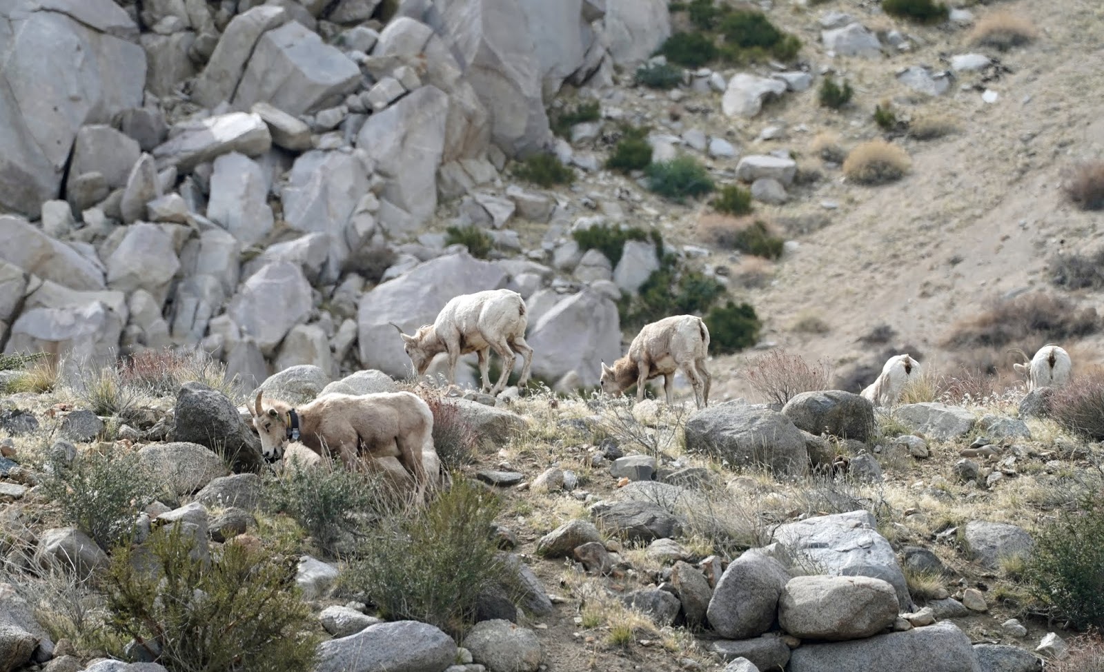
The Six Sheep In Sawmill Canyon (That we could find)
My wife Sharon and I went to
Sawmill Canyon near Aberdeen this week with the tip from Steve Yeager (AKA “The
sheep whisperer) that there were bighorn sheep in the mouth of the canyon.
Knowing they are there and the general area is no guarantee, however that you
will actually find the sheep even with spotting scopes and binoculars.
We drove as far as prudent and
parked and walked the rest of the way. We both found a seat on large boulders
and began to scan where we thought they might be. Fortunately for us it was
early but late enough that they were up and moving and not laying down. Finding
the sheep usually begins with finding one and continuing to look until others
begin to appear also.
This was a group of 6 standing near
each other standing and eventually began moving out from the mouth of the
canyon. It seems like the ordinary morning routine is to be up higher for
safety from mountain lions and to work their way down to better feeding areas
as the day progresses.
The morning sun from the east was
in our favor for finding and photographing the sheep. Even though they were
well aware of our presence, they continued to actually move toward us making
for closer photographs. They seemed to know that we were a benign presence.


The following morning, we drove off
the highway at Pine Creek Road and made our way to Wheeler Ridge. Even though
we got close to the ridge, the sheep were up quite high and more than a quarter
mile away. The sheep stayed high for much of the morning and did come down some
but we had to leave for Fresno at 11:30am.
We bid our adieus to Steve and
Danny from the CA Department of Fish and Wildlife who had recently pulled up to
conduct some mission in the area. Just can’t get enough photos when you have a
chronic case of sheep fever.
A tripod was necessary for these
photos. I used the Sony 100-400 mm GM lens with a 1.4 TC. These were not
National Geographic photos but had it not been for Steve, Sharon and I would
never have found the sheep. Keep in mind that there are only about 500 of these sheep total.


Young Ram


