Dale Matson
Click On Photographs To Enlarge

Hike Route

Edison Lake Ferry


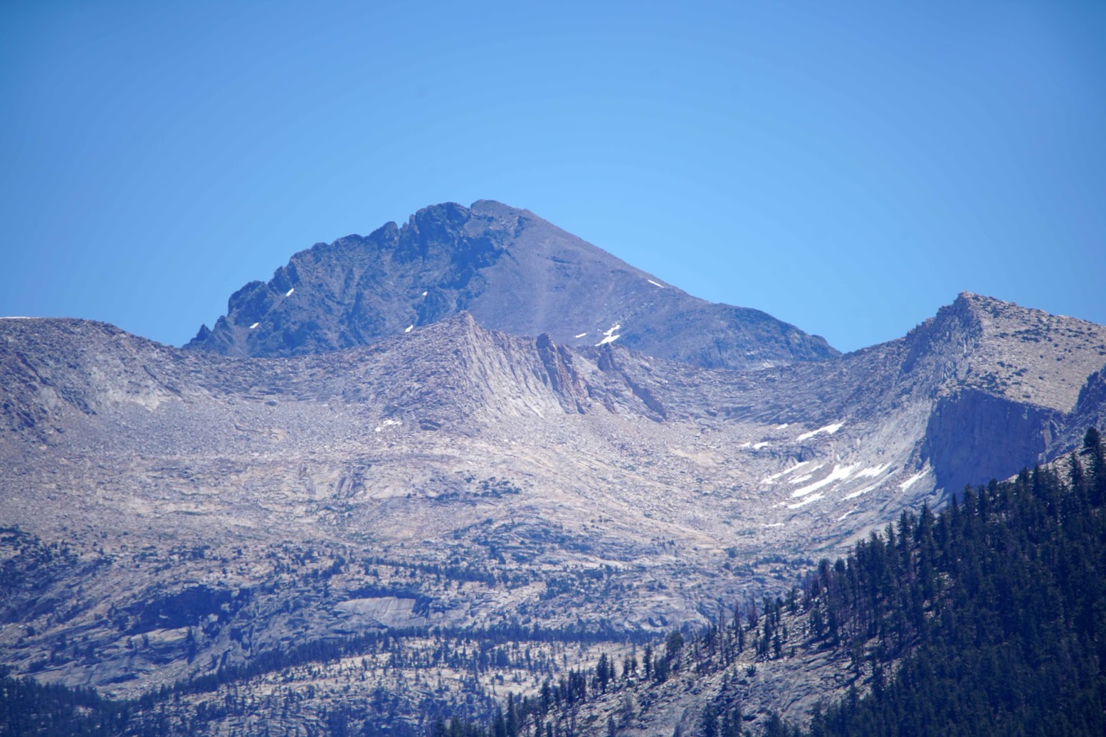
Devil's Bathtub Is In The Arena Formed By The Mountains

Mono Creek


Creek Crossing The Trail


My Tent Location


Waterfall on East Side Of Mott Lake

Snow Still Evident

Heading Back To The VVR On The Ferry

Morning Photograph Of Mott Lake
Mott Lake details: elevation 10,072’. The distance is about
15 miles round trip from the boat landing at the east end of Edison Lake. The
elevation gain is about 2,650’ overall with nearly all the gain outbound. My
hike time was about 6 hours outbound and 6 hours inbound the following day. I
paid $25.00 for the round trip ferry and overnight parking. The money is well
spent. It would have been an additional 10 miles of hiking if I had begun and
ended at the Mono Creek Trailhead instead of taking the ferry.
My friend Mike
Phillips recommended the hike and I opted to do it instead of an overnight at 4th
recess lake on the Mono Creek Trail. It was a good decision. The other hike
would have been too ambitious for me.
Riding the 9am ferry is a ½ hour social event where you chat
with folks who are returning to the JMT/PCT from their stopover at Vermillion
Valley Resort (VVR). Others are just out for a day hike and will return on the
5:30pm return run to the VVR. Special trips can be arranged for extra money. We
were dropped off at the east end of the lake and followed Cairns through a
campground to the Mono Creek Trail. The drop-off point changes as the water
level drops throughout the summer.
After about a mile and a half, there is a junction with the
JMT. Heading northbound toward Silver Pass both trails run together until the
Mono Creek trail heads east toward Mono Pass. Continuing north on the JMT there
will be a sign for Mott Lake at the Junction. The Mott Lake trail heads
northeast. On the Tom Harrison map the trail is indicated by dots instead of
dashes. It is a trail that is rarely, if ever maintained and it is discouraging
to see such a steep trail heading up and away from the JMT. Don’t be
discouraged; the worst of the climb is the initial part.
The first part of the climb is dry, with the creek far below
the trail. You have to pay attention as you step over deadfalls and cross open
granite slabs. There are helpful stones and Cairns placed for guidance. When
you finally reach Mott Lake, there are a few established campsites above on the
west side of the lake. There is a nice waterfall that can be seen and heard on
the far side of the lake. Because of fatigue and time limitations, I set up my
tent, stayed the night and headed back the following morning after taking more
photographs. I used a Sony A7R2, a Zeiss 18mm 2.8 and 85mm 1.8 for the
photographs.
My recommendation would be to spend at least two nights at
Mott Lake and do day hikes to Rosy Finch Lake, Bighorn Lake and or Blue Jay
Lakes if you are good at off trail navigation and a fit climber. Just remember
to be back at the ferry landing by about 5 pm for the ferry pickup unless you
want to add another 5 miles of hiking.
I got to the landing about 3pm and others gradually showed
up. The clouds began to gather and we heard distant thunder. The ferry was
“storm delayed” until 7:30pm. Of the 15 or so folks, none decided to hike the
additional 5 miles to VVR on the Mono Creek Trail on the north side of the
lake. We went from being prospective passengers to being a support group. Not
everyone was prepared to spend the night there. When we finally saw the ferry
approaching we all gave a cheer as if we were being rescued not picked up.
A video slideshow with additional graphics is available on YouTube.
https://youtu.be/s8GWmzSM31c
A video slideshow with additional graphics is available on YouTube.
https://youtu.be/s8GWmzSM31c