Dale Matson
Click On Photographs To Enlarge

Hike Route
As you drive east through the east gate of Yosemite on
Highway 120 (Tioga Pass Road) a few things catch your eyes. There is the steep
11 mile 3,000 plus foot descent to Highway 395. On your right there are two
lovely lakes, Tioga Lake and Ellery Lake below it. You can also see Mount Dana
on your right (13,061’).
Between Tioga and Ellery Lakes on the north side of the road, there is a sign for Saddlebag Lake. As you glance to the north (don’t take your eyes off the road too long) there are snow-clad mountains that beckon. After 25 years of passing up the opportunity, I made my left turn, drove the slow 4.5 miles to the Saddlebag Trailhead parking area and walked down to the store area to purchase my $15.00 round trip ticket on the pontoon boat water taxi. http://www.saddlebaglakeresort.com/amenities.html
While there is a
trail on both sides of the lake, the actual 20 Lakes Basin 6 mile Loop trail
starts at the north end of Saddlebag
Lake. One can hike the loop trail clockwise or counter clockwise. Most folks opt
for the ferry to save 3 miles round trip.
The seasonal ferry
runs on a regular basis and you designate a return time when you buy your ticket.
I didn’t get started until 11:30am because I couldn’t leave Fresno until 7 am.
If you don’t have a map, you can get a hand drawn map from the store for free.
The second issue for me besides the late start was the fact
that I also wanted to hike to Conness Lake (not a part of the loop trail),
which is accessed by a use trail and has a moderate climb. The reason for the
side trip was a photograph I had seen of the lake with beautiful green water
caused by glacial melt from the Conness Glacier below Mount Conness. You simply climb following the outlet stream
to the first lake. Therefore, I only had time to climb to the first Conness
Lake and then hike the west side of the loop trail before taking the final
water taxi back to the south end of Saddlebag Lake.
As you head back on the water taxi, there is an
excellent view of Mt. Dana from the lake. I would like to go back a second time
and hike the east side of the loop and look down into Lundy Canyon. On my hike,
I was able to see and photograph Saddlebag, Greenstone, Conness, Wasco and
Steelhead lakes. Fellow travelers included backpackers, fishermen and other day
hikers.

Wasco Lake

Conness Lake

Conness Lake

Mount Dana

Saddlebag Lake Looking Northwest


Use Trail To Conness Lake

Conness Lake

Conness Lake

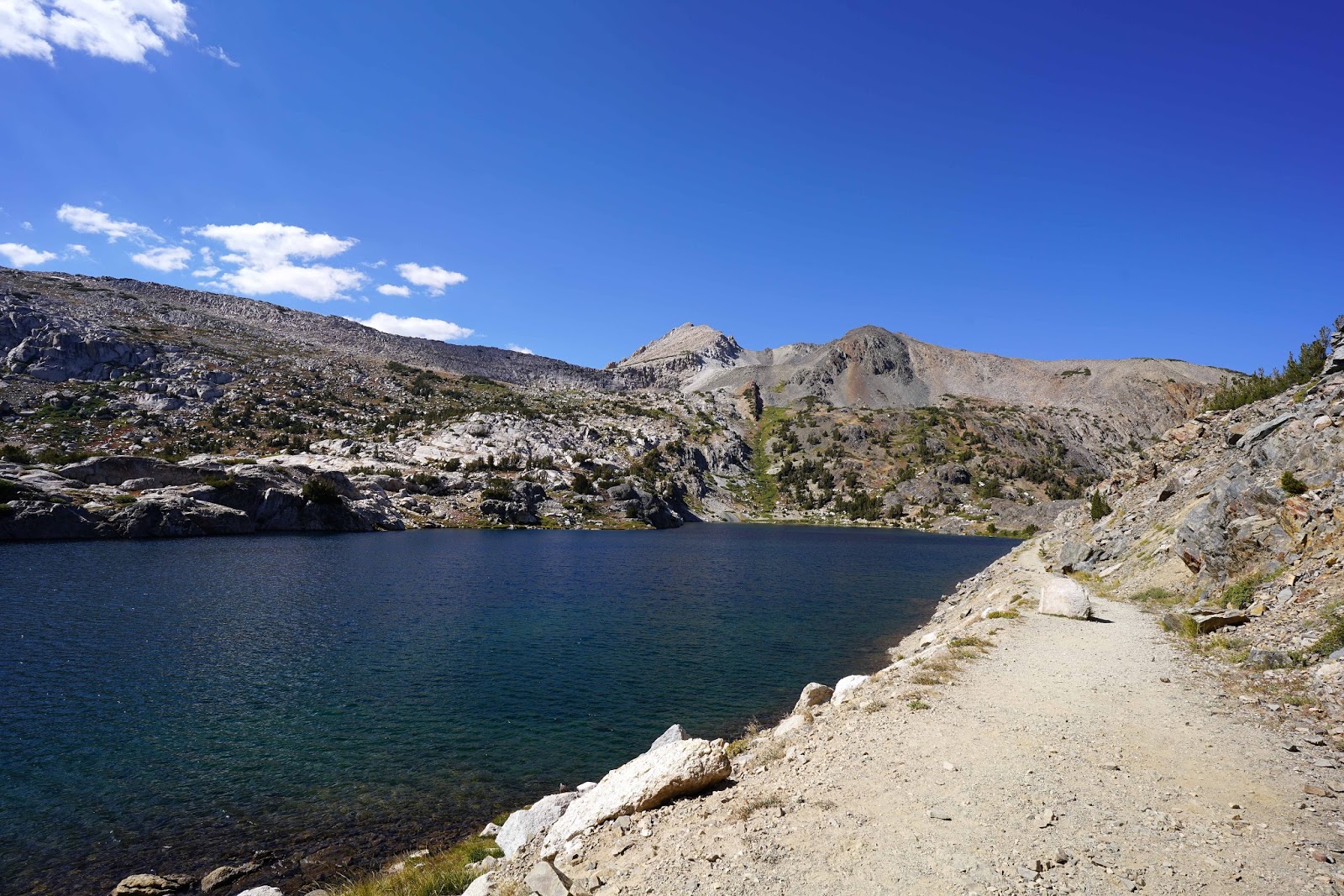
Greenstone Lake

70mm

Greenstone lake


Southern End Steelhead Lake
Steelhead Lake Looking North
I highly recommend this day hike and an early start
including the water taxi should allow one to hike the entire loop in a day. I
published a book on Alpine Basins which did not include 20 Lakes Basin but I
believe the per mile beauty of this basin hike is as good as any basins I have
hiked. https://www.amazon.com/Introduction-Alpine-Basins-Central-Sierra/dp/151768482X
Additionally it doesn’t require going over a high pass to
get there. It seems like each trip to the eastern Sierra Nevada provides at
least two more reasons to return.