Translate

Tuesday, November 9, 2021

Sierra Winter Recon 2021


Dale Matson

Click On Photographs To Enlarge


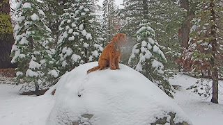
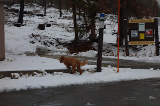
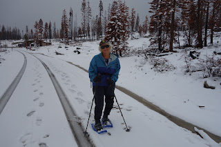
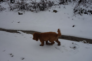
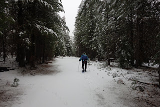
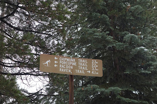
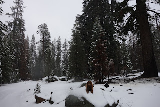
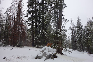
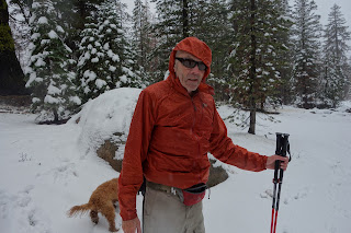
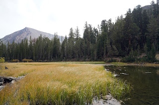
After a swim this morning Sharon and I decided to do a recon to Tamarack (Elevation 7,600’) with our Mini Golden Doodle Hobbes. This is his second winter and he really enjoys running free and running in the snow in particular. He also likes climbing up on boulders for a better view!

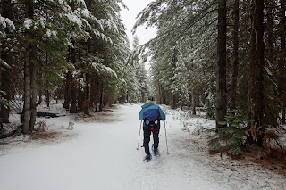
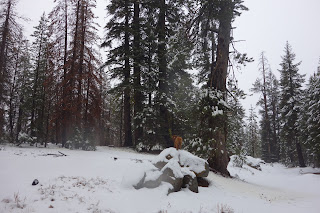
The snow last night was above 7,000’ and when we got to the snow, it was raining. So off we went. We were out about 50 minutes. We all got plenty wet! Sharon was in snow shoes and I just wore boots since I knew the snow wouldn’t amount to much. 

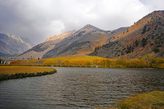
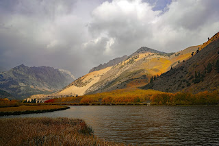
After we finished, we headed down to Norm Kato’s Shaver lake Deli for Tri-Tip sandwiches. The whole trip only amounted to half a day and we were glad to get back in the snow. Shaver Lake is really low right now. Hope we get lots of snow this winter.


Norm


Sunday, October 17, 2021

Bishop Creek And North Lake: Fall Color


Dale Matson

Click On Photographs To Enlarge

Smoky Sunrise

It never seems like we get the right combination for full color. Last year we were too late and this year we were on time but the sky was smoky. We went to the East side of the Sierra and were as far North as Virginia Lakes and as far South as highway 168 (Line Street in Bishop). Additionally, Yosemite was closed for our return to Fresno because of anticipated snow, so we had to return via Bakersfield.

Highway 168 is much photographed Eastbound out of Bishop and the second day we headed that way. Because of the smoke, Mts. Tom, Basin and Humphrey were barely visible as we drove East. The first stop (on our left) was a small reservoir with nice fall color and a pleasant walk to and over the dam. We also went to Sabrina Lake but found it smoky with very low water levels. I think I got a couple of shots near the dam of the creek outflow.

We then headed to North Lake and… bingo! We could see about 9 tripods with cameras set up on the end of the lake. The smoke was not as bad because the distance was shorter for the color surrounding the lake. The sky was variable with some rain, some snow and some sun. This yielded a moment by moment change in the lighting. This was the year for North Lake and the creek flowing from it. It’s funny how some places are better one year than others. 

A day earlier, Lundy Canyon and Lake, while clear of smoke, were a bust for water and color this year. We didn’t go on lower Rock Creek Road or McGee Creek this year but the Fall colors were reported to be good there.

My photos were taken primarily with the Sony A7R4 and the 24mm 2.8 lens. All of my shots were hand held.


Tuesday, October 12, 2021

Garmin Fenix 6X Pro Solar HR Data Problem And Solution


Dale Matson

I have used a HR monitor for more than 25 years and have gone from a Polar to a Suunto and to a Garmin Fenix. One of the features that led me to the Fenix 6X was a wrist-based heart monitor that was reputed to accurately record my HR while swimming. Well, Garmin is not there yet.

This is what Garmin states.

“Some Outdoor watches feature an optical heart rate sensor (OHR), which uses light to penetrate the skin and estimate heart rate. The sensor requires a constant seal against the body to be accurate. The watch will need to be in direct contact with the skin of the wrist, and the band should be adjusted so that the watch is snug enough not to move or shift during the swim, but not so tight as to impede or restrict circulation. By default, the OHR sensor may be disabled. The OHR can be enabled during swim activities on compatible watches, but accurate heart rate tracking will require proper fit of the watch during swimming. Wrist Heart Rate settings can be found in the Sensors & Accessories menu of your watch.” https://support.garmin.com/en-US/?faq=FiDFYSmt6wAsvsw5yd7DD7

If you are not getting accurate wrist HR data while swimming, then you will need to purchase and use a chest strap that has a blue tooth connection to your watch. The information is transferred to the watch after the exercise. I use the Garmin TRI Strap for swimming. It is paired using Menu>Sensors and Accessories>Add New>External Heart Rate>Chest Strap.

Here is the rub. If you use a chest strap, you must turn off the wrist-based HR sensor when swimming. This is done by going to Menu>Wrist Heart Rate>While Swimming Off. If you don’t, you will download to Garmin Connect and get conflicting data. In this example, I show both the downloaded chest strap data AND the wrong heart rate information in the swimming part of the chart. It also increased my recovery time b/c the recovery time was determined by my inflated wrist-based number which was above 150 HR. (I’m age 77). 

    Hope this helps explain the confusion some of you may be experiencing. Click Photos To Enlarge.


Sunday, October 10, 2021

Out And Back On Virginia Lakes Trail To Cooney Lake


Dale Matson

Click On Photographs To Enlarge


Location Hoover Wilderness/Toynbee National Forest

The drive in is north of Lundy Lake off 395

Trailhead Elevation 9,565’

Maximum Elevation 10,200’

Round Trip Distance 2.62 miles


We were on the east side of the Sierra Nevada for the fall color. And decided to take the Virginia Lakes Trail to Cooney Lake. The trailhead begins at and slightly above Big Valley Lake. There is a toilet there also.  On the way in, you drive past the resort at Little Virginia Lake on the way to the trailhead. My final photo is of Little Virginia Lake which is not a part of the trail.

It is a pretty good climb outbound of over 600’. We took our time and rested often. The weather was great for hiking. After Big Valley Lake, there is a large unnamed pond before you get to Blue Valley Lake. As you continue to climb you will go past a former miner’s cabin, and not long after that, you will arrive at Cooney Lake. The trail continues to Frog Lake and beyond.

The trail is well maintained and well-traveled. We past several folks who were sight-seeing or fishing on a Thursday. I suspect it would be a busy trail on the weekends.