Dale Matson
Click On Photographs To Enlarge

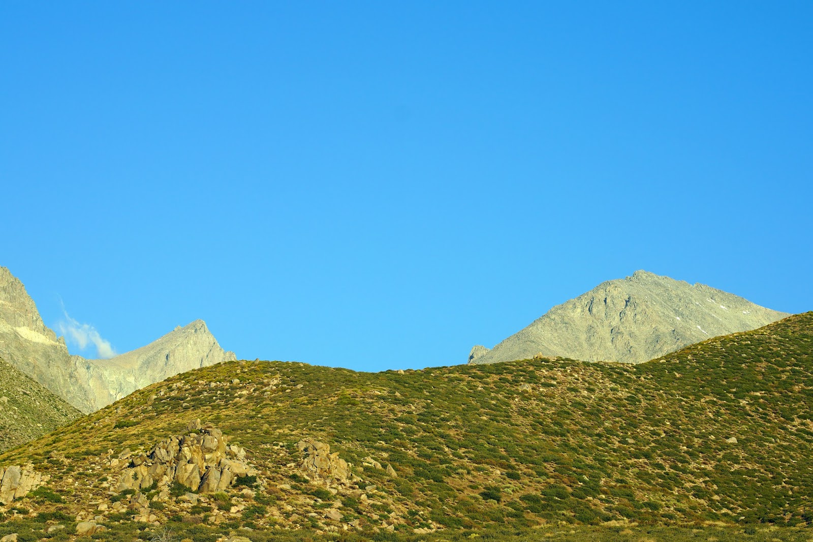
Trail Route
 Birch Lake Basecamp Map Route

[Trailhead elevation about 6,500’. Lake 10,800’, Steve and I required 14 hours total time]
Well, after two separate efforts to get to Birch Lake, I thought the time was right for a third try. I was relatively fit from hiking over on the west side of the Sierra. The daylight hours were long and my friend Steve Yeager from Bishop was willing to go with me. I made reservations in Bishop for two nights, for the night before and the night after my hike. The hike day was forecast to be the coolest day of the week. It was very windy in Bishop Saturday and Sunday but the wind stopped at 4am on Monday morning (a good omen).
Here are the particulars on getting to the trailhead. The Birch Lake Trailhead is accessed by heading west out of Big Pine CA on (initially) Crocker Street which eventually becomes Glacier Lodge Road. After about two and a half miles there is a left turn onto McMurray Meadows Road which is unpaved. Make sure you are on McMurray Meadows Road. You drive about 5.5 miles and Just before you cross Birch Creek, there is a trail to the right going slightly uphill there is a sign there. Follow that road for less than a mile with a high clearance vehicle and find a slot to park near the gate which is currently locked. There are about 4 places to park. The trailhead sign is not far from there.
Steve and I met at the trailhead for Birch Lake at 5:30am. We were the only ones on the trail that day. You can see by his photo that he was wearing shorts. Not a good idea. This would give us a lot of daylight hours for the hike, which we needed. The hike was twelve miles round trip with over 4,000’ of elevation gain. The trail is entirely exposed and Birch Lake is 10,800’. My second attempt with Sharon required us to turn back early because of daylight issues and no headlamp last Fall.
The climb is merciless except for a few flat spots. The view up and (later) down is amazing. There is one place you cross a stream before you get to the lake. That is the only opportunity to resupply water except for the lake (purified or filtered). You climb following the stream before you cross it. Some anti-cairn person knocked down many of the ducks that help guide the way including where to cross the stream.
And here is the caveat. The Tom Harrison map shows the last half mile as having no trail. That is the only honest map. If only. If only it was just cross country but it is boulder hopping and pushing through thick willows. This trail is seldom used and I’m guessing everyone who eventually gets to the lake finds their own way the last half mile. And… you have to be at the lake to see it! For this hike I highly recommend a GPS to find the lake and…to find your car when you return. There are lots of cow paths near the parking area that can be confusing.
Steve is kind of a pack rat and added a couple of items to his 30-pound day pack. He found a part to an airplane that crashed into Birch Lake and put that in his pack along with a single antler which he strapped to the back of his pack. He said he was going to come back and look for the other antler. He had a good time fishing and caught something every cast. He was sorry he hadn’t brought his sleeping bag and stayed the night. I was glad he was heading back with me.
I had my Sony A7R4 and used two lenses for this hike. I used the 85mm 1.8 Sony lens and my Sony 24mm 1.4 lens. I have a crop mode shortcut button and thus could get 130mm and 35mm shots with big files also.
Was this worth the suffering for this 75-year-old? Yes, it was. This is one of the most beautiful lakes in the Sierra Nevada. Thanks once again Steve.


Tinnemaha and Split Mountains


Birch Mountain


L-R Birch, Ed Lane Peak, The Thumb


Steve Looking Back At The Owens Valley


Ed Lane Peak With Glacier


Author With Birch Mountain


Beautiful Birch Lake


GPS Tells The Story


Steve Catching Fish

Rock Shelter


12/12/41 Gen. Dargue killed in bomber crash near Birch Lake in the Sierras due to bad weather. Interesting tidbit.
Hello there Dale. A friend of mine talked me into going with him to "scout" the Birch Lake area out for some future hunting. Your blog was very helpful during my preparation for the hike. Although you described the hike as merciless, I thought, "how bad could it be?" Well, merciless probably does not do the hike justice. I have hiked different parts of the Sierras and Grand Canyon over the last 25 years and would rank this hike as one of the five toughest, without question. Being exposed as you ascend is brutal, but the bushwacking and boulder hopping after the climb is misery. Having seen a number of glacial lakes over the years, Birch Lake is pretty but I wish it was more accommodating for some camping. Anyway, you already know all of this because you have done it. I will let you know that our group consisted of a very athletic 28 year old, a twelve year-old (my son), and myself who am 47 and run marathons. I say that because you were the topic of discussion during our descent and our determination was that you are some type of physical freak! For you to complete that hike in a day is almost unbelievable. We stayed the night and still struggled to get it done. Thanks again for the blog information because without it we may have never found the actual trail after beating through the maze of cow paths. I am going to ask a favor of you, if that is ok. I noticed your GPS and am trying to get real mileage. What did you come up with? From my perspective that is a one time hike, just to say you did it. Thanks again for all of the help.
ReplyDelete12 Miles. Congrats!
ReplyDeleteI have permits to visit this lake for Labor Day weekend and I'm having trouble finding a GPS track to download to my phone or watch. Would you be able to share yours? I'm a little nervous to try without it. My email is bamanda28@gmail.com
ReplyDeleteAmanda,
ReplyDeleteYou need a software map that you can use to find coordinates on. The trail is shown on my GPS and is exactly where it shows it to be except when you have to dive through the willows and boulder your final half mile. At that point, the lake location is obvious. I don't have/use a phone for navigation. I used the GPS you see in the photo, a Garmin GPS Map 64 With a West 24K chip set. That is detailed enough to see the trail on your screen. Don't go by yourself and have someone along experienced at navigation. P.S your first waypoint should be where you park your vehicle. That way you can find/trackback to that point. Read the first comment too. This is a serious hike. Have you done a hike with 4,400' of gain with a backpack on an exposed trail in a single day? Is there someone out there who can suggest a mapping software program for a phone?