Shuteye Peak (8,351’)
Dale Matson
Click On Photographs To Enlarge

Shuteye Peak Hike Route
Since I live in Fresno Ca, I am
always looking for new ways to view the Sierra Nevada from the west side. Some
of my articles have included, White Bark Vista, Kaiser Peak, Mt. Gibbs,
Mitchell Peak and fire lookouts. These include the lookout in Kings Canyon near
Panoramic Point, and the Mt. Tom fire lookout near Kaiser Pass. Yesterday we
spent 4 hours getting from Fresno to
the place we started our hike from. I guarantee you, the roads above Bass Lake
are confusing to say the least. Let me begin with a route to consider. Keep in mind that unless you have an
off-highway vehicle (OHV) set up especially for off road travel, you
will not be able to drive to the top of Shuteye Peak. I have a 4X4 Tahoe
with undercarriage protection but would never consider driving the 2.7 miles
beyond the gate to the top. There are places above the gate that look similar
to the Dusy Ershim Trail. We parked 1.0 miles below the gate so our total hike
round trip was about 7.5 miles. There are two areas on the left in relative
proximity just below the gate where we could have parked had I known ahead of
time that they were there. One has a campsite.
Here is one way to get there from Fresno.
Take Highway 41 north past Oakhurst to the Bass lake turnoff (road 222)
continue until the road forks taking road 274 to the east side of the lake.
Turn north on Beasore Road. In about 10 miles turn south on Central Camp Road.
This immediately turns into a dirt road which requires a high clearance vehicle (recommend 4x4 also). There is a
sign at a junction indicating “Shuteye L.O. 8 miles” stay left. In about 5 more
miles there is a wide spot in the road. To your left is a road that goes off at
45˚ angle. There is a sign there that says, “Caution, share the road with
others” A few feet into the road is a short post marked 6S59. This is the road
to Shuteye Peak but there is no sign saying this (also known as fs road 8029).
Take this road till you get just below the gate and park there. You will cross
two areas on the road that would have a water course that crosses the road
itself. In the Spring that could be a serious problem.
If you park near the gate, the hike is about
5.5 miles round trip with about 1,500’ of gain outbound. The hike is exposed
the entire way which makes for a great view to the east but there is no shade.
There is no water along the way for resupply this time of year. Additionally,
there is considerable sand and scree on the granite surface that makes it
rather slippery descending inbound.
Richard Bushnell was on duty the
day we visited and was cordial and helpful with helping locate various
mountains starting from the north, Madera Peak, Mt. Lyle in Yosemite,
Banner/Ritter in the Ritter Range, Mammoth Mountain and further south to the
Palisades (Sierra 14ers). We also were able to see both Bass lake and Shaver Lake.
The view to the west was hazy as usual. The air to the east was relatively
clear with clear views. Richard said the air was clear enough the previous day
to see the Coastal Range. He also mentioned that the Shuteye Ridge area had
become a favorite of climbers and showed us a climbing book dedicated to the
area. I got lots of photos and some video with the flag waving though some
shots because the best area for viewing was right below the flag.
Thanks for your hospitality Richard
and keep an eye out for the mountain lion that made some tracks that we spotted
on the road up. The drive home was much shorter although just as bumpy before
getting to Beasore Road.
Photos were taken with the Sony
A7R3 and Batis 135mm 2.8 (with some photos cropped in camera to 200mm) The
other photos were taken with the Sony RX1R2.

Gate

Lookout Tower In Distance Center


Memorial Plaque

Ricard Welcome
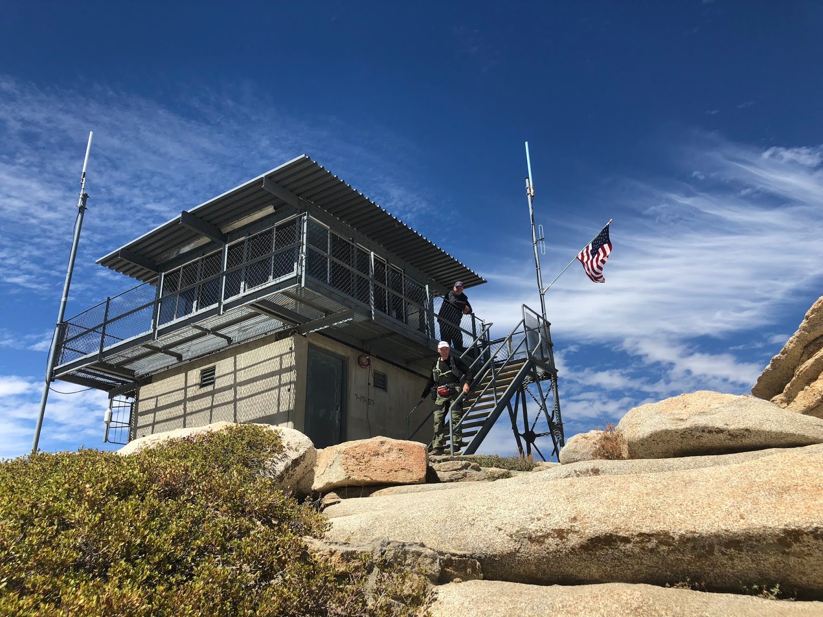
Photo By Sharon


Palisades Center Left


Photo By Sharon

Banner Ritter


Mammoth Mountain

Madera Peak Center Left

Shaver Lake

Long Burning Lions Fire Near Mammoth Center Far Right


More Memorial Plaques


Photo By Sharon
Stream Crossing In Spring!
No comments:
Post a Comment