Translate

Wednesday, June 24, 2015

Day Hike From Glacier Lodge Road: Eastern Sierras


Dale Matson

Click on Photographs To Enlarge 


I honored a commitment to drop of a couple of friends at the Taboose Pass Trailhead. They were headed out on a big cross-country trip. You would think that after hiking to Taboose Pass last year I would know better than to drive to the trailhead a second time. The four miles from Highway 395 to the trailhead takes almost an hour one way. This is the worst “road” I have driven in California.

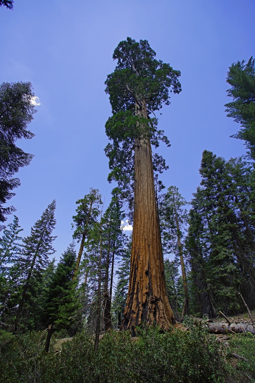
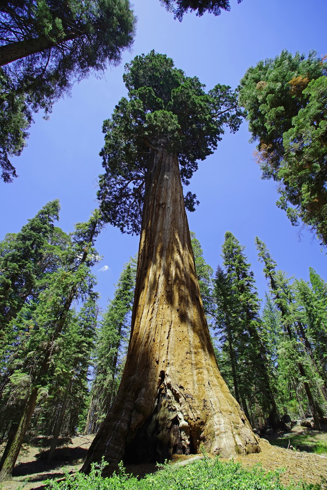
While in the area, my wife and I decided on a day hike from Glacier Lodge Road just north of there out of Big Pine. The route to the trailhead begins as W. Crocker Ave out of Big Pine and quickly becomes Glacier Lodge Road ending about 11 miles further. The hike is in the John Muir Wilderness in the Inyo National Forest. The original Lodge burned down in the 1980’s but cabins and tent cabins remain along with campgrounds along the way. The famous mountaineer Norman Clyde once ran the Lodge at one time.

We made a mistake and parked too far from the end of the road, which meant way too much additional hiking. We parked in the trailhead parking but it is mainly for backpackers, not day hikers. We could have driven much further up the road and begun from that point (see map). I think there may be a small parking charge.

We began our hike at 10:30 am, which was too late and too hot on a mostly exposed trail, to reach the first lake on the north branch trail of Big Pine Creek. We had a turn around time of 3 hours because we had to be back to Fresno (through Yosemite) the same day. I believe with an early start, it could be a tremendous day hike reaching the 3rd lake with a turn around early enough to get down for dinner and a stay-over in Bishop that evening (or Lone Pine if you are headed south).

The best view for us was down the south fork of Big Pine Creek before you go around the bend that will take you along the north fork. When you look south you can see the Middle Palisade (14,012’) elevation and it’s glacier.

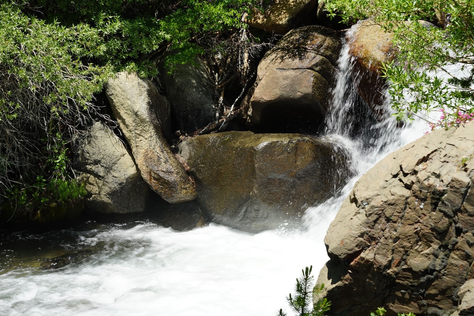
The trail stays on the north side of the creek as it passes 2nd falls. Further on there is a ranger cabin with a nice spot to get wet in the river in front of the cabin. We turned around before 1st lake but had a preliminary view of Temple Crag.

If you had a wilderness permit for an overnight, perhaps a campsite at first lake and some day hiking before packing up and heading back down (or a longer stay).

It seems odd that last week, when I was with friends in Dusy Basin, I was only about 5 miles as the crow flies from where we hiked yesterday. The air yesterday was hazy for quality photographs because of several fires that are burning near Oakhurst, Bass Lake and elsewhere. I found my Sony G 70-200mm F4 to be my most useful lens for this hike. 


 Front Of Ranger Cabin From Creek


 2nd Fall

 Middle Palisades Glacier

Norman Clyde Glacier And Middle Palisade Glacier


Saturday, June 20, 2015

Dusy Basin Hike 2015


Dale Matson

21.5 total miles

Click On Photographs To Enlarge


This was a three-day two-night hike to Dusy Basin from the South Lake trailhead near Bishop California. We left Fresno at 4am and headed to Bishop through Yosemite over Tioga Pass. We arrived about 8:15am and picked up our walk-in wilderness permit for three individuals.
We took highway 168 West to the South Lake cut off and parked at the trailhead. We were on our way by about 9:30am. People we met on the trail were complaining of mosquitos but there was a breeze blowing and we were moving most of the time.

This hike is wonderful in many ways. There are lakes along the route, the view is grand and the trail is well maintained. It is popular for day hikers with dogs that go as far as Bishop Pass and turn around because dogs are not allowed in Kings Canyon Park. You see lots of fishermen also on their way to one of the lakes. This trail also goes south (through Dusy Basin) and joins the John Muir Trail in LeConte Canyon.

The climb up to Bishop Pass (about 12,000’) was more difficult this year because of the weight extra camera gear. The trail maintenance people had just finished clearing the last snow from the steps on the north side of the trail. We had to cross about 100’ of snow to the pass.

Our intent was to camp overnight in Dusy Basin and do a day hike into Palisade Basin with a second overnight in Dusy. As it turned out we never even got to Knapsack Pass before turning back. There is no trail and the boulder hopping was very tiring. I fell but was not seriously hurt. I do carry a satellite phone if necessary. As it turned out, my Sony A7R stopped sending files to the memory card the morning of the second day. A day and a half of our trip was not recorded on the SD memory card. Too bad!

We turned around about 10am and headed back to our camp. We decided to break camp and head back over Bishop Pass for an overnight at Bishop Lake. We left about 2pm and were at Bishop Lake about 5pm. I was lagging behind my friends Carlos and Rusty who were patient with me and frequently waited for me to catch up. It was a lovely spot with a mountain view. Our hike out started around 7am and I was at my truck by ll:30am. We had lunch in Bishop and were back to Fresno over Tioga Pass by 5pm. It was really great to have others share the driving. If I had been by myself, I would have stayed the night in Bishop before driving home. Backpacking is more enjoyable with friends. Thanks gentlemen.

I used three lenses for these photographs. My native 55mm/f1.8 Zeiss was my carry lens. I also had an adapted Canon 17-40mm f4 lens and Sony G 70-200 native lens. I'm not sure this trip required the G lens. I only took two shots at 200mm. When you are in the mountains it seems like a telephoto just doesn’t take in enough real estate.   


View At Trailhead 
Long Lake 


 View Climbing To Bishop Pass
 Bishop Lake


Palisades 

Mt. Sill Left Of Center
Mt. Agassiz Carlos Named It Mt. Agony 


Knapsack Pass A Bridge Too Far

There are more photographs used to create a video on YouTube here:

There is also an interesting story of a plane crash in Dusy Basin.

Friday, June 12, 2015

The Last Alaskans


Dale Matson

I was drafted during the Vietnam era and after my training, I was stationed at Ft. Wainwright in Fairbanks Alaska until my discharge. The Alaskan state flower is the Forget-Me-Not and I haven't forgotten Alaska. I intended to go back but have not done so.

There are quite a few reality series TV shows centered on the “Off the grid” lives of folks who live in the Alaskan outback. I have followed most to one degree or another. “The Last Alaskans” is the latest and very best of this genre. The show follows the lives of three families and a single man living alone estranged from his wife and children. They are allowed to remain in the Arctic National Wildlife Refuge (ANWR) in Alaska until they and their offspring die. Then no one will be allowed to live there. There is additional background on the program here: http://www.animalplanet.com/tv-shows/the-last-alaskans/about-the-last-alaskans/

The series has excellent reviews including the Wall Street Journal and the New York Times. Alaska’s two major newspapers offer a mixed perspective with the Fairbanks paper being very positive and the Anchorage paper being negative. In the latter case, I believe it is more a function of a reviewer who often feels obligated to be critical. I base this on reading some of her other reviews.

The filming is excellent. The quality of the footage is the absolute best of any series. They even use a drone for overhead filming. There is an intimate focus on the activities of daily living. There is great detail in filming the hands and facial expressions of the people. These folks are involved in the serious business of living each day as it is presented, being resourceful and finding enough to eat. The game is not plentiful. Bob Harte stated that there is less game per square mile there than in the lower 48 states. Some of the film footage of this stark landscape could be an individual landscape photograph. Everything this far north is understated including the spindly trees. There is an abundance of fish and caribou if you are in the right place at the right time. It is the moose however that provides enough meat to get through the winter. The background music is not “Creepy” as the Anchorage paper’s resident cynic Emily Fehrenbacher put it. I find the music both haunting and fitting.

The People are easy for me to identify with since most came from the Midwest also. I’m not sure folks born and raised in Florida would ever find this much snow and cold an attractive place. In fact it is a harsh, barren and difficult place to live…. to survive in.

Why would people be attracted to a place like this? For those who live there, it is not just the location but also a way of life. Ray Lewis (who reminds me of a younger Tom Selleck) said it is a difficult life but a simple way of life. Certainly there are no “YUPPIE nightmares” like the tail falling off the pool sweep. Certainly they don’t worry about who is in or out of power in Washington or how to do an electronic funds transfer. If there is a home invasion robbery it will be a bear and not a person. They can make it and have the skillsets to live there but could they ever live in “civilization” again?

What they do worry about is more basic than that. They worry about making a mistake that would get them killed like falling through the river ice. I held my breath as I watched Bob Harte climb a limbed tree to adjust a radio antenna. Hearing the sound of another human voice is necessary for him, even if it is only on the radio. He noted that he should have died 10 times already and as I watched him land his plane, I believed every word of this lonely man.

The people don't seem to exhibit a lot of humor or joy but they do reflect contentment and a sense of determined independence. Their human qualities and care for one another are very evident. There is no acting no matter how good, that could portray the genuineness of these people who have been shaped, hardened and softened by their environment.

Why are we here watching?  We are watching because we too wish for a simpler life and must find it vicariously. In their world, “Yes” means yes. The nuances of life are analog not digital. There is respect toward one another and the lives that must end in death at their hands for them to survive. They are the top of the food chain and are cognizant of it. Could we give up the many possessions that possess us? No. This show is our respite. It is our visit to the wilderness and to a way of life more suited to and understood by the brain in our head as it has evolved to this point. Thanks for sharing your lives with us. We are not only entertained, we are edified and reminded.

Trail name Padre.    


Tuesday, June 9, 2015

Grant Grove Area: Kings Canyon National Park

Dale Matson

The Grant Grove area of Kings Canyon National Park is a great day trip from Fresno CA and is in Fresno County. It is about a 60 mile 1.25 hour drive out Highway 180. Grant Grove Village has lodging, food and park information.

There are two sights I went up there for yesterday. There is a place called Panoramic Point where you can see a good section of the Sierra Nevada and all the way across Kings Canyon Park to Mt. Gould at Kearsarge Pass. If you pass through Grant Grove Village and make a right turn just before Muir Lodge, there is a winding asphalt road that will take you up to a parking area for Panoramic Point. My wife and I have parked in Grant Grove Village and skied up to Panoramic Point in the winter. It is marked as a ski trail. When it is icy, I would not recommend this ski since the descent is fairly fast under good ski conditions. There is an asphalt walk that takes you up to the view from there. There is a potty by the parking lot and I believe a motorized wheel chair could negotiate the fairly steep asphalt walk. I did the .75-mile loop counter clockwise.

The photos of the view were taken with my Sony A7R, the Sony Zeiss 55mm 1.8 and my Sony G 70-200mm lens. Two sign photographs were taken with my adapted Canon 17-40mm f4 USM lens. The autofocus works with this adapter. The most appropriate lens overall was the 70-200. This spot is a great place to view some of the iconic mountains in Kings Canyon including Mt. Goddard, Mt. Brewer and North Palisade. The metal signs offer excellent graphic information on the mountain locations and what can be seen from that location. It was a bit hazy yesterday but above average for the clarity of the air. There is a 2.5-mile trail along the ridge that leads to a lookout tower.
Click On Photographs To Enlarge


 Hume Lake


Canon 17-40 F4 USM Adapted To A7R Sony
I Needed The Wide End Of This Lens For A Full Photograph Of A Sequoia

The second sight was the Grant Grove of Giant Sequoias. http://www.visitsequoia.com/general-grant.aspxThe General Grant is the second largest Sequoia in the world and considered “The nation’s Christmas Tree.” The “General Sherman Sequoia in the Giant Forest is the largest Sequoia in the world. There were plenty of parking spots and the loop hike through the grove was leisurely and not crowded.  When I compare this to the Mariposa Grove in Yosemite, just the logistics discourage me from going to Yosemite. On most days, you have to head the opposite direction of the Grove from the entry gate toward Wawona and take a shuttle bus back to the Mariposa Grove. The driving time from Fresno is about the same for both Park entrances.

A woman with a huge Canon Camera with a 24-70mm lens said she had brought the wrong lens for the Sequoias. She stated that she was a professional wedding photographer not a landscape photographer. 


 General Grant Giant Sequoia