Dale Matson
Click On Photographs To Enlarge

From Fresno California take highway 41 north to the Yosemite
Gate then take Wawona Road to the Glacier Point Road turnoff at Chinquapin.
Glacier Point is another 15 miles. It is about a 2 hour 15 minute drive and
requires an early start to avoid traffic and parking issues, which become
difficult later in the day.
There
are roadside views along the way at the Clark Range Overlook, Sentinel Dome and
Washburn Point. Sentinel Dome requires a hike and climb to the top but the view
is 360 degrees. Glacier Point (7,200’) is about a one-quarter mile walk from
the parking area. On a clear day I believe it is the best view in the park with
the least effort.


Yosemite Falls

Mt. Hoffman, Kettle Dome And North Dome


Don't Believe This Sign!
 Panorama Trail Route


Illilouette Falls

Illilouette Creek


Mike The Patient Trail Buddy


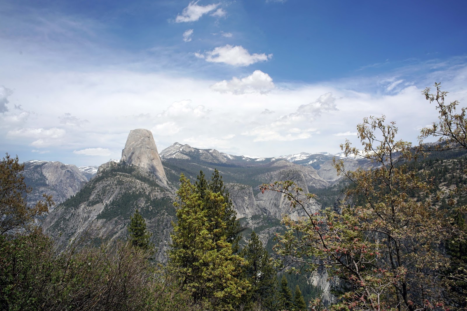
Half Dome And Mt. Hoffman


Illilouette Creek And Falls


Mt. Clark Center

The
Panorama Trail is about 5.5 miles round trip to the bridge over Illilouette
Creek. You can see the falls from an area just off the trail before you drop
down to the bridge. Take plenty of water for the return climb of about 1,400’
back to Glacier Point. The sign at Glacier Point says it is only 2 miles to the
bridge but don’t believe it.
If
you are interested in a longer hike you can continue on the trail past the
bridge to Nevada Falls and then return. You could also park in Yosemite Valley
at Half Dome Village and take the shuttle bus to Glacier Point and hike back
down.
There
is a lot to see from Glacier Point and plenty of views along the Panorama
Trail. Just remember to get an early start because it can be a hot climb back
out from Illilouette Creek.
The
photographs were taken with a Sony A7R2 with an adapted Leica 28mm 2.8,
Voightlander 15mm 4.5, and a Zeiss Batis 85mm 1.8.
A YouTube Video consisting of these photographs and additional video clips is available here.
https://www.youtube.com/watch?v=-V-AF-w_GnU&feature=youtu.be
A YouTube Video consisting of these photographs and additional video clips is available here.
https://www.youtube.com/watch?v=-V-AF-w_GnU&feature=youtu.be
A buddy and I did the 4 mile trail up to Glacier Point then took this trail down back to the valley floor. We thought that it would be mostly down hill but you have to climb back up to about the altitude of Glacier Point, then head down to the valley floor. Finished hiking down the Mist Trail. Overall, great hike, but a killer one. I think we logged about 16 miles that day.
ReplyDeleteWhen you hit the bridge over Illilouette Creek you have to climb out in either direction you take. Glacier Point would seem like a good place to start to get to Half Dome but it has more climb if done as an out and back than starting from Happy Isles. I remember the climb to to Nevada Falls from the Illilouette Creek bridge goes above 6,000 and actually drops back down as you approach Nevada Falls.
ReplyDeleteHave you hiked Twin Lakes this year yet? I've been looking to do it but don't know it kaiser road is open yet. One of my favorite hikes and you said you do it every year as a warm up.
ReplyDeleteHi Justin,
ReplyDeleteHere is the current road report on Kaiser Pass Road. https://www.fs.usda.gov/detail/sierra/home/?cid=stelprdb5399344
Your "namesake" Potter" Pass is about 9,000'. I don't think much is snow free above 7,000' yet. Most of my hiking for now is below 7,000'. My son and I tried to get to Courtright Reservoir for photographs today and the road is closed. We went to Wishon Reservoir instead.