Dale Matson
My first visit to Humphrey’s Basin was in 2007. It was an
easy 30-minute ride from Florence Lake on Eagle One, the Fresno County Search
And Rescue Helicopter. I was dropped off at about 11,000’ and met up with a
search party looking for a lost hiker.


Helicopter Photos By Deputy David Rippe
The helicopter located the hiker late in the day and we
stayed overnight. We were extracted the following day. I was a Yosemite fanboy
until that momentous day when I realized that there was much more out there to
see in the Sierra National Forest and Kings Canyon National Park.
Humphrey’s
Basin is just north of the more famous Evolution Basin and is separated by the
Glacial Divide. The John Muir Trail (JMT) threads its way through Evolution
Basin in Kings Canyon. There is a popular multi day 48 mile loop hike from North
Lake to South Lake or the reverse out of Bishop that takes in both these
basins. Having done both hikes, if I had my choice of this loop or the similar
distance Rae Lakes Loop hike, I would do the North Lake/South Lake Loop. There
is more climbing but much more scenery.
Humphreys Basin From Florence Lake.
I finally returned to Humphrey’s Basin in 2013. I got my wilderness
permit in Prather at the Sierra National Forest ranger station the day before I
began my hike. This allowed me to make the first ferry the next day at 8:30am.
It is a three-hour drive from Fresno to Florence Lake. The last seven miles is
painful. I did it as an overnight out of Florence Lake. The 18-mile outbound
route is pretty straightforward once the ferry drops you off at the south end
of the lake. The 5-mile ride is worth the $20.00. There is about 4,000’ of
elevation gain outbound. The trail intersects occasionally with a primitive
road used by a Unimog that carries supplies to Muir Camp, a private primitive
resort. There are several creeks that cross the trail for water resupply until
you reach the San Joaquin River. That is a good place for a break before the
dry climb. There is a pretty good climb from the San Joaquin River up to the
halfway point at the bridge that spans Piute Creek. Crossing the bridge leads
to the entry point of Kings Canyon. However the Piute Creek trail to Humphrey’s
Basin heads north just before the bridge. Lots of folks rest at and below the
bridge and resupply water. The climb from the bridge parallels Piute Creek and
is exposed, hot, dry and steep. It is
dry because much of the trail is considerably higher than the creek down below.
There is a wide spot in the trail with a wooded campsite for those who have had
their fill of hiking for the day. The campsite is at least 60 feet above the
creek and a long steep descent for water. I continued and the trail eventually
begins to flatten out and travel near the creek. I hiked on through Hutchinson
Meadow passing several campsites in the meadow along the trail. In late
afternoon I arrived near the same location I was dropped off by the helicopter
and decided to call it a day with a view of Mt. Humphreys. I could see Piute
Pass to the East. Piute Pass is the boundary between Fresno and Inyo Counties.
In the morning, I broke camp but waited until there was enough light for a few
more photographs of magnificent and distinctive Mt. Humphreys (13,993’). I
tried to keep a good pace for the return leg since the last ferry leaves for
the far end of the lake at 5pm. It is still a long 3-hour drive back to Fresno.
Click On Photographs To Enlarge


Water Taxis At Florence Lake


Mt. Shinn

Pasture Near Muri Camp


San Joaquin River

Under Piute Creek Bridge


Small Camp Along Trail


Mt. Humphreys


Trail Through Hutchinson Meadow

Back To Piute Creek
Humphrey’s Basin From North Lake
The wilderness permits are obtained in Inyo County at the
White Mountain Ranger District in Bishop. The trailhead is near North Lake.
From Bishop, one takes highway 168 east. You head toward North Lake at the
junction with North Lake Road. There is a parking area before the North Lake
campground. Parking at the campground is only for campers. The trail follows the
north fork of Bishop Creek. Piute Pass is about five miles from the trailhead
with about 2,000’ of elevation gain with plenty of water for resupply. One
might ask, “Wouldn't it just be easier for Fresno folks to drive through
Yosemite on 120 and down 395 to Bishop.” Yes it would. The trail is well marked
and there is only one junction where a trail to Lamarck Lake heads south. The
trail is in a canyon with huge crags on either side. It is a scenic hike to
Piute Pass including Loch Leven and Piute Lake.
The view from the Pass (about 11,500’) is especially good to
the east. We had lunch there and headed down toward Summit Lake where we
pitched our tent. The sky was overcast with a chance of a thundershower. We
pitched our tent and stowed our gear for a day hike to Desolation Lake. There
is a use trail that heads north which is sketchy at times but the terrain is
easy to navigate. We first arrived at Lower Desolation Lake and continued on to
Desolation Lake. The sky really got dark and we decided to head back to our
tent. We were caught in a tremendous downpour but had our hooded rain jackets
with us. We were glad to warm up in our tent that was covered in hail. The next
morning we hiked southwest on a trail to Muriel Lake. From there we retraced
our steps and headed over Piute Pass back to the trailhead. From there we
headed back through Yosemite to Fresno. It is also possible to head to
Bakersfield from Fresno and go over the pass at Tehachapi, then take highway 14
north to 395 and north on 395. It is a longer but arguably faster route especially
if one is only going north as far as Lone Pine.


Hiking From Parking Area To Trailhead



Bishop Creek


Loch Leven


Piute Lake


Summit Lake

The Pinacles

Mt. Humphrey

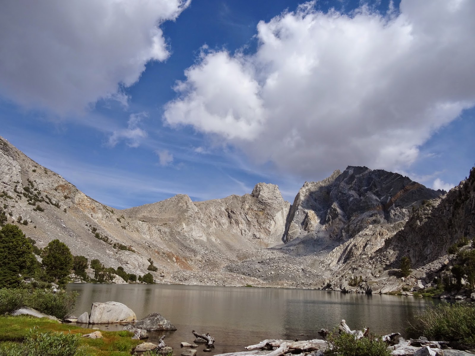
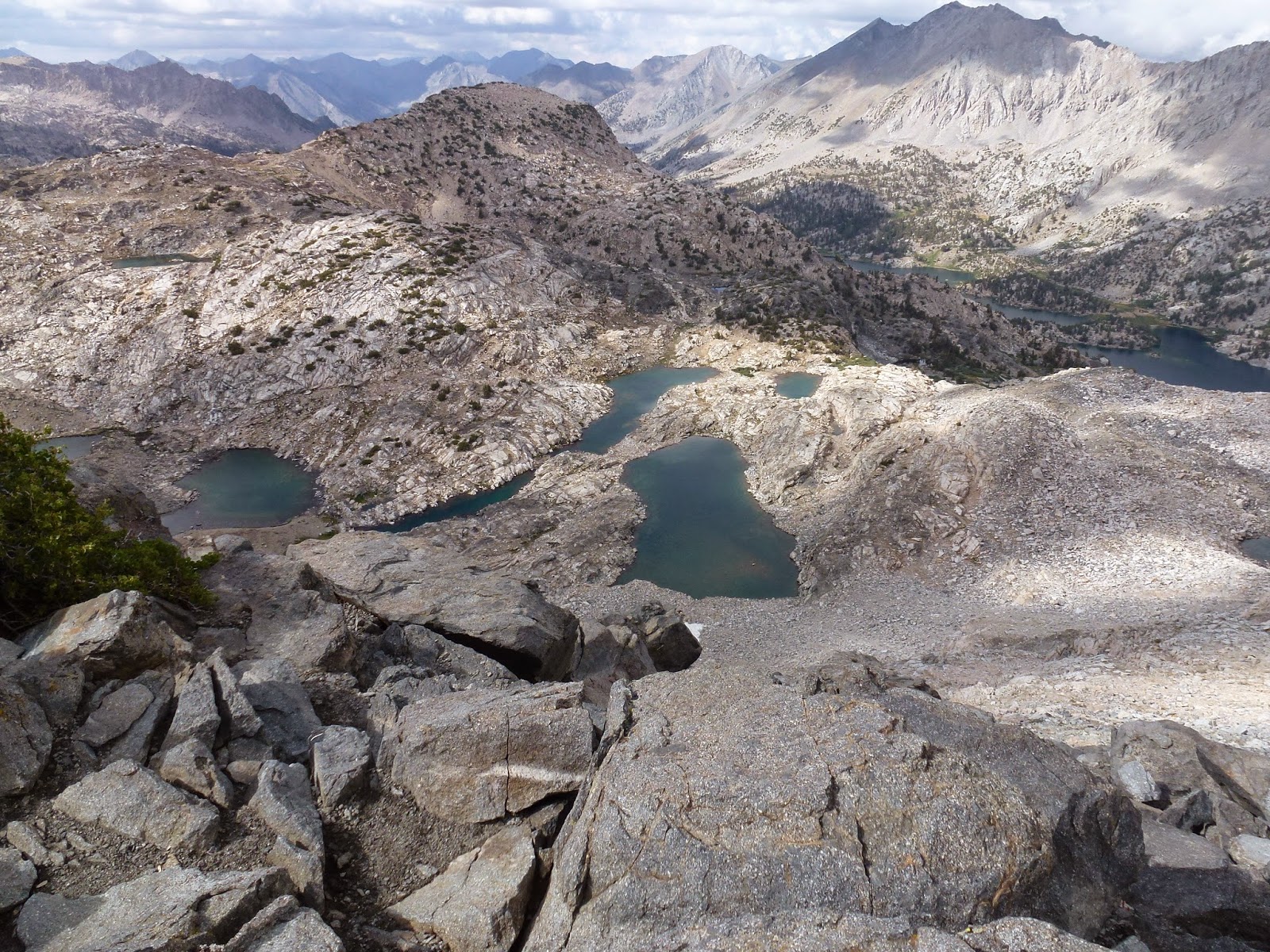
Lower Desolation Lake

Desolation Lake