Translate

Sunday, April 3, 2016

The Zeiss Batis 85mm F1.8 Meets CA Highway 395

Dale Matson

Click On Photographs To Enlarge

Before Dawn Mt. Whitney 1/10 second f2 ISO 6400

If you cross over Tehachapi Pass from Bakersfield and head north on highway 14 you will eventually hit highway 395. The eastern Sierra Nevada begins in earnest near a small town named Olancha. From there to Yosemite in the north you travel in a valley with the Inyo and White Mountains to the east and the Sierra Nevada to the west.

Along this stretch of the eastern Sierra Nevada Mountains there are occasional passes that generally lead west into Sequoia and Kings Canyon National Parks. Native Americans followed creeks and made the trails that lead over the passes.

As you drive north past Lone Pine through Independence, Big Pine and eventually to Bishop, there are hints at these passages that follow a dark green strip of land created by the flow of a stream. One ‘gateway’ town that is often overlooked is Aberdeen located on old 395 with Taboose Pass to the north and Sawmill Pass to the south. You can see these slashes in the massive Sierra wall and are tempted to seek a quick route across. As one who has hiked a couple of these “Nasty passes” (Taboose and Baxter) avoid them and seek a higher trailhead unless you are into suffering.

There is only one creature that seems to thrive in such hostile and rugged real estate. The Sierra Nevada Bighorn Sheep frequents these passes and overwinters on the east side to avoid the deep snow. The sheep then move back over and along the western crest in the summer, staying at high altitude for safety from predators.

Over the years I have come to this area of the Sierra from both the west (Roads End in Kings Canyon) and the east. What I have come to appreciate in my quest for photographs of Bighorn Sheep is the rugged beauty of the eastern Sierra.

Last week I had an opportunity to photograph Bighorn Sheep near Aberdeen and north of Bishop along Pine Creek road. As I scanned the cliffs near Highway 395 and drove north I could not help taking a few photographs with my new Zeiss Batis 85mm 1.8 lens and Sony A7R2 camera. When I use a 85mm lens, the photographs faithfully reproduce what I remember in my mind’s eye. 50mm always seems smaller than I remember the scene to be.

The more I photograph the Sierra Nevada especially in spring, the more shades of color I see. As I traveled north, the weather began to set in and the mountains became starker. When they still have their mantle of snow, they are even more glorious. I have included a photograph of Mt. Whitney I took at 6am on the way back home. The sunrise that day was at 6:42 and I could barely see the outline of the mountains. When I was northbound, the mountains near Lone Pine were covered in clouds. Homebound the sky was clear. Although I reduced the file size of these photographs, none were cropped.  


Scanning For Sheep With My 4X4 Truck Below

 Near Aberdeen Looking East


 White Mountains To The East
 Mt. Tom (Elevation13,652') 

 Mt. Humphreys Shrouded In Clouds    


Friday, April 1, 2016

Sierra Nevada Bighorn Sheep: Steve Yeager Docent


Dale Matson

Click On Photographs To Enlarge
Steve Yeager

Well this is the second time that looking for Bighorn Sheep has led me to a man of good character who is also long on experience. Virginia Chadwick, a board member of the SNBSF gave me contact information for Steve saying, “He gets the best photographs of sheep and he knows where to look.”

Steve is as much a part of the Eastern Sierra Nevada as the sheep herds that migrate there in the winter. Steve has a long family history in the Eastern Sierra. His grandfather and father lived there before he was born. He is a husband, father and grandfather. His children and grandchildren also live in Bishop.  He told me he was well acquainted with two Sierra icons Galen Rowell and Norman Clyde. Steve is a “retired” cement contractor.

We parked my truck and headed toward a possible view area where he had recently seen some rams. Wednesday was a cold and windy day but it didn’t seem to bother Steve much. He has spent most of his life outdoors. After scanning the area with binoculars and a spotting scope he determined there were no sheep to be seen. I was scanning with a second pair of his binoculars and knew that his experienced eyes were much more dependable than mine. Unless it is a brown sheep on a white rock, I will not see it. The California DFW had recently stirred things up with several captures using a helicopter.

We then drove up Pine Creek road to another possible view site. He got out of his truck and said; “I can smell them. They are close.” And he was right. He pointed to a slope that ran down into a slag pile from a closed Tungsten mine and I could see three ewes on the skyline along the ridge with binoculars. I took some 400mm shots while Steve got my tripod out of his truck. Some were good, some not so much. After several shots we moved below them on Pine Creek road. They were above us across Pine Creek and it was flowing too fast and deep to safely cross with camera gear so we were unable to climb any closer. These sheep are a part of the Wheeler Ridge Herd Unit. I got lots of shots and tried a 2X Teleconverter on the 400mm lens. I immediately lost autofocus and used focus peaking. The 800mm shots were disappointing at best.

The 400mm shots were my best so far and I have Steve to thank. I had spent much of the previous day scanning an area south of Aberdeen to no avail other than contracting a sore neck.


Follow The Leader
Cropped Telephoto Of Climber Near Sheep
Climb Area
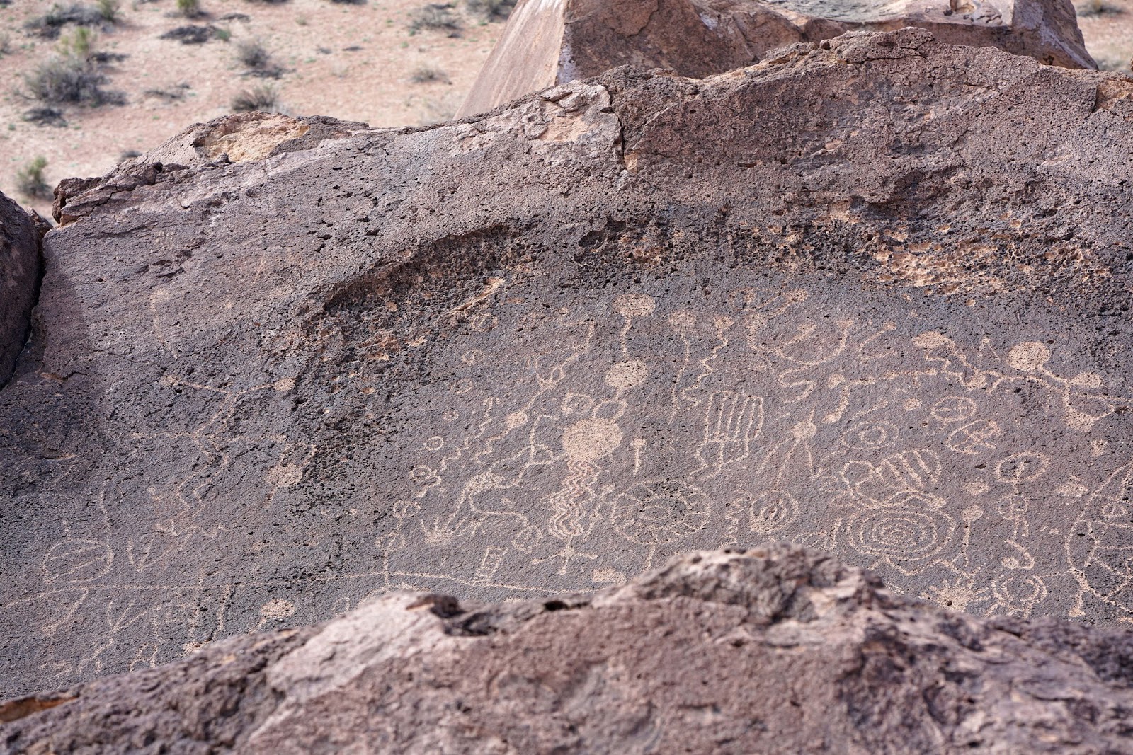
We tried other locations and eventually went over to some petroglyphs that Steve wanted me to see. What a day we had telling old man anecdotes. His were better than mine. He once called the California DFW to report a missing California Condor in the Pleasant Valley area near Bishop and has walked up on mountain lions by sheep kills!


Steve
Owens River With Sierra Nevada Mountains In Background

Thanks Steve!


Tuesday, March 15, 2016

San Joaquin River Gorge


Dale Matson

Click On Photographs To Enlarge
 Seasonal Stream Along Auberry Road 24mm
 35mm


 Dave Using Monopod As Trekking Pole

 Above The San Joaquin River From The Bridge
 Kerckhoff Powerhouse Upstream


 Suspension Footbridge
Dave's 55mm Shot
Dave's Shot Of Me
 Lupin
 Mountain Lion
Close Up Of Waterfall Along the Hike 300mm

From Fresno CA. take Highway 168 (or Auberry Rd. they merge in Prather) east to the turnoff to Auberry. Drive through Auberry and make a left on Powerhouse Road by the elementary school. Drive till you see a sign that says San Joaquin River Gorge and make a left on Smalley Rd. Take it to the trailhead. There is a five-dollar use fee registration as the trailhead. It is about a 40-minute drive. There are potties, potable water and campsites.

My friend Dave and I headed out for photographs yesterday and hopeful we would have an opportunity to see the San Joaquin River full and fast once again following a four year drought. We stopped along the way to take photographs of a seasonal creek along Auberry Road, which has been dry for four years and then continued to the trailhead.

It is about a one mile 400’ drop to the suspension bridge from the trailhead. If you are so inclined, there is a 6-mile loop trail beginning on the other side of the bridge. It is popular with hikers and mountain bikers. Lately, I have seen a few ultra runners that have also discovered the loop.


This section of the San Joaquin spanned by the footbridge, is below Kerckhoff Reservoir and above Temperance Flat. It then flows into the final reservoir, Millerton Lake before continuing to the ocean. There has been preliminary work done in hopes that a 1 million acre foot reservoir could be added between Millerton Lake and Kerckhoff Reservoir at Temperance Flat.

I am personally in favor of the idea for additional water storage during years when there is average to above average snowpack. It is dispiriting to watch the huge volumes of San Joaquin River water flow through Woodward Park in Fresno headed out to the ocean because there is not adequate storage. Since the existing system of reservoirs was built, California has seen a huge increase in population making additional demands on an overburdened infrastructure. 


The photographs and video were taken with a Sony A7R2 Camera and Sony Zeiss 16-35 f4, Zeiss Batis 85mm f1.8 and an Adapted Sony A-Mount 70-300mm G lens. 

Wednesday, March 9, 2016

The Sony A7R2 And Zeiss Batis 85mm 1.8


Dale Matson

Click On Photographs To Enlarge
Sony A7R2 With Zeiss Batis 85mm 1.8

I recently wrote a post on the three lenses I plan on taking with me when I backpack in the Sierra Nevada Mountains this summer. This is my generic list that will apply to most areas and when I am not trying to photograph the elusive Sierra Nevada Bighorn Sheep. http://midsierramusing.blogspot.com/2016/03/my-mountain-backing-lenses-for-sony-a7r2.html

The three lenses are the native Sony Zeiss 16-35mm f4, The native Sony Zeiss 55mm 1.8 and the Zeiss Batis 85mm 1.8. The particulars of the Batis lens are here. http://www.zeiss.com/camera-lenses/en_us/camera_lenses/batis/batis1885.html

Yesterday I took the Batis 85mm lens with me and traveled from my home in Fresno (elevation 308’) east 60 miles To Huntington Lake (about 7,000’). I made stops along the way for photographs. We had recent rain and the mist lingered in places until I was above Shaver Lake (5,500’).

The A7R2 has IBIS and the lens itself has image stabilization. When I viewed my photographs “actual size” they remained sharp. I believe there is room to crop photos and get similar results to a 135mm lens. This is not an official review, only an assortment of photographs taken along the way. I am however impressed with how well balanced the lens feels on the Sony A7R2.

Vineyard On The Outskirts Of Fresno Facing East 
Crop Of Above Photograph
 Seasonal Stream Returning After Four Years of Drought
Crop of above Photograph
Tamarack Creek
 Crop Of Above

China Peak Ski Resort Above And Across from Frozen Huntington Lake
Crop Of Above


Crop