Dale Matson
Click On Photographs To Enlarge

Route To Sentinel Dome Off Glacier Point Road
From Fresno CA, Glacier Point in Yosemite is essentially the
same time (2 hrs.) as Yosemite Village on the Yosemite Valley floor. From the
junction at Chinquapin (elevation 6,000’) Glacier Point Road climbs away from
the main road headed to Yosemite Valley and ends 15 miles further at Glacier
Point.
In the winter, the road ends five miles from Chinquapin at
the Badger Pass ski resort. The remainder of the road to Glacier Point is
groomed as a ski trail. I have skied to Glacier Point more than I have driven
there. Overnights are solitary and splendid. Wilderness permits for overnight
are available at the ranger station near the lodge. http://midsierramusing.blogspot.com/2015/01/winter-overnight-at-glacier-point-in.html
One could write a book and fill it with beautiful
photographs about this lesser known destination. There are plenty of hikes off
Glacier Point Road including, Dewey Point, Mcgurk Meadow, Ostrander Lake, Taft
Point, the Pohono Trail and Sentinel Dome.
Today, I drove up early and got to the turn off at
Chinquapin by 7:30am. Unfortunately the morning sun does not make for the best
photographs. I stopped to look at where Bridalveil Creek goes under the road as
it drops from its source at Ostrander Lake. My wife and I were married at the
foot of the falls in the valley.
I decided to begin at Sentinel Dome. There is a parking area
with potties at the trailhead. I usually go past this area and begin the
descent to Glacier Point. In about a mile, there is a gated service road on the
left as you round the bend. I park across the road in the dirt and walk up this
road till I meet the trail from back by the potties. The last portion of the
trail is a steep climb but not a long climb. A woman and her husband from back
east were behind me as I was descending. Her husband had left her about three
hundred feet from the top and she was fearful of going any higher. I talked her
into going up with me and told her to keep her eyes on the back of my jacket.
She was glad she overcame her fear and made the top of Sentinel Dome with its
panorama of the park.
My photographs from there were probably two hours early and
I might have been better off going the Glacier Point first. Anyway, the
photographs are from Sentinel Dome, the Clark Range overlook (about half way
between Badger Pass and Glacier Point), Washburn Point and Glacier Point. Go
early since the parking area, while big, fills up fast as the morning heads
toward noon.

Bridalveil Creek


Half Dome From Sentinel Dome

El Capitan Right Of Center


Clouds Rest Above and Left Of Half Dome


Mount Hoffman with North Dome On Left And Basket Dome On Right

18mm Shot

Mt. Clark Left Of Center Mt. Starr King Far Right

Yosemite Falls
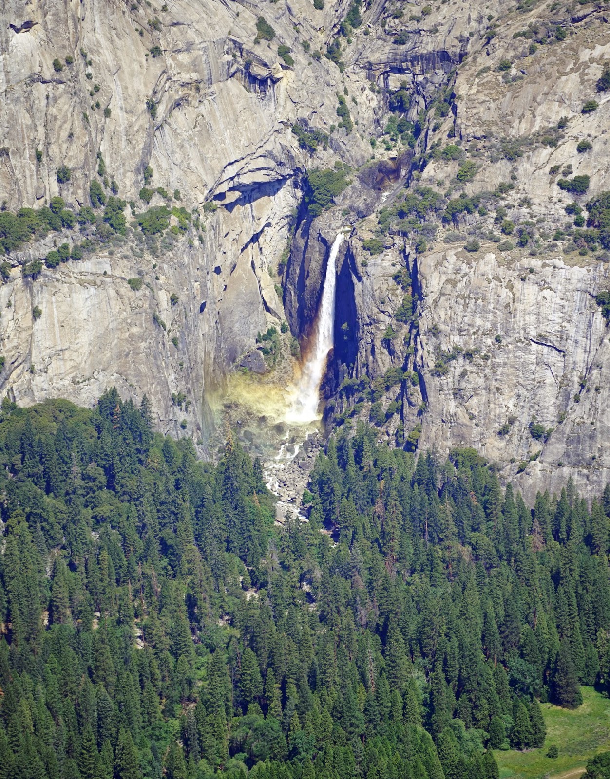
Lower Portion Of Yosemite Falls

Geological Hut At Glacier Point- I Slept There On Two Winter Overnights

Nevada Falls-Bridge Is Evident
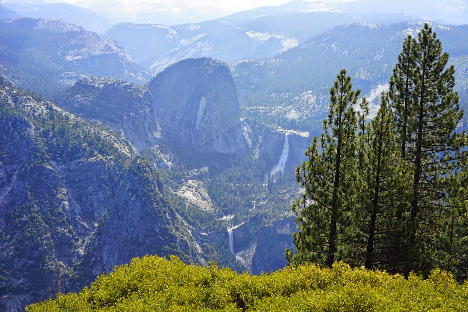
Vernal Falls Below Nevada Falls Liberty Cap Left Of Center
No comments:
Post a Comment