Dale Matson
Click On Photographs To Enlarge
Click On Photographs To Enlarge


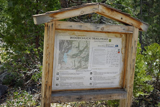
The Woodchuck trailhead is about a two-hour drive from
Fresno on Highway 168 to Dinkey Creek Road in Shaver Lake to the McKinley
Grove Road by Dinkey Creek. After crossing the Wishon Reservoir on the dam, the
trailhead (about 6,700’ elevation) is about .4 miles further on the left. There
is a bathroom available.
This was my first hike on the Woodchuck Trail and I had a
sense of sadness since my former experiences with the Wishon area involved a
search for a missing hiker who fell to her death and was found by the YOSAR search
team on the third day of our search. I wrote about this search in my book
“Seeking The Lost: Stories Of Search And Rescue”.
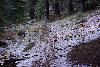
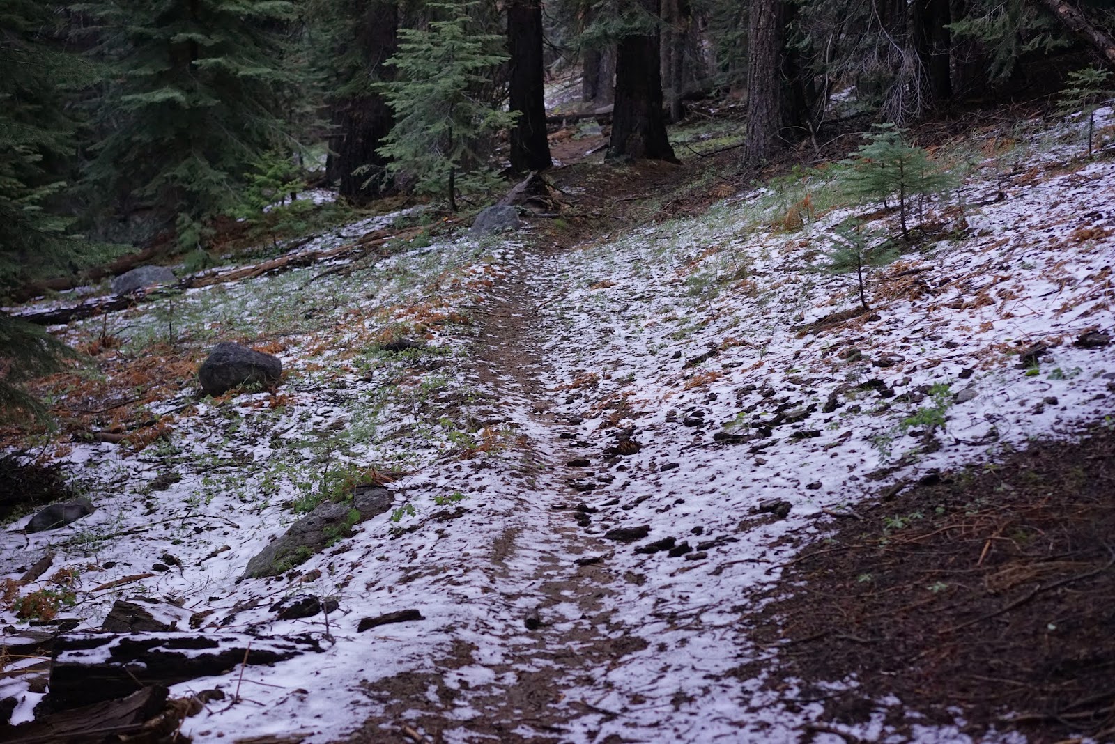
There have been afternoon storms in the higher elevations
recently and portions of the trail were covered in about 2” of snow. No rain
was predicted for the day of the hike. It was a chilly 29 F degree start with
cloudless skies. As with most trails in the Sierra National Forest, the trail
was littered with debris and fallen trees. This is somewhat unfair since most
trails are a mess after the winter season.
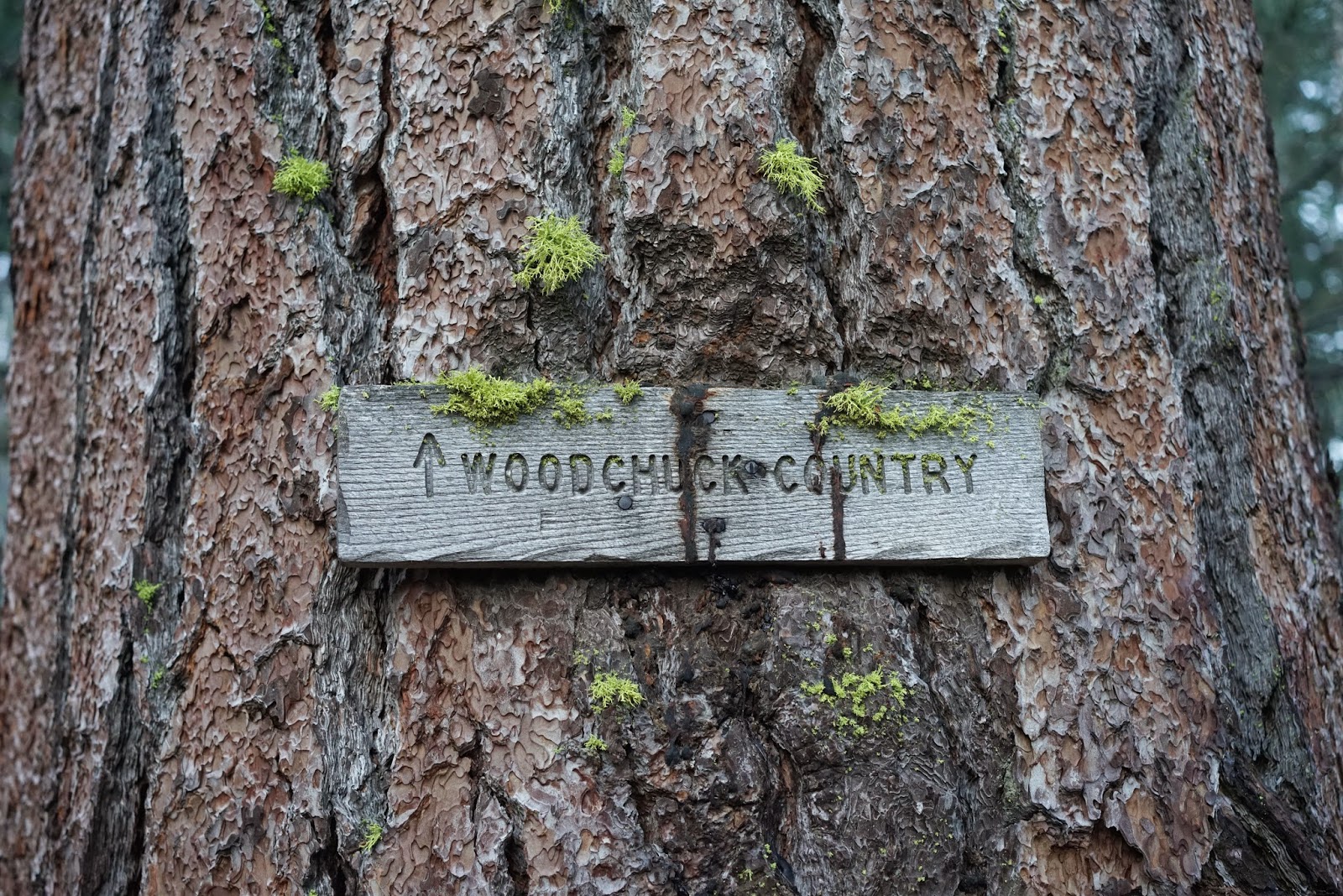
My intent was to go to Woodchuck Lake (or Chimney Lake as a shorter
plan B). I had reviewed the maps and read about the hike in a Sierra South
hiking book. The distances were given as 8 miles to Woodchuck Lake. With an
early start, I figured it would be a hard but doable push round trip. And this
is where I question the distances from the book. Did the authors actually measure this hike or did they scale if from a
topographical map? I used both a Suunto Ambit II and a Garmin Oregon and
found the distances to be considerably farther. I never got to Moore Boys Camp,
which was supposed to be about 6 miles from the start. I turned back at 6.52
miles by my Ambit, which is stingy with mileage and 7.5 miles by my Oregon. I
guessed that I had missed the trail junction at the boys’ camp but when I
downloaded my route, I had not even got that far yet. I hope the “Tom Harrison
Maps” folks do a map for this area. They use a wheel to measure the distances.
His maps are pretty dependable.
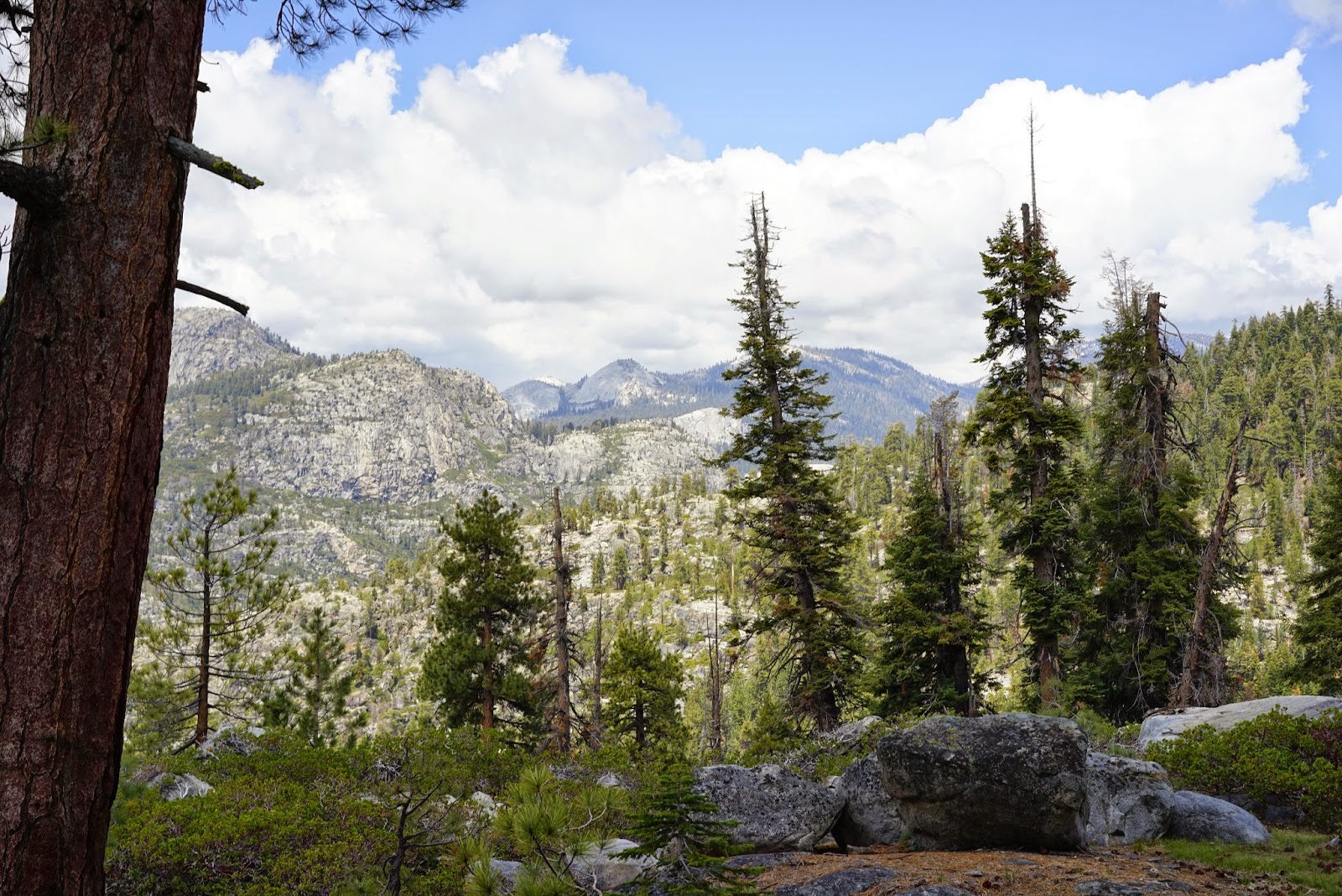
With several large trees across the trail and no real
vistas, this was a bit of a disappointment for this solitary hiker. I spooked a
small deer herd and realized that in an area where hunting is allowed, the
animals are more timid than those in the national parks. Bugs were not a
problem but I always carry bug spray. There were dependable water sources
outbound starting at Woodchuck Creek.
Most of the outbound trail is climb and my Garmin indicated
2,537’ of elevation gain overall on my route. On the return leg, there is a
hard climb on tired legs after re-crossing Woodchuck Creek. Once you reach the
ridge that parallels Wishon Reservoir, the trail is civilized with gentle
rollers. The best place I found for crossing Woodchuck Creek is upstream from
the “trail” sign. There is another place further outbound where I just decided
to wade the stream with no evident opportunity for a dry crossing.
This was a trial run for me since I plan on doing an
overnight with my sons at Woodchuck Lake this summer. It looks very doable and
I hope the sights will be better at the lake. For me, the Woodchuck Trail is
mostly about destination not the view along the way.


Wishon Reservoir


Woodchuck Creek


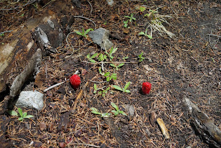
Snow Plants

Campsite Above Woodchuck Creek Far Side Outbound

No Dry Crossing


Seasonal Assurance Markers
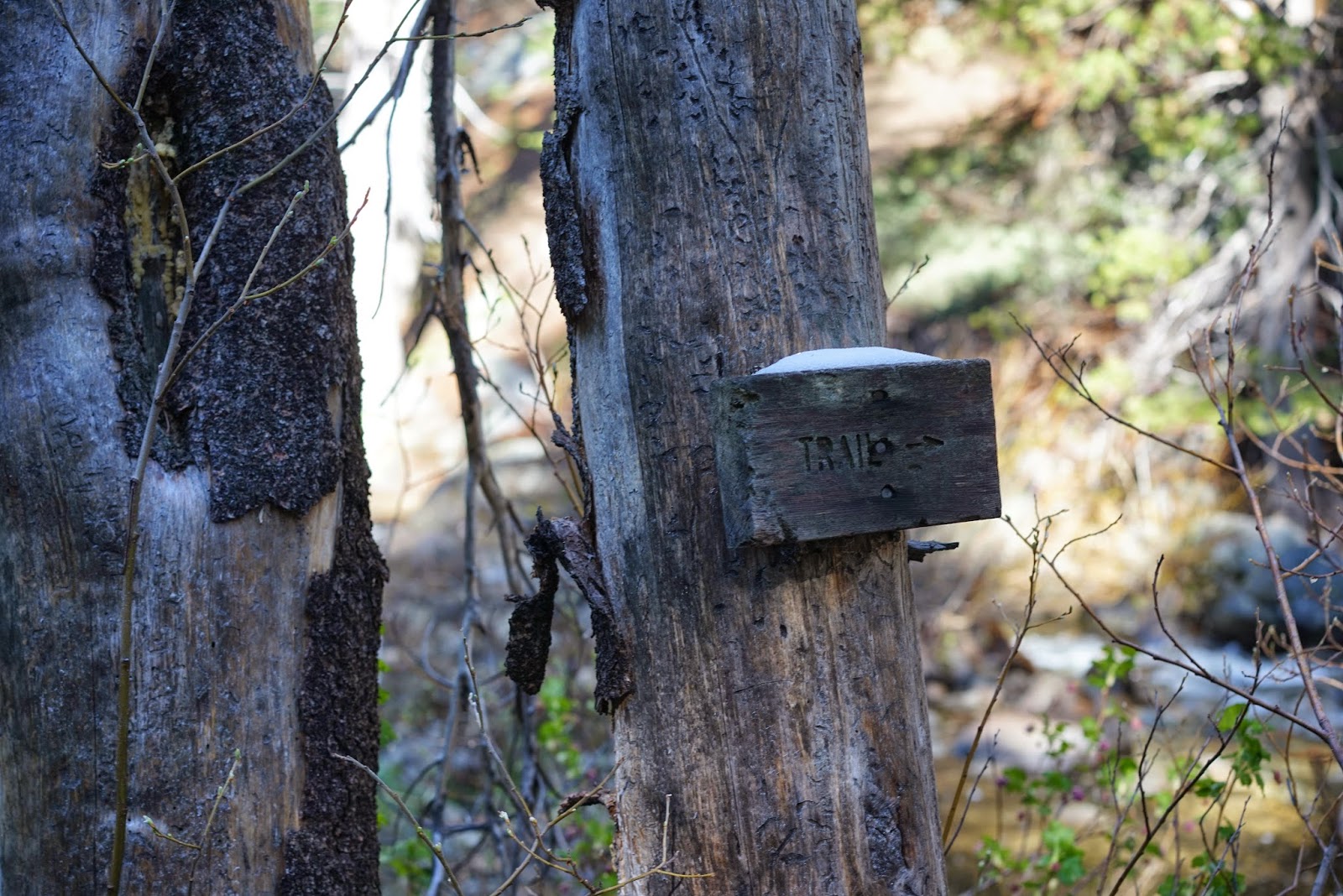
I Crossed Upstream From This Sign


Bear and Coyote Track Together


Frozen Water On Brush


Trail Follows Road For Short Distance

Thanks Jessica. Seems like there would be snow on the trail yet. I guess the seasonal gate in Dinkey Creek across McKinley Grove Road is open now too.
ReplyDeleteDale, thanks so much for this information. I'm looking at heading up to Wishon this weekend (may 11-12). Do you expect snow to still be lingering around then? Will the streams be flowing too strongly for fly fishing? I'm new to the area so trying to figure out the mountain climate (lived in Chicago my whole life). I hit up Blackrock Reservoir last weekend; no snow perfect weather, but NF of Kings was flowing way too hard to try to fish it.
ReplyDeleteThanks again!!
-Darin
Hi Darin,
ReplyDeletehttps://www.fs.usda.gov/detail/sierra/home/?cid=stelprdb5399344 According to the information on the Forest Service website, McKinley Grove Road off Dinkey Creek Rd. is open.The Woodchuck trail crosses Woodchuck Creek but it is a steady climb from the trailhead and I would bet lots of snow before you ever get to the creek. the creek is probably an uncrossable raging torrent right now. The road to Courtright Reservoir off Mckinley Grove Road is still closed. I have only been as far as Balch Camp and Blackrock seemed a bit tricky to get to. By the way, one of the creeks that flow into the North Fork of the Kings is Dinkey Creek. When I wrote this story (2015) there was a lower snowfall year too. Here is a tip for Midwesterners. The mountains make their own weather. (Former Michigander)
P.S. Legend has it that the Woodchuck area was named by Midwesterners who mistook the Marmots for Woodchucks.
ReplyDeleteThanks for your info. I was just telling my youngest son about my first backpacking trip (to Woodchuck in 1977). No electronics (GPS, etc.) in those days, but I do remember it was a long, grueling ~12 hour hike uphill (especially bad with my novice 100 lb. backpack!). Great memories though!
ReplyDeleteThis comment has been removed by a blog administrator.
ReplyDeleteThis comment has been removed by a blog administrator.
ReplyDelete