Dale Matson

12.35 miles round
trip with 1,135’ of gain overall. 5 hours total time out.
Maximum Elevation 7,425'
Maximum Elevation 7,425'
* Note: Yosemite Park requires all vehicles to carry chains in the winter and this includes 4
wheel drive vehicles.
It is a promising beginning to the winter ski season with
Badger Pass opening on December 12th this year. The Nordic Holiday
Ski Race was cancelled the last two years for lack of snow. I didn’t
ski in Yosemite at all last year. I have one caveat about skiing on Glacier Point Road. If you are a novice skier, and the surface
is icy, rent snowshoes instead.
My son Ben and I drove up to the Badger Pass ski area from Fresno in
about two hours. For those who have a longer commute, there is also lodging nearby
by the Chinquapin turn off to Glacier Point at Yosemite West. I called ahead of time to the cc ski center (209)
372-8444 to ensure Glacier Point Road from the downhill ski area to Glacier
Point had been groomed since the last snowfall. Snow reports updated daily are
available usually here: http://www.yosemitepark.com/DailySnowReport.aspx
The road from the Highway
41 Yosemite gate to Badger Pass (25 miles) was slow because it was snow covered
and slippery. Well, yes Glacier Point Road had been groomed but there were no
tracks laid for track skiing by the grooming machine. (I was informed today
that parts have been ordered and hopefully the machine will be ready to go
soon.) Glacier Point Road is not just hilly; it has severe slopes to
accommodate the curves. Without tracks, track skis slide unmercifully toward
the low side of the road making the route more difficult. Skate skiers had a
good surface. The snow was cold and squeaky and there was no difficulty with
sticky transitional snow. It is always a good practice to put a fresh coat of
glide wax on skis to avoid snow build up as you ski. The temperature remained
in the low 20s under clear skies for our ski.
There is an initial quick curved descent from the Badger
Pass parking area to Glacier Point Ski Trail. From there it is about a .75-mile
climb that crests before a short descent to Summit Meadow. There is a pottie
located there. Folks heading to Dewey Point usually depart at this point. Most
use snowshoes since this is a difficult ski.
From here it is
downhill to where Glacier Point Road intersects with the road to the Bridalveil
Campground trail. It is downhill to where Bridalveil Creek crosses under the
road also. The route then begins to climb in earnest for about 1.5 miles until
you reach the Clark Range Overlook. At this point you’re a tad past 6 miles
from the trailhead and facing an initial long descent followed by a long climb
back to the trailhead on tired legs.
When I was younger and fitter, the Clark Range Overlook was
just a stop on the day ski to Glacier Point and back (21 miles round trip).
Actually, you can get as good a photograph from Washburn Point as Glacier Point
and save about 45 minutes and a long steep climb out from Glacier Point. Here
is a video I did of the full trip about 6 years ago. https://www.youtube.com/watch?v=O76s7-xy6P0

Badger Pass Parking By Trailhead


Ben Adjusting His Daypack


Bridalveil Campground Junction About 2.5 Miles From Trailhead

Bridalveil Creek With Headwaters At Ostrander Lake

Ridge Above Ostrander Lake

This Is A Gutbuster Of A Day Ski. Most Stay Overnight At The Ski Hut
Here Is A Video I Posted Of The Ostrander Day Ski In 2010
https://www.youtube.com/watch?v=_KM6bhClokw
Here Is A Video I Posted Of The Ostrander Day Ski In 2010
https://www.youtube.com/watch?v=_KM6bhClokw


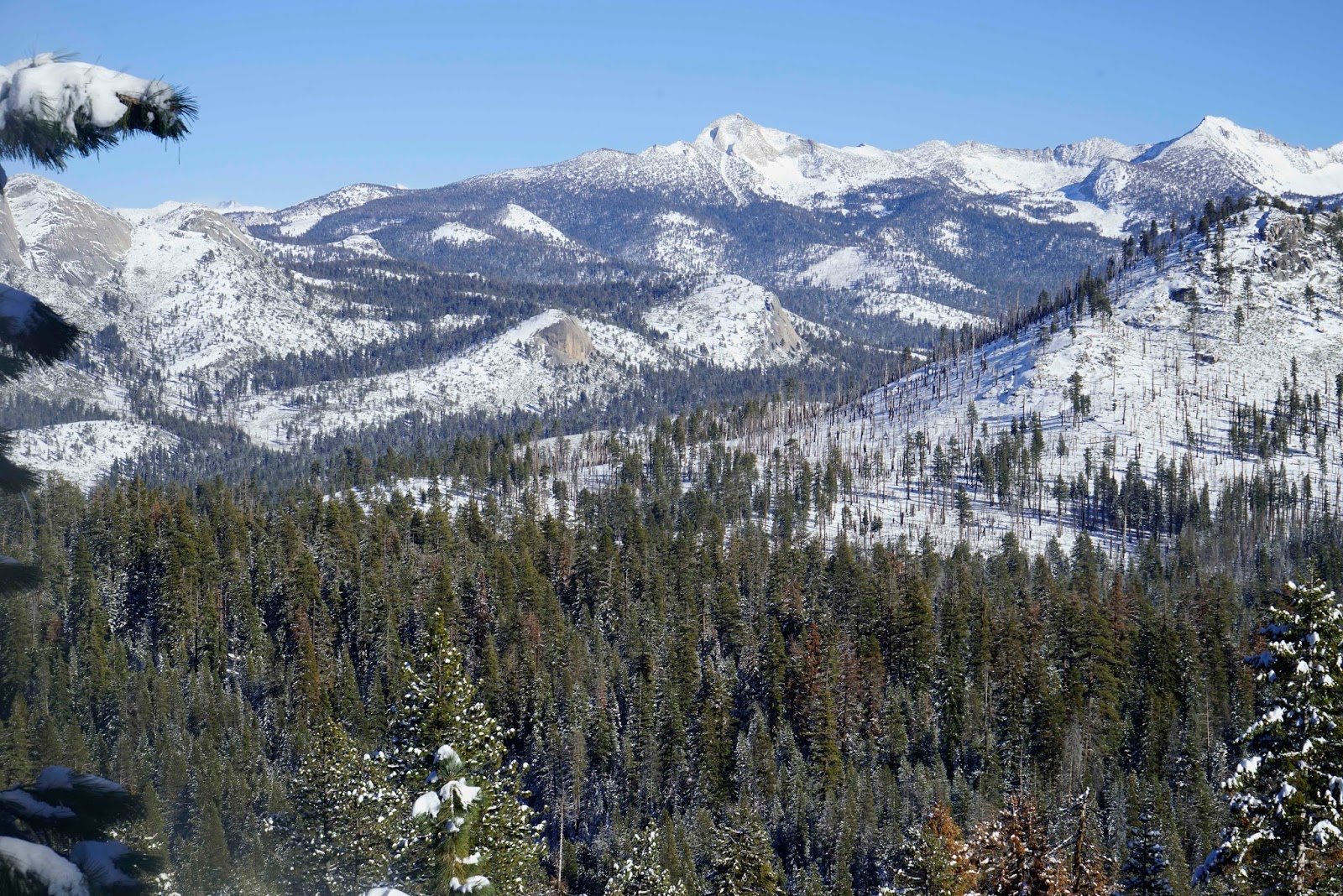
Clark Range Overlook Cloud's Rest Far Left


Photographs were taken with a Sony A7R and native Sony Zeiss 24-70 f4 lens.
ReplyDelete