Dale Matson
Click On Photographs To Enlarge

Pine Flat Reservoir
Note: please excuse the dust on the sensor. I need to clean it.
Note: please excuse the dust on the sensor. I need to clean it.
From Fresno California, we took Highway 180 to Piedra Road
just past Centerville. You will pass Avocado Lake. When you meet Trimmer Springs Road, take a
right and drive to the end. Trimmer Springs Road is the main road along the
north shore of Pine Flat Reservoir.
Over 20 years ago Sharon and I went with two of our sons and
their uncle above Pine Flat for a float in inflatable kayaks. I’m not saying it
was the same as our recent visit but the rapids were more than enough for me to
never float the Kings River again.

Notice Sharon Has A Smile But Not Me!

We Dumped Twice

Get Me Out Of Here!
We recently visited the same area and drove to the end of
the road just beyond were we put in years ago. It took us about 3 hours from
Fresno but we were taking photographs along the way. The water levels were
high, the current was fast and the water was cold and turbulent. The “Kings
River Expedition” kayak company had a row of kayaks set along the riverbank in
a calmer area. The guides were waiting for a busload of adventurers. I gave the
sign of the cross as we passed by them.
We started our hike at the end of the road, which is 8 miles
from the bridge on the north shore. There is a broad trail that begins after
the gate, which initially could be traveled by an OHV if there was access. As
we continued on the trail split. The broader trail continued climbing and
eventually ended further up. We took the “Angler’s Trail” which remained along
the river. At this point both the South and Middle Forks of the Kings have
already merged. After about 2 miles we turned around and headed back to the
truck for lunch along the roaring river. It was a hot day but there is a breeze
created by the rushing water and we sat on a rock in the shade.
After lunch we decided at the bridge to drive the 3 paved
miles to Balch camp, which is a PGE employee village. As we drove toward Balch
Camp, we followed the North Fork of the Kings River upstream where it is joined
by Dinkey Creek in Balch Camp. Further above Balch Camp the North Fork comes
out of the Black Rock Reservoir. As far as I know, Pine Flat and Black Rock are
the only reservoirs on the Kings River. Pine Flat is enormous at 1 million acre-feet.
I used my Sony A7R2 and the Sony GM 24-70 2.8 lens for the
photographs.
My only caveat is to be very careful near the shoreline of
the Kings River. If you or your children
get caught up in the current it could be fatal.


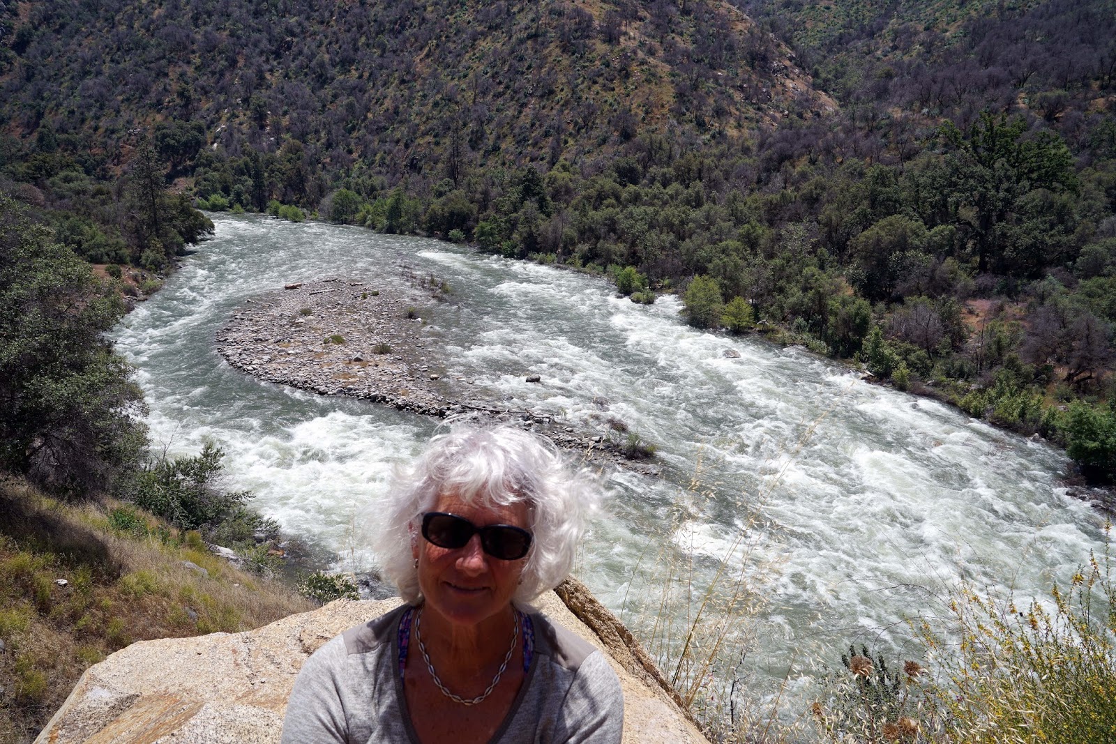
Sharon

Start Walking


Confluence Of North Fork (Darker Water) With Kings River

North Fork Kings River
Here is a video on YouTube:
No comments:
Post a Comment