Translate

Wednesday, July 15, 2015

Moro Rock Sequoia National Park


Dale Matson


South of Lodgepole on the General’s Highway, there is a parking lot, which provides access to the shuttle that will take you to the base of Moro Rock. There is also a 1.8 mile shaded trail through Giant Sequoia trees that will take to the base of Moro Rock.

Here is a brief YouTube video of the climb. https://www.youtube.com/watch?v=8LWBmiSSKp8
It is a 300’ climb at an altitude over 6,000’ on a staircase set into the granite dome. At times it is rather exposed and reminds me somewhat of a smaller version of the cable climb portion of Half Dome, which is even more daunting. Sometimes the path narrows and folks have to wait for one another as they head in opposite directions. It really is possible to fall off Moro Rock. http://www.mountainonline.com/gods-eye-murder-mystery-sequoia-california/

It is also not the place to be during a thunderstorm. http://www.socialpositive.com/c/stories/A-Hair-Raising-Experience-on-Moro-Rock-133301 I have climbed these stair several times over the years and never really got an optimum view because of the hazy air. After a rain would probably be best.


 Click Photographs To Enlarge


Sunday, July 12, 2015

Buck Rock On A Better Day


Dale Matson

Click On Images To Enlarge


(For additional information see the previous article “Bad Day At Buck Rock”. http://midsierramusing.blogspot.com/2015/07/bad-day-at-buck-rock.html

I was frustrated with the overcast weather when I took the photographs from Buck Rock earlier in the week. I went back Saturday and tried it again. My first shots were with my Panasonic Lumix TZ60 30X optical zoom point and shoot camera. I headed south on the General’s Highway. There is an overlook on the east side of the road about 2.5 miles south of the Junction and I knew the day would yield better photographs.


If you are at the overlook and look east-northeast you can see the lookout tower on top of Buck Rock. It is about 2.5 miles as the crow flies. You can see Mt. Clarence King (near Rae Lakes), which is about 25 miles to the northeast. You can also see the massive Mt. Goddard (near the Ionian Basin) to the north-northeast about 32 miles as the crow flies.


 Mt. Clarence King
Mt. Goddard Panasonic 30X Zoom
Mt Goddard Sony 200mm

 Sony A7R 200mm f4  
 Adapted Canon 17mm f4
 Sony Zeiss 55mm f1.8
 55mm
55mm

Wednesday, July 8, 2015

Bad Day At Buck Rock


Dale Matson


Click On Photographs To Enlarge


(No, this is not a review of the movie Bad Day At Black Rock starring Spencer Tracy)
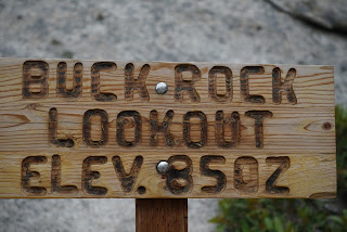
Buck Rock Lookout is about 2 hours from Fresno. Take highway 180 eastbound to the Sequoia/Kings Canyon entrance. Continue on highway 180 until the highway forks. Head south on the General’s Highway, turn left at the sign for Big Meadow. After about 2.5 miles, turn left at Big Meadows at the sign toward Buck Rock and Buck Rock Campground. At this point the road becomes a bumpy dirt road and is NOT recommended for low clearance vehicles. After 2.5 miles of climbing, you arrive at a parking area with a sign showing the way to Buck Rock. It is a fairly short walk and a long climb up to the lookout tower. Along the way you will notice trail markers in the trees and this is a great winter ski. There is a parking area just off The General's Highway and that is the winter trailhead. the main trail heads toward Big Meadow but their are spur trails also. My Airedale Susie often went with me on these skis. The lookout is closed in winter.

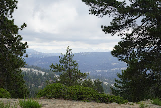
It was a bad day because there was really not much of a view. The weather closed in. It was a cool 54 degrees when I parked my truck. There were folks from Montecito Sequoia Resort being trained on ropes on a lower portion of Buck Rock. It is also a popular climbing destination. There is some additional information here: http://www.buckrock.org/aboutbrl.html

Kathy was on duty and multitasking as she talked to the forest service helicopter on the radio and ushered me in out of the wind and cold. I signed the guest log and began sorting lenses in hopes that the clouds would part and I could get a clear view. As it turned out, the longer I was there the more the view deteriorated. She couldn't see well enough help the forest service fighting a small fire with a water bucket hanging down on a cable.

I took shots with my three lenses. I used the Sony 70-200mm f4 G lens, 55mm f1.8 and my adapted Canon 17-40mm f4. None of my vista shots were satisfactory but closer shots of the climbers were OK. Kristi was the climber looking into the camera with her permission to publish.


Drought Results Elevation 4,000'

For better photographs on a better day see the next article. http://midsierramusing.blogspot.com/2015/07/buck-rock-on-better-day.html