Translate

Saturday, August 28, 2021

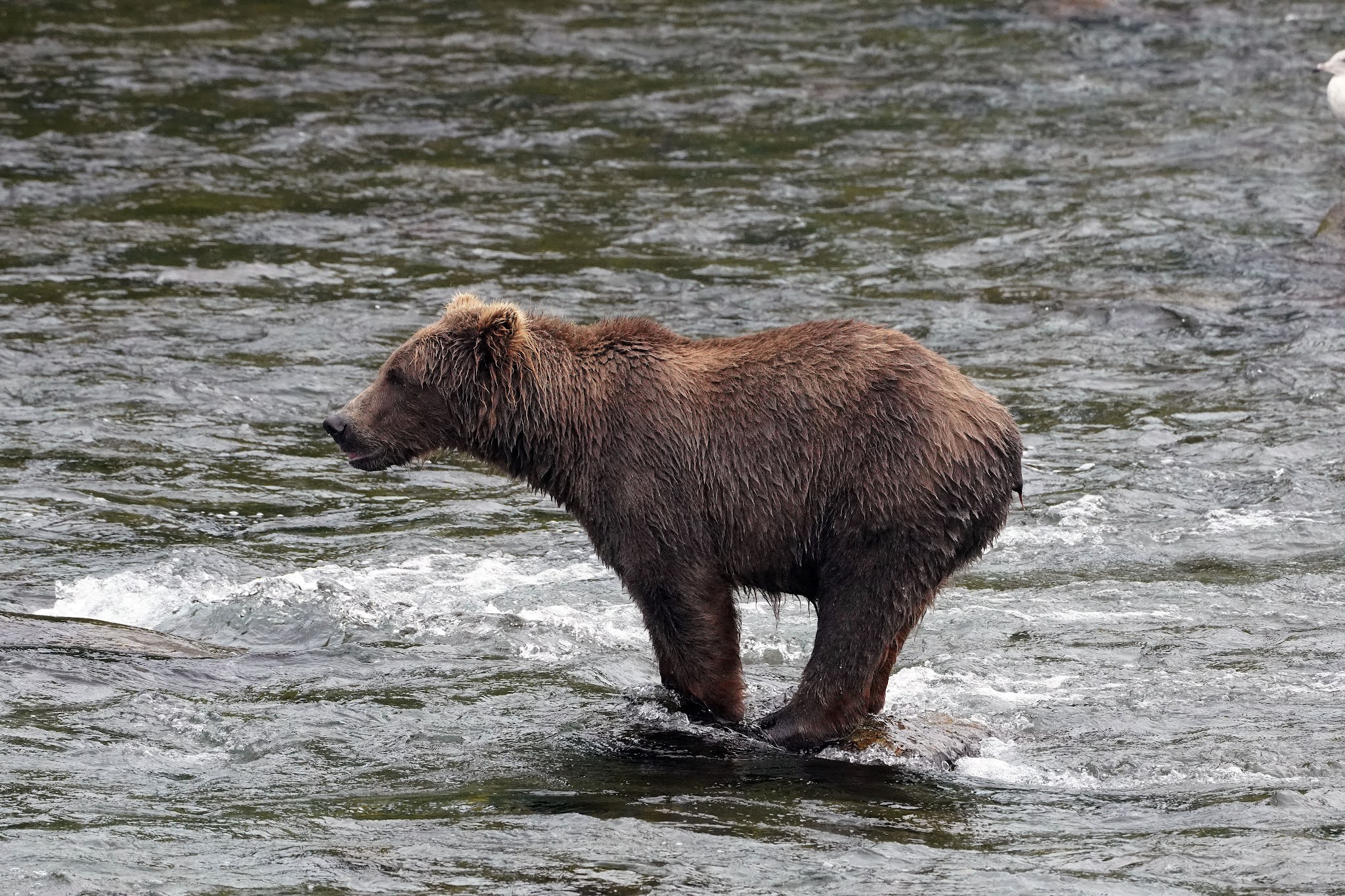
Grizzly Bears At Brooks Falls AK


Dale Matson

Click On Photographs To Enlarge


We flew from Fresno to Seattle, Seattle to Anchorage, Anchorage to King Salmon (1.25 hrs.) and took a float plane (40 min) to Brooks Falls. We stayed there for three nights. One day was devoted to the bus tour (I will write about this in another article) and the other three days were devoted to watching, filming and photographing Grizzly Bears.

It is two miles round trip to Brooks Falls from the camp where we stayed. We stayed in a small cabin with four bunks, a toilet and shower, which was adequate for our needs. When you initially arrive, you are given an orientation talk about how to behave around the bears. The food was great and I gained six pounds during our full eight day visit to Alaska. There is an initial raised and gated platform for viewing the bears as you leave the camp. Once you leave this platform, you are on a gravel road which then becomes a gravel path that winds through the woods to the viewing platform by the falls. You are encouraged to walk in groups, never run and give the bears the “right of way”. They often walk on the beach where the float planes are anchored and even through the camp. One night we heard a ranger yelling at a bear chewing on the cabin next to ours. There is also a camping area for fishermen and bear watchers that has an electric fence surrounding it.

Although we didn’t go at what is considered the optimum viewing months of July and September, my wife Sharon and friend (also named Sharon) saw as many as sixteen bears one evening. We also did not have to contend with the crowds or bugs. Because it was mid-August, it was seasonably rainy but we had lots of opportunity for photos.

These bears are well fed and huge. I never imagined that they would be even larger in real life than I have seen on video. I was always happy to get to the viewing platform by the falls or back to camp. My wife and our friend were not as bothered by the walk through the woods as I was.

I brought a Sony A7C with both a 24mm 2.8 lens and a 50mm 2.5 lens mostly for landscape. My main camera was a Sony A7R4 with the 100-400 GM lens. I also had a crop setting that allowed me to shoot at 600mm and still get 24mp photos. I brought three batteries (both cameras use the same battery) but did not bring a charger. I almost ran out but one of the employees lent me his charger and a full battery which made the final two days as enjoyable as the previous six days. Our friend Sharon wished she had brought her 500mm lens but didn’t. Her large lens only zoomed to 300mm.

I want to thank the staff and Park Service Employees for their help in making this portion of our Alaska stay a once in a lifetime experience.   


Otis


Sunday, August 15, 2021

Six Day Goddard Canyon Area Hike

Six Day Goddard Canyon Area Hike
Dale Matson

Click On Photographs To Enlarge


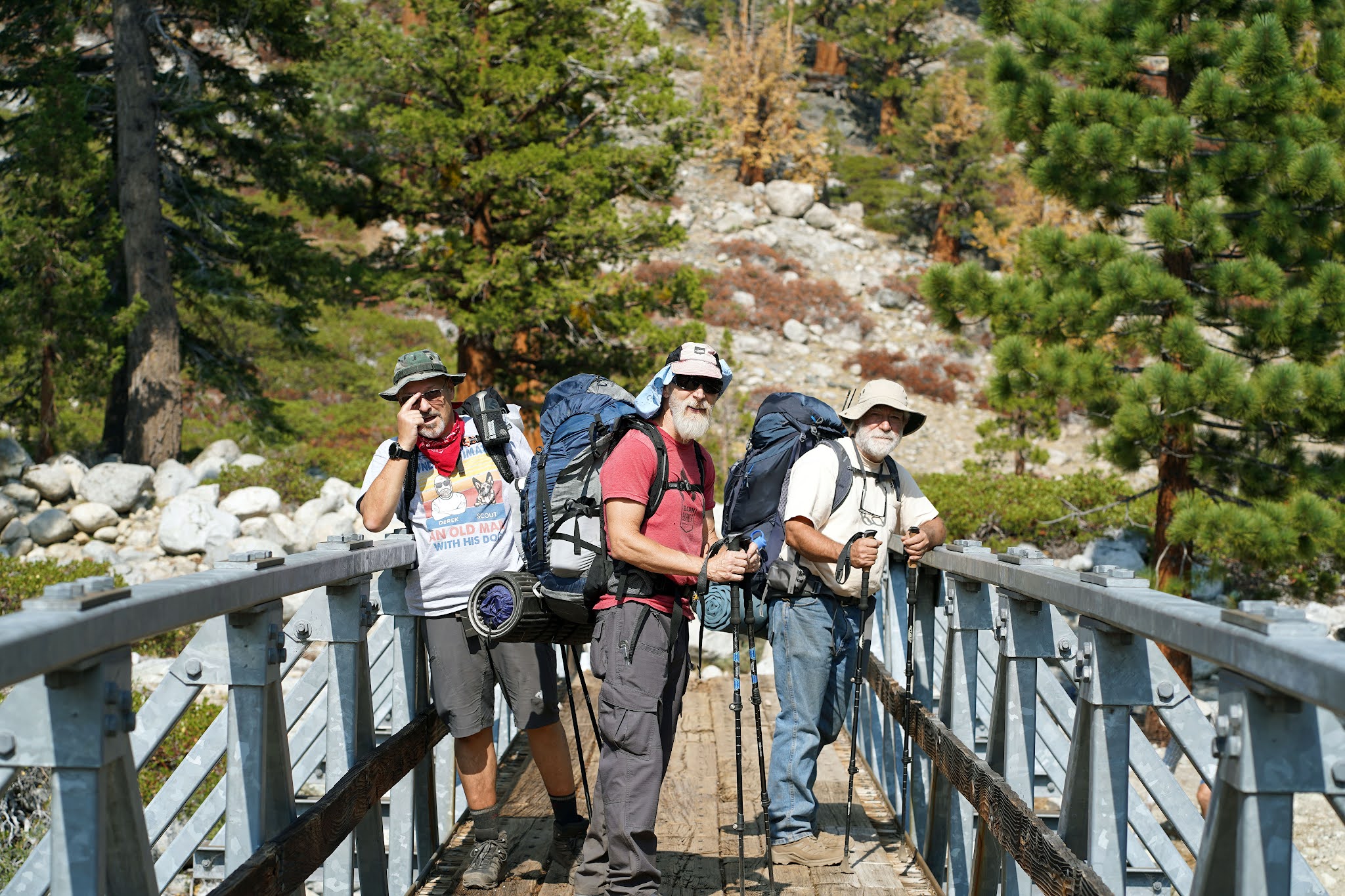
    This was a trip organized by Derek who got the permits. We also had Mike who works with Derek at Community Hospital in Clovis Ca. I ran Western States with Mike back in 2001. He was the youngest member at 59. Derek also recruited Brad who he backpacked to Evolution Basin with last year. I was the oldest and slowest member who will be 77 next month.
    We took two vehicles the three hours to Florence Lake which allowed for more flexibility. The final fourteen miles over Kaiser Pass on a one lane road takes one hour by itself. We arrived at the Florence Lake Store and purchased our tickets for the first ferry ride Sunday morning at 8:30am.
    We hiked about ten miles the first day and camped above the San Joaquin River about a mile beyond the Piute Creek Bridge. It was a hot hike and we were all glad to pitch our tents. Brad and Mike, who had never met, had lots to talk about, while Derek and I listened from our tents.
    The next morning Brad suggested we try and get to the campsite just beyond where the trail comes down from Hell-For-Sure Pass out of Red Mountain Basin. Mike and I got an early start and arrived ahead of Derek and Brad. There was a nice creek that flowed just below the campsite. We were about three miles from Martha Lake at that point. The two overnights helped us acclimate to the 11,000’ altitude at Martha Lake. There are a limited number of good campsites in Goddard Canyon because the San Joaquin is in a low gorge, making river access difficult in most spots. This was my second trip to Martha Lake. Last year, I was with a packer that carried my pack on a mule.
    I believe Derek and I saw only three people during our time in Goddard Canyon. The more popular route is Evolution Valley on the JMT which departs from the Goddard Canyon route at the beginning of Goddard Canyon.
    We set out on day three and climbed the final 1,000’ to Martha Lake, the source of the South Fork of the San Joaquin River. That three miles has patches of trails but the last mile or so has no trail. You just follow the river and head toward Mt. Goddard. We all got there by noon and Mike found a good camping spot on the left side of the lake. We were all ready to kick back for the rest of the day.
The following morning, we all set off for Davis Lakes off trail and then hoped to get up to Evolution Basin from there. Mike and Brad had a route in mind but Derek thought that we would be giving up too much elevation. We parted ways and I went with Derek. And that was the last we saw of Brad and Mike on our trip. Brad and Mike got to Davis Lakes where they overnighted. They then boulder hopped to Wanda Lake and down to McClure Meadow on the JMT. They then got to Florence. They were out two more days than Derek and I were. We wound up at Goddard “Pass” where we could see Davis Lakes about 1,000’ below us but, there was no trail down to Davis Lakes. There is nothing on the map that names the location. At that point we decided we would head back to Martha Lake, spend the night and head back to Florence Lake. It was a wet and stormy return to Martha Lake.
    We broke camp about 9am, left beautiful Martha lake and began retracing our steps back down the canyon. We quickened our pace, as the thunder and lightning began when we past Franklin Meadows on the trail. We got as far as the trail junction of the JMT and the beginning of Goddard Canyon. There is a great campsite right there across the wooden bridge. As soon as we set up camp, it began to rain.
    We broke camp about 9am and hoped to make the final ferry at 5pm. We had 12 miles to go and I kept a pretty good pace of about 1.8 mph. I had run out of food and Derek shared breakfast and lunch with me. We took the time for Derek to prepare a spicy lunch down by the San Joaquin River and it powered us down the trail. Derek at one point near Florence Lake was concerned we had missed the trail to the boat but I had my GPS on track back and we soon came to the sign for the ferry. We actually got to the shed with the phone to the store about 4pm. Derek called and they said the boat was still there from dropping off a passenger. We got an early 4pm crossing. We dropped off a lady backpacker at the junction to Edison Lake who had her car at Mono Springs Resort.
    Derek drove all the way to his house and we passed some crazy Friday PM drivers on Kaiser Pass Road. I was so tired, I had to put my address in the navigation to get home.