Hiking The North Fork
Of The Big Pine Creek Trail To The Palisade Glacier
Dale Matson
Click On Photographs To Enlarge


The trailhead for this hike is off
Glacier Lodge Road out of Big Pine CA. Overnight parking is available near the
store at the end of the road for a small fee or you can park off Glacier Lodge
Road in the backpacker’s lot. This is a 21-mile round trip hike with about
4,500’ of gain outbound.
We drove from Fresno through Yosemite
and arrived at the White Mountain Ranger Station in Bishop CA for our “walk in”
wilderness permit. We opted for two nights at Third Lake. This is a popular
trail for day hikers, back packers and alpinists. We then drove west to the end
of Glacier Lodge Road (Crocker St. in Big Pine) and parked near the store. We
paid our fee for two nights and filled out emergency information.
We had stayed overnight at Second Lake
a few years ago and enjoyed hiking along 5 of the green glacial lakes but our
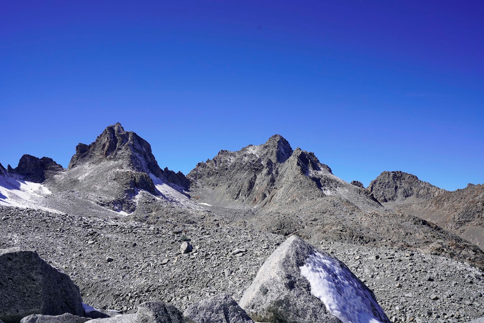
goal was more ambitious this year with a plan to hike to a view of the Palisade
Glacier which is the largest Glacier in the Sierra Nevada. The glacier is
located in a cirque below several 14’ers including Mount Sill, Thunderbolt
Peak, North Palisade, Polemonium Peak.
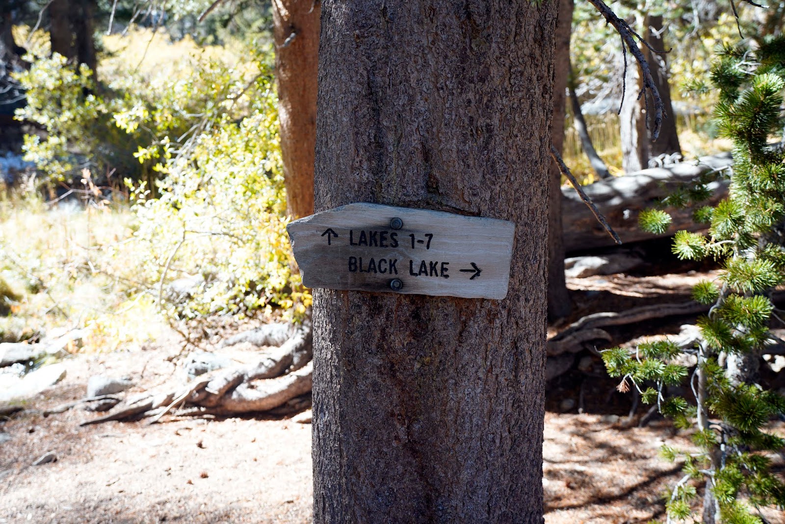
What is somewhat misleading is the
fact that the hike from Third Lake is only about 3 miles one way but the “Glacial
Trail” ends about a half mile before the end of the climb to the view. The last
half mile weaves through a boulder field marked with occasional cairns to guide
the way. Additionally, it had snowed the previous week and we had snow and ice
to contend with on the trail and through the boulders. At one point we had to
use the tips of our trekking poles to break the ice off areas where we had to step
on to climb up. The boulder part was slow and difficult for us up and down. Our
last rest stop, I looked at my GPS and said to Sharon, “Only another 100’ of
climb”. It took us about 9 hours for the six miles round trip.
We headed back down after about a
half hour on top because the wind had picked up considerably and clouds began
to roll in. We “rushed” back to our camp at Third Lake and arrived about 6pm. It
was a slow hike out the following day and a very long drive back to Fresno. We
could not have done it without two drivers.
Was this worth all this effort for
this 74-year-old man and his bride? Yes, I think of all the views I have seen in
the Sierra this may be the most awe inspiring and beautiful yet. In addition to
the typical view of Lakes One through Three from above, Lake Four, Lake Five,
Black Lake and Summit Lake can also be seen. White Mountain Peak can also be
seen far to the Northeast.
Most of my photographs were taken
with my Sony A7R3 and 16-35mm GM 2.8 lens. I also used my Sony Zeiss 55mm 1.8
lens and Sony RX1R2 for backup shots. It is a lot of gear but I think the views
warranted it.


First Falls


Middle Palisade and Clyde Glaciers Down South Fork


Lon Cheny Cabin


First Lake

Second Lake

Campsite At Third lake

Temple Crag At Third lake


Mt. Robinson


Frozen Waterfall

Sam Mac Meadow

Mount Sill Far Left


Lakes One-Three

Mount Gayley and Sill

Fifth Lake

Fourth Lake


Sharon Sitting Looking At Next Cairn Above


Mount Winchell left and Mount Agassiz Right

White Mountain Peak Left Top


North Palisade Left and Starlight Peak


Sudden Clouds

Temple Crag Above Lake Two

Author

Glacier Reflected In Glacier Lodge Pond

Our Highest Elevation
I have a YouTube video with video footage and additional graphics here:
Great photos! When was the trip?
ReplyDeleteThanks. I posted the story October 11th, about a week after we did the trip. We did it in early October which, when we applied for the permit, was the first available reservation. This area is one of the most popular for backpacking, hiking and camping in the entire Sierra Nevada.
Delete