Dale Matson
Click On Photographs To Enlarge
Kaiser Peak (10,300’) is my annual penultimate hike on the west side of the Sierra Nevada before I take on more difficult hiking and backpacking on the east side of the Sierra. This year was the first year I was able to see first-hand some of the fire damage from the monstrous Creek Fire. The Kaiser 17-mile Kaiser Loop trail is closed but that hike includes a more westerly section that was hard hit by fire. I took the shorter and my traditional trailhead route for me which heads due north from above the D&F Pack Station (Upper Deer Creek Lane) off Huntington Lake Road. Although there was evidence of spot fires lower down, there was no evidence of fire about 9,000’. There is much less vegetation than to the West. The trail is in good condition with only one tree to have to go around.
The weather has been hot and I assumed there would be no water resupply opportunities by now with a low snow year so I packed in about 3 liters of water in my day pack and got an early start and began my hike about 5am (start temperature 45degrees). The air was relatively clear. It is always good to get an early start because thunder storms can pop up in the afternoons. The Sierra makes its own weather.
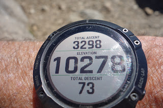
Based on years of experience I would measure the round-trip distance as eleven miles with about 3,300’ of gain. I would classify this as a strenuous hike. I was out about 7.5 hours and traveled at my old man (76) pace. It was a double test since Sharon and I did the Twin Lakes trail with friends two days later.


No comments:
Post a Comment