Translate

Thursday, August 11, 2016

Dinkey Creek CA And The Pine Logging Company

Dale Matson

Click On Photographs To Enlarge

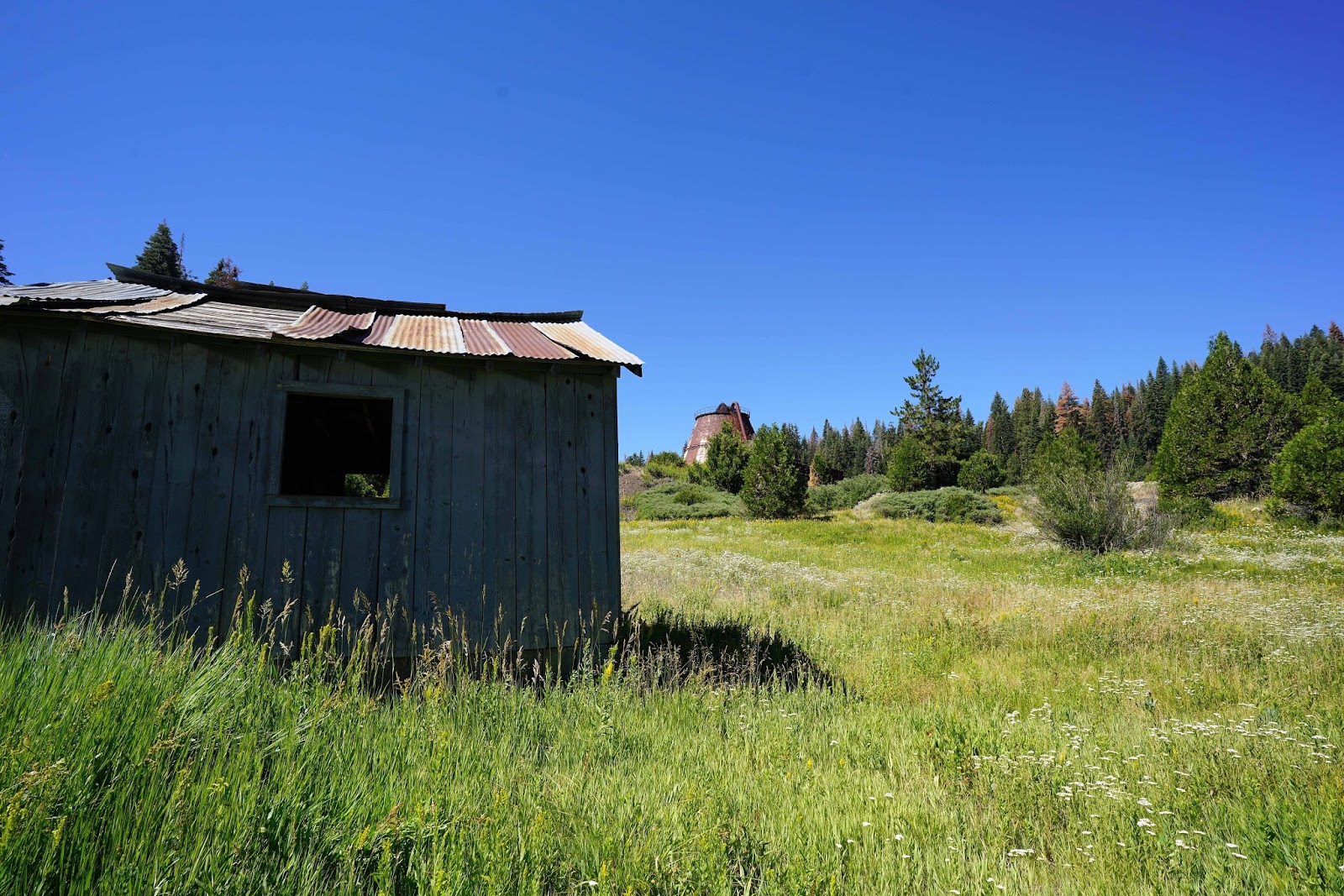
Housing For Pine Logging Company

Dinkey Creek is both a small resort community east of Shaver Lake and the name of a creek that flows nearby. Most of the time the creek is tame and good for fishing, camping and recreation. However, I have seen the creek flowing as a raging torrent like in 2006 when school administrator Mike Young drowned in Dinkey Creek. The mountaineering unit of SAR team was not involved in the search for his body because of concern about the dangerous conditions of the fast flowing deep water headed to Pine Flat Reservoir.

Living near the central Sierra Nevada one gradually learns and gains appreciation for the history of the area. There is the glacial/geological history but there is also the more recent human history connected to the Sierra. The Sierra is such a wonderful and necessary resource for California in general and the local communities in particular. Each year much of the California irrigation and drinking water comes from the annual snowmelt held conveniently in the high Sierra and gradually released via the major rivers flowing west toward the Pacific Ocean.

In addition to water, electricity and mineral resources, the central Sierra Nevada has provided millions of board feet of lumber for home construction. Lumber companies in Bass Lake, Shaver Lake and Dinkey Creek sent lumber and logs to towns like Sanger, Clovis and the Pinedale area of Fresno.

Shaver Lake was initially only a millpond created by damming Stevenson Creek. http://historical.fresnobeehive.com/2012/02/the-old-shaver-dam/
Only later was a larger dam built that held additional water for the generation of electricity at Big Creek.

The Pine Logging Company in Dinkey Creek was built in 1937 and operated until 1979. http://www.pinelogging.org/Home
These lumber camp/mills became self-contained communities. As you descend toward the community of Dinkey Creek on Dinkey Creek Road, there is a CDF station on the left. If you turn there, you will also encounter the deserted logging community. It is well worth the time spent wandering among the buildings and imagining what life would have been like in this busy community with the immense wood scrap burner as the central feature. If you go inside, with all the bullet holes, it is like being in a kind of planetarium.


There is an additional feature of Dinkey Creek worth visiting. If you go into Dinkey Creek, continue past the ranger station and store. Turn right on the paved road that heads down to the creek. There is a beautiful unique Bowstring Arch Timber Truss bridge. There are large boulders placed at each end to prevent vehicular travel. I enjoyed seeing the wonderful craftwork and worked my way into the center of Dinkey Creek to photograph the bridge from the side also.


Friday, August 5, 2016

Sabrina Basin II


Dale Matson

Click On Photographs To Enlgarge

Hike Route

Last year at this time I drove over to Sabrina Lake near Bishop CA with a friend and his dog for a day hike to Blue Lake. I knew as we drove back to Fresno that I wanted to return with more time to explore the basin. http://midsierramusing.blogspot.com/2015/07/sabrina-basin-day-hike-from-fresno.html

My wife and our friends Carlos and Carol were not able to get a walk-in wilderness permit for the north fork of Big Pine Creek and opted to spend two nights at Blue Lake in Sabrina Basin. I was somewhat disappointed that our friends would not see the ‘Glacial Green’ lakes of the north fork of Big Pine Creek.

It was good to see Sabrina Lake with lots of water in it this year. The backpacking parking area is ½ mile from the trailhead. I dropped off my wife, friends and gear and drove back to the parking area. My Garmin Map 64 included this mileage with about 21 miles overall for the entire time out. After about four and a half hours, we arrived at a good spot for a camp with enough time to set up camp and hike to Donkey Lake before dinner the first day. Remember that the trail crosses the Blue Lake outlet. Don’t follow the use trail that will eventually disappear. The total ascent the first day was about 1,500’ with about 8 miles of travel overall. Tom Harrison has an excellent map of the area “Bishop Pass: North Lake-South Lake Loop” which we bought at the White Mountain Ranger Station in Bishop where we obtained our trail permit.
    
Donkey Lake

We decided on a route the second day, which would take us back to the junction with the trails to Donkey and Dingleberry Lakes. From the junction, we would head to Hungry Packer Lake with the route including Dingleberry Lake, Sailor Lake, passing above Topsy Turvy Lake, and an off trail view of Moonlight Lake (They did get to see a ‘Glacial Green’ lake). The trail was generally good with Cairns to mark the trail over smooth granite. Younger folks could probably include a side trip to Midnight Lake, which would add an additional 1.2 miles, overall to the total hike mileage. It would have been too much for us to include this lake also. We had about 1,000’ of ascent the second day overall.

 Blue Lake
 Dingleberry Lake
 Hungry Packer Lake Below Picture Peak
 Sailor Lake

 Moonlight Lake
 Sailor Lake
Topsy Turvy Lake

Unlike my hike last year, this year was perfect for photographs with white fluffy clouds in a blue sky. It seems like an overcast sky vastly diminishes the colors and contrasts. I used a Sony RXIR (Zeiss 35mm f2) and a Sony A7R2 with Zeiss 85mm and Zeiss 18mm native lenses. I continue to be amazed at how good the color rendering is with the RXIR. These photographs were as they came out of the cameras other than file size reduction.

Our final evening we had a bit of rain during dinner and then the winds died down. The sunset over Blue Lake was amazing with a mirror lake and the clouds adding character to the fading light on the mountains. It is not often that the conditions come together for a photograph. That is why being in the wilderness overnight provides the golden moments.


 Mt Emerson and Piute Crags
 Clouds Reflected In Pond By The Trail
Sabrina Lake From Trail Above

We had a brief storm that came up at daybreak and just as quickly vanished which made the trail less dusty on our 2.75-hour return to Sabrina Lake. We had lunch at the Burger Barn on Highway 168 and drove back through Yosemite, arriving back in Fresno about 5pm. Trading drivers made the trip much more enjoyable. I would compare this hike to any I have taken for beauty. Whether you hike out of Bishop CA from North Lake, Sabrina Lake or South Lake, the scenery is just grand!

A YouTube slide show video with additional graphics is available here:
https://www.youtube.com/watch?v=gnHrx9_lM6M&feature=youtu.be