Dale Matson
Click On Photographs To Enlarge

Right now you are saying, “Are you serious? This was a good
opportunity for a day hike with my friend Faron and his young Rhodesian
Ridgeback “Diesel”. Diesel (the dog) got sick in my diesel truck on the way. It
didn’t seem to slow him down on the trail however and he probably went twice as
far as Faron and me. We kept the windows rolled down on the way back, which
helped the dog. This effort was something that worked for both of us. It meant
leaving Fresno at 4am and arriving at the trailhead by 9am. We hoped to get to
Midnight Lake but the threat of thundershowers even during the morning turned
us back not far past Blue Lake. I used the “Bishop Pass North Lake-South Lake
Loop Trail Map from Tom Harrison because it shows distances between trail
junctions.
By my calculations, we went about 8 miles round trip with 1,675’ of ascent. Our top elevation was around 10,400’. There was adequate replacement water along the way, if treated. Sharing the driving home made for a relatively comfortable 16-hour push. Of course an overnight would have been better but we did avoid the afternoon thundershowers until the last mile inbound. Faron and Diesel went ahead of me and avoided more rain than me. I was prepared for and not bothered by the rain. The thunder was a different matter however. Even for a weekday, the trail was busy with day hikers and backpackers. It is easy to understand why.
By my calculations, we went about 8 miles round trip with 1,675’ of ascent. Our top elevation was around 10,400’. There was adequate replacement water along the way, if treated. Sharing the driving home made for a relatively comfortable 16-hour push. Of course an overnight would have been better but we did avoid the afternoon thundershowers until the last mile inbound. Faron and Diesel went ahead of me and avoided more rain than me. I was prepared for and not bothered by the rain. The thunder was a different matter however. Even for a weekday, the trail was busy with day hikers and backpackers. It is easy to understand why.
My GPS download shows where we parked for this day hike near
the trailhead. Overnight folks have to park further back along the road. It
seems like the climb up as you hike along the lake, makes the first part quite
long. As you travel, you can see a waterfall near the south end of Lake
Sabrina. It looks like the headwaters for this creek is at Sunset Lake. You can
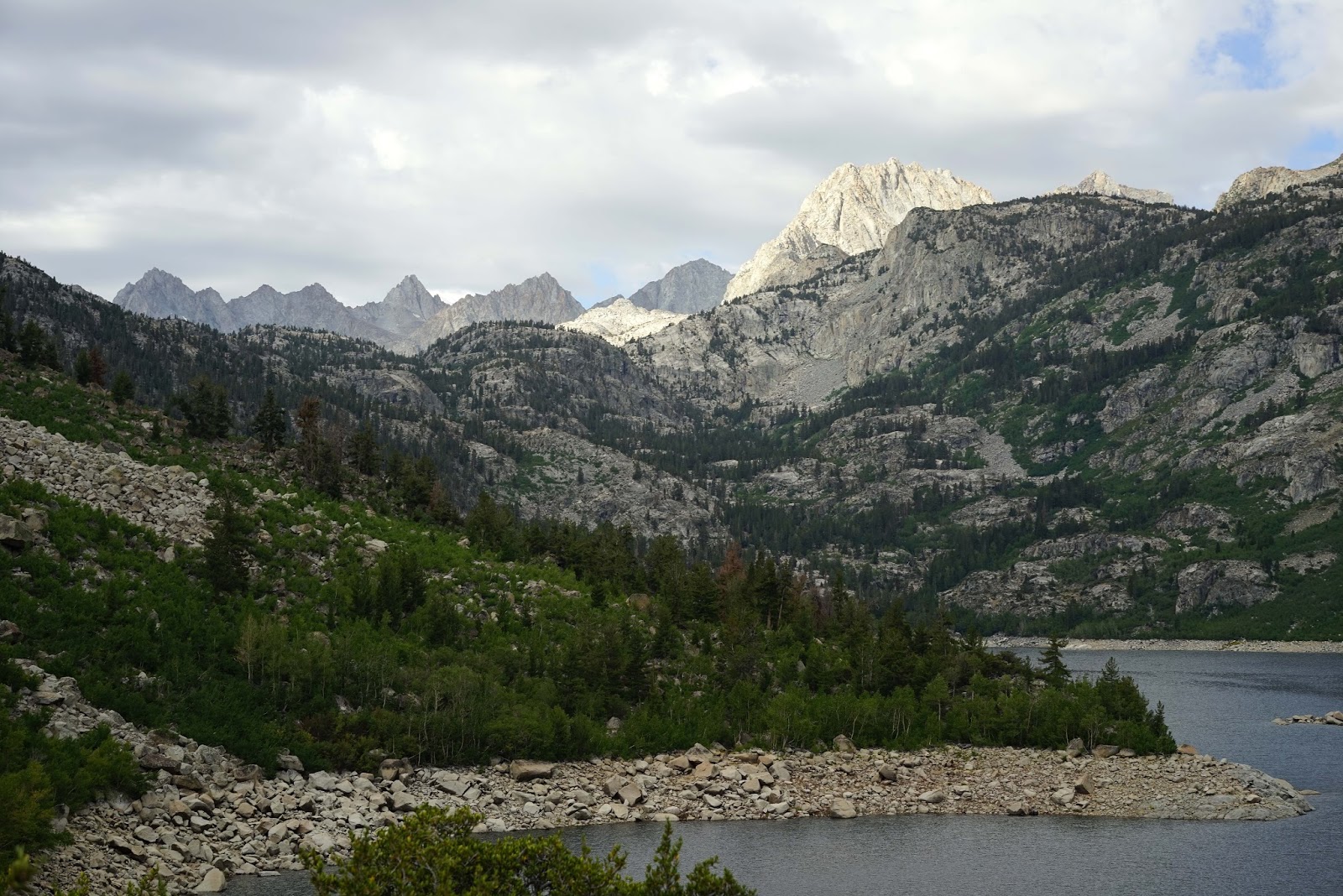
also see Mt. Emerson (named after the poet Ralph Waldo Emerson) and the Piute
Crags to the west-northwest of Sabrina Lake. They are actually north of the
north fork of the Bishop Creek trail that goes to Humphrey’s Basin. If you hike
to Humphrey’s Basin out of North Lake you will see these rust colored crags to
your right also.
I am somewhat embarrassed to say that we got turned around
after taking a use trail down to the north end of Blue Lake. The trail is obvious and crosses the lake outlet
on stones. There is a much better view of both the lake and the mountains to
the south a little further on. There are nice established campsites near the
lake. As I examined the map it looks like the Mountain View may include Mts.
Powell, Gilbert and Thompson. They are all over 13,000’. It was overcast for
our hike which was good for temperatures but less so for photographs. I can
only imagine how beautiful the view would be during the golden hours.
I believe one could easily get to Midnight or Hungry Packer
Lakes on a day hike with an early start. For most, it would involve an overnight
stay after the hike. If it is done with backpacking gear one could stay in
these areas too and hike back the following day. This day hike in no way even
begins to explore this basin but is an introduction of one of the most
beautiful locations in the Eastern Sierra Nevada.


Wide Angle Photograph Of Sabrina Lake From The North End


Faron and Diesel


Piute Crags and Mt. Emerson (13,204')

Outlet Near North End Of Blue Lake


Old Man Blocking A Good Mountain Photograph


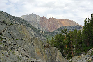
Interesting Rock Colors


Diorite Country Rock Intruded By Granite Pegmatite
Identified By My Friend Phil Mariotti PhD Geologist
Originally Formed 5 Miles Below The Surface Of The Earth

Different Rock Types Layered

Diesel Awaiting Instruction From Faron

Waterfall At South End Of Sabrina Lake
There is a YouTube video slideshow here:
No comments:
Post a Comment