Dale Matson
For those who like a moderate hike with a view at each end, this is a good hike for you. For the preliminaries on this hike please see my article on the Grant Grove area which includes Panoramic Point. http://midsierramusing.blogspot.com/2015/06/grant-grove-area-kings-canyon-national.html.
I would also note that the parking area below Panoramic Point not only has lavatory facilities but it also has bear boxes and picnic tables. We had a nice shaded lunch there. When you finish your initial view at Panoramic Point, there is a trail sign for the Park Ridge Trail. If the view is hazy at Panoramic Point, it will be hazy at the fire lookout. I would recommend an afternoon start for those who want the sun in the best spot for photographs.
The hike is about 5.5 miles round trip with considerable climb and descent as the trail generally follows the ridge. It is about the same elevation (about 7,500’) at Panoramic Point as it is at the fire lookout. We had a leisurely pace and took about 4 hours round trip. There is one place where the trail is somewhat overgrown with buck brush and Manzanita and two places where the trail follows the service road for a time. Watch the signs. I initially missed the left turn toward the tower and headed downhill a bit toward Wilsonia. There are some views on either side of the ridge as you hike toward the fire lookout tower with the valley views generally hazy.
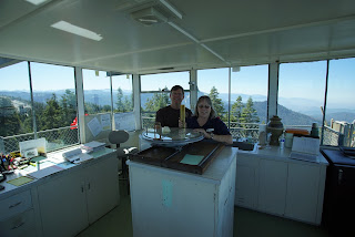
It is a short and easy climb to the deck surrounding the enclosed tower command center that is staffed by volunteers from the Buck Rock Foundation. Today, Wendy and Bob were on duty and answered lots of questions about the surrounding landscape features.
Click On Photographs To Enlarge
55mm Shot
Dale And Wife Sharon
Friend Mike With Sharon
Mt. Henry To The North
Dennison Mountain
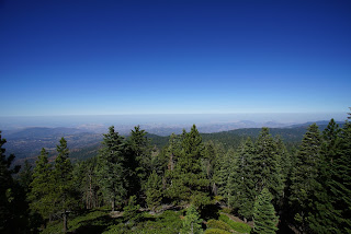
17mm Of Central Valley And Smog
Wendy And Bob
Big Baldy Ridge
Buck Rock Lookout
Kings River Canyon
Mt Clarence King Far Right
Mt. Goddard


No comments:
Post a Comment