Translate

Sunday, March 6, 2016

My Mountain Backpacking Lenses For The Sony A7R2


Dale Matson

You might be saying, “Haven’t we heard from this guy before on this topic?” Yes you have. The answer depends on lens weight, quality and focal length.
There is no point going to the trouble of hauling a full frame camera up and down mountain trails (and off trails too) if the lenses are too heavy and/or too big. For example the Zeiss 21mm 2.8 is a great ultra wide lens but the size of the lens plus the weight of the lens and adapter of almost 2 pounds, makes it prohibitive. This lens is heavier than my sleeping bag and pad combined! It is also a manual focus only lens.

Click On Photographs To Enlarge
Convict Lake 16mm

I use the native Sony Zeiss 16-35 f4 lens, which is autofocus; image stabilized, covers a wide range of focal lengths and weighs a tad more than a pound. This is a very important lens consideration when surrounded by mountains and lakes that are close.

Dusy Basin Trail 55mm

For a walk around lens, the native Sony Zeiss 55mm 1.8 is fast, lightweight, auto focus and compact, highly regarded and covers the middle focal length well. The IBIS in the Sony A7R2 makes this non-stabilized lens even better.

For a short telephoto prime lens, The new Zeiss Batis e-mount 85mm f1.8 is fast, image stabilized, autofocus, light and compact. It also gives the reach of a 135mm lens in cropped mode. Unless you are in bighorn sheep territory, this is enough reach.

 Zeiss Batis 85mm 


This combination of camera and lenses also allows me to eliminate the extra weight of a tripod and I can carry any combination of camera and lens in the Think Tank Digital Holster 10 on my belt. I however sew the belt loop closed because the Velcro closure on the belt strap will open up climbing off trail and the camera can fall off the belt.


So, there you have it. This is the 2016 plan for the mountains with hopes of new places in the Sierra Nevada Mountains. Some of those places are off trail which gives me some pause but that is where the beautiful but less iconic shots are.       

Friday, March 4, 2016

Mammoth Mountain CA Area

Dale Matson

 Click On Photographs To Enlarge
Mammoth Mountain Far Left
I was in Mammoth CA with relatives recently for some skiing and photography.
Mammoth Mountain is still listed as an active volcano. https://en.wikipedia.org/wiki/Mammoth_Mountain

Mammoth Mountain is rated as one of the top five California ski resorts for downhill skiing. Additionally, it has an excellent cross-country ski area in the lakes region. While my relatives skied the mountain, I had the best cross-country skiing ever, with spring like conditions. I have been there when the wind and cold make for conditions that only the hard-core skiers would endure. Sometimes the top of the mountain (11,050’) must be shut down because of winds that can exceed 100 miles an hour.
 Crystal Crag
 Bridge Over Twin Lakes
 Lake Mary Road Groomed As A Ski Trail

Lake Mary

The Tamarack cross-country ski area is off Lake Mary Road, which is groomed as a ski trail in winter. The ski course includes Lake Mary, George, Mamie, Horseshoe and Twin Lakes. Twin Lakes is the closest to the ski center and about the same elevation (about 8,500’). There is about a 500' climb to the other lakes and a wonderful nearly flat loop around Lake Mary. Horseshoe Lake has a considerable amount of CO2 emissions and there are warning signs. Perhaps the best overall view is from the dam at the end of Lake Mary. Crystal Crag (10,377’) is best photographed from another angle on the loop. The crag is evident from many areas of the ski trail as the trail winds among the lakes. The best time for photographs is in the late afternoon but before the trail begins to get icy. It is a fast descent on the return to the ski rental area. I had my own ski equipment but had to purchase a trail pass. The lodge is a great place to get a noon meal.

I also took the gondola to the top of Mammoth Mountain for morning photographs. 
Minarets, Ritter And Banner From Mammoth Mountain
 Close Up Of Minarets

 Photo Taken Near Mammoth Airport
Close Up Of Ritter And Banner From On Top Mammoth Mountain

Each day before sunup, I traveled to an area where the morning sun would illuminate the other nearby lakes east of Highway 395 including June Lake to the north and Convict Lake to the south. Frozen lakes are not quite as beautiful as open water lakes but Convict Lake had just enough open water to provide a reflection. The snow in the mountains is optimal when the lakes are frozen however.
 Convict Lake At Sunrise
June Lake At Sunrise


For my photographs, I used a Sony A7R2 with native Sony Zeiss 24-70mm, 16-35mm, and an adapted SAL 70-400mm lens. Convict Lake was the widest shot at 16mm. June Lake was 70mm and the Minarets in the Ritter Range were shot from atop Mammoth Mountain at 320mm.     

Tuesday, March 1, 2016

Kings Canyon National Park Snowshoe To Panoramic Point


Dale Matson

Click On Photographs To Enlarge
Route Uploaded From Suunto Ambit II

The trip is almost 5 miles round trip with about 1,100’ of elevation gain, taking about 4 hours total time by snowshoe.

I included a piece on Panoramic Point in a Spring 2015 article on the Grant Grove area found here: http://midsierramusing.blogspot.com/2015/06/grant-grove-area-kings-canyon-national.html


This time of year, the only way to get to Panoramic Point is by skiing or snowshoeing there. The snow had melted down to pavement in many places making skiing impractical. I skied it years ago and the return trip from Panoramic Point is scary fast!


This time of year there is quite a bit of snow in the mountains and combined with cleaner air, it makes for a better view and photographs. The vista on the west side of the park provides a view across all of Kings Canyon Park to the eastern edge.


There are certain features identified on metal informational plaques at the vista where I have visited backpacking and thus they have great meaning. Mt. Clarence King is in the Rae Lakes area, North Palisade is a 14er near Dusy Basin, Mt. Gould and the Kearsarge Pinnacles are at Kearsarge Pass and Mt. Goddard is near Evolution Basin.


It is somewhat ironic that the park is only about 30 miles wide across from this spot yet it would take about 5 hours from Fresno CA to drive across via the seasonal highway 120 through Yosemite Park to the north or Tehachapi Pass to the south. Lacking any roads through it, Kings Canyon thankfully remains a backpacker’s park.


Hume Lake Christian Camp was spared the ravages of the 2015 “Rough Fire”. This fire was one of the largest forest fires in California history and did destroy a historic lodge between Cedar Grove and Hume Lake along Highway 180. As can be seen in the photograph of Hume Lake, the water level is quite low partly due to water being drawn from there to fight the fire.

The photographs were taken with a Sony A7R2, native Sony Zeiss 24-70mm f4 and adapted Sony A-Mount 70-300G.

 Trail Begins Near Muir Lodge 


 24mm
 70mm Hume Lake


 Mt Clarence King R of Center and Mt. Rixford L of Center


 Hume Lake 300mm
 Kearsarge Pinnacles Center and Mt Gould Left of Center
 Mt Goddard 300mm


200mm
 Mt Goddard 300mm Crop
 Mt Clarence King Far Left and Mt Rixford Right of Center
North Palisade At Center
300mm


Friday, February 26, 2016

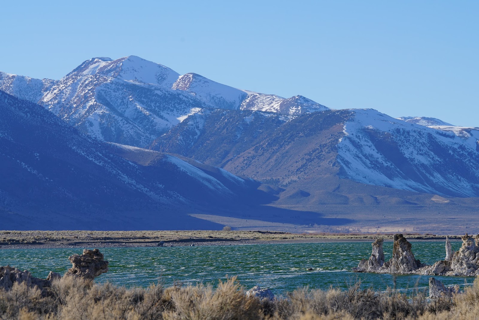
Mono Lake


Dale Matson

Click On Photographs To Enlarge
Mono Lake Photographed From On Top Of Mammoth Mountain
(22 miles away as the crow flies using a 400mm lens)

As you drive east through Yosemite National Park on Highway 120, you pass through Tuolumne Meadows. Continuing east you pass through the gate at Tioga Pass at almost 10,000’. As you drive the steep descent toward Lee Vining CA, The stark sight of Mono Valley begins to appear as a sharp contrast to Tuolumne’s lush green and mountainous ambiance.

In the middle of Mono Valley lies Mono Lake. There is a great deal of politics surrounding the water that feeds Mono Lake, which has no outlet. Because there is no outlet, the lake has more than twice the salinity as the ocean and the more freshwater routed away from Mono Lake and to Los Angles, the lower the level and the more saline the water. Because the saline content is so high, the lake has a deep blue color different than freshwater lakes. https://en.wikipedia.org/wiki/Mono_Lake


Legal action has now established a suitable level that is lower than before fresh water was routed away from the lake but higher than it is now. There is a sign along the trail where the hoped for increased water level will be. The latest lengthy California drought has slowed much of the lake elevation goal. The irony is that the higher the water rises in the lake, the more the famous Tufa’s are lost from sight by the water.


I found it to be a windy and barren sight with a unique brutal beauty. There is a parking area, three-dollar entry fee, bathrooms and an established trail with informational signs placed along the way. The lake is an important flyway for birds and the Brine Shrimp in the lake provide a food source.