Dale Matson
Click On Photographs To Enlarge
So, you thought that the only thing
preserved from the original Fresno County seat town of Millerton was the
historic courthouse. Fort Miller (named after Major Albert S. Miller) and the
town of Millerton have been below the waters of Millerton Lake since the dam
was completed in 1942.
The occupants of the
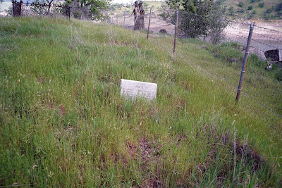
Winchell Cove Cemetery are listed in one article as deceased soldiers from Fort
Miller. https://www.findagrave.com/cgi-bin/fg.cgi?page=cr&CRid=2375588
However
the link which actually names many of the deceased https://www.findagrave.com/cgi-bin/fg.cgi?page=gsr&GScid=2375588
suggests
that there were also residents from the town of Millerton near the fort who
were also buried there. The cemetery plaque simply states “Pioneers of the
Millerton area”. The hospital at Fort Miller was later used as the Millerton School.
https://en.wikipedia.org/wiki/Fort_Miller,_California
Millerton was the original
Fresno County seat when Fresno County also included what is now Madera County
and parts of other counties. Millerton was conveniently located along the banks
of the San Joaquin River and near the Los Angeles to Stockton road. (The
memorial refers to the “Visalia to Stockton Road”). I remember reading a story
from Clarence King’s book, “Mountaineering In The High Sierra,” where he wrote
of traveling from the village of Visalia
to Millerton and having to outrun two bandits who dogged his heals most of the
way.
The demise of Millerton was
the result of being flooded by the San Joaquin River (1867) and the
establishment of a railroad station near what is now central Fresno (1872). https://en.wikipedia.org/wiki/Millerton,_Madera_County,_California
The cemetery is not an easy
place to locate. I paid $20.00 at the Winchell Cove pay gate to gain entry to
the marina parking area. The ‘official fee’ is $10.00 but the machine rejected
every bill I inserted except a $20.00 dollar bill!
The cemetery is located on
a small peninsula that juts out into Winchell Cove and is accessed by following
a dirt road that dead ends and turns into a use trail up to the top of the
hill. The cemetery is near that area.
Why does this story have
particular meaning for me? My Father’s family immigrated to Quebec from Ireland
in 1832. They settled in a place near Quebec City in a place called Cranbourne.
The Matson’s that died there were buried in the St. George’s Anglican Cemetery
in Cranbourne. That cemetery existed from 1851 to 1973. Eventually the town of
Cranbourne became predominately French. A French landowner wanted the land were
the cemetery was located. The deceased were exhumed and relocated to the
cemetery at Christ’s Church of Springbrook near Frampton Quebec. My wife and I
viewed the graves of my family who hopefully will continue to RIP there.
View Of Peninsula And Marina Beyond From East Side Of Cove. Far Right Above Is Winchell Point.


I lived near Frampton and I visited the cemetery a few days ago. I photographed some gravestones, very interesting!
ReplyDeleteIt is a lovely location. I can't remember if the Church is still in use. My relative were town officials in Cranbourne and the records were originally in english. Then the records were in French. Thanks for commenting and God Bless.
ReplyDeleteIf you are interested, here is more of my families experience immigrating to Quebec from Ireland.
ReplyDeletehttp://sanjoaquinsoundings.blogspot.com/2011/11/gift-of-lineage.html
Hi Dale (Jim and I were on the Millerton eagle tour yesterday) I found the cemetery. I walked in from the Blue Oak Trail. Beautiful spot. Thanks for telling me about it. Lynette
ReplyDeleteThanks folks. Glad we met and chatted.
ReplyDelete