Dale Matson
Note: I have two photographs I added today taken 10 days later to show the drastic drop in water levels because of the massive Millerton Lake water release. According to the Fresno Bee today (March 14th) Millerton Lake has now been intentionally reduced from over 80% capacity to a paltry 57% capacity. This is a disgrace. This is not flood control. It is massive waste of water, a precious resource.
Click On Photographs To Enlarge

Hike Route Ambit 2 Upload To Movescount
This hike route we took is about 5.5 miles round trip with
about 900’ of altitude gain. The trailhead is about 1,400’ in elevation and
begins at a locked gate on Wellbarn Road. Wellbarn Road begins at Marshall
Station off Auberry Road and heads north. There is a restaurant on the corner called "Don Fernando's". When you come to a locked gate, you
are at the trailhead and there is limited parking there. After the gate the
road is referred to as Spearhead Road on my topographical map. The outbound
route to the river is downhill to the river and it is a long climb back out!
Sharon and I decided to visit another section of the San
Joaquin River we have not been to before. The Temperance Flat section of the
San Joaquin River is below the San Joaquin River Gorge section. That section
has a trail and footbridge across the San Joaquin River. That section is
accessed off Powerhouse Road out of Auberry. The Temperance Flat section is
more like a lake and is quite wide. It is the possible site of a new dam
between Kerckhoff Reservoir and Millerton Lake that would increase water
storage by about one million acre feet.
This was a good time of year for this hike with lots of
greenery, moderate temperatures and no mosquitos yet. The initial portion of
the trail has lovely ponds on either side with groups of grazing cattle and an
occasional coyote. Occasionally you will see bluffs above you which are the
location of the original river bed. Most of the birds are crows or buzzards
with an occasional hawk. I would recommend staying on the road since there is
poison oak along the sides of the road. There is evidence of some maintenance
with cut brush but big wash areas too.
We passed a few folks. Some had dogs on and off leash and
some were on mountain bikes. Trail runners have also discovered the route. Some
of the mountains to the east were visible with snow. It was not long before we
could see the Kerckhoff Power Plant far below us along side the river. If the
dam is built this power plant will be under water.
We crossed the San Joaquin River Trail just before leaving
the main road. The trailhead for the SJR Trail is at the end of Sky Harbor Road
in the Finegold Day Use area. Near the
end we had to decide whether to follow a drainage area to the river or stay on
the road. My GPS map route indicates our decision. We passed one occupied and
fenced property and two empty derelict cabins.
We packed lunches so sitting by the water with a gentle
breeze was just glorious even knowing the tough and long climb back out. I am
currently recovering from anemia and my cardiologist advised me to keep my
heart rate below 110 bpm. I have always used a heart monitor for exercise so I
could keep track. It was a tall order and a very slow walk back up to our
vehicle with lots of sit down rests. Sharon was patient and carried my water.
If you have a choice of hiking the San Joaquin River Gorge
Trail or this trail I recommend this trail first if you have no physical
limitations. It is also much less traveled.
My photographs were taken with a
Sony A7R2 with 85, 50 and 28mm lenses.

(God's Dogs) Coyote


*March 14 Only 10 Days Later See Below


Bluff Elevation - The Original River Elevation

Guardian Angel And Water Bearer

San Joaquin River From Trail Above


The San Joaquin River Trail As It Crosses The Road


At River Level

*March 14th Only 10 Day Later See Below

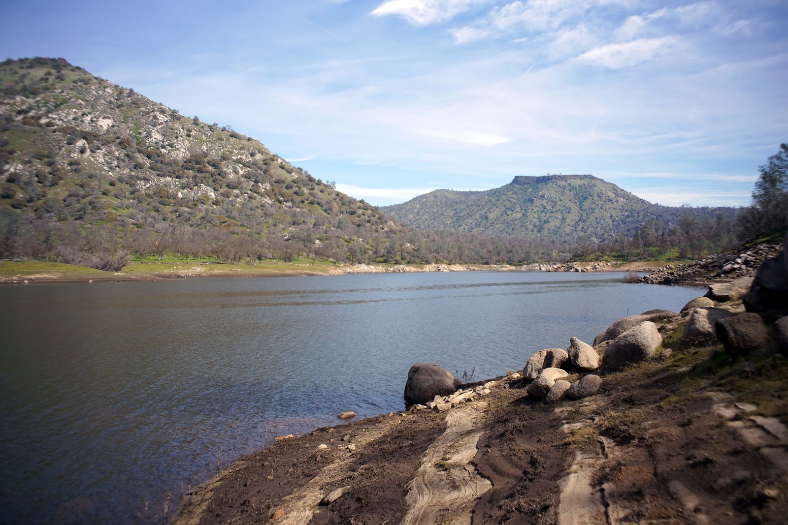
Indications Of Higher Water Levels Determined By
Millerton Lake Outflow


Poison Oak With New Leaves 'You're Going To Need An
Ocean Of Calamine Lotion' (Coasters- "Poison Ivy")


Two Unnamed Knobs Across The River About 2,100'


Kerckhoff Power Plant

Pond Near Trailhead

This Is From the Wikipedia Article On The Temperance Flat Dam
https://en.wikipedia.org/wiki/Temperance_Flat_Dam
*Take a good look at the wasted water released from Millerton Lake in just a 10 day period comparing photographs from above and at river level. This is an example of flood control!
No comments:
Post a Comment