Dale Matson
Click On Photographs To Enlarge

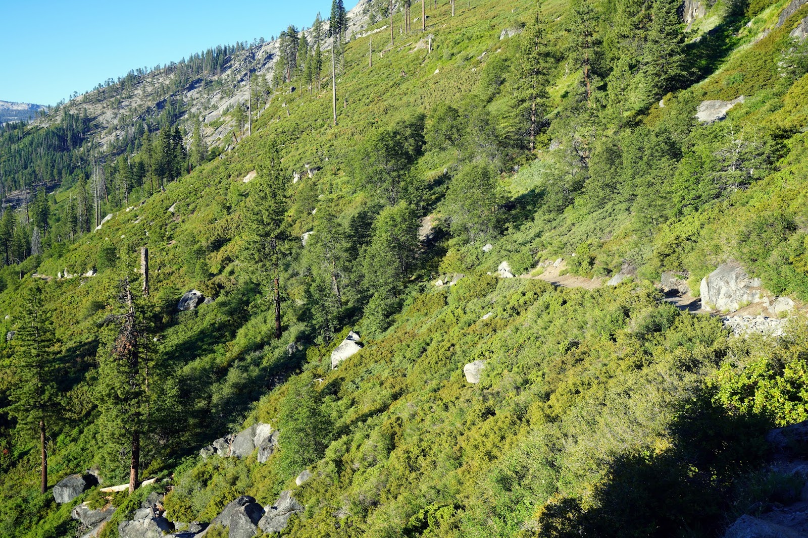
From The Panorama Trail
I have a May 2017 post on this hike with more water and particulars.
Since Yosemite was essentially closed until the permit system was instituted because of Covid19, Sharon and I were unable to get there. I got a seven-day permit which began Sunday.
We knew it was a long hike out with almost 1,400’ of climb and a 5-mile round trip. We also knew it would be hot so we left for Yosemite at 4am. Our permit said the hours were 5am to 11pm. However, when we arrived at the gate about 5:15am there was no one in the booth and we had to fill out a form to self-register. It was to be kept on our dash in our truck.
The trailhead for the Panorama Trail is at Glacier Point. We arrived shortly after 6am and there were already several cars parked in the lot. There were also several cars parked along Glacier Point Road who I assume had backpacking permits. When we began our hike, it was relatively cool but still tee shirt and shorts weather. If you are a photographer, there is not much point taking photographs outbound. As you descend to the falls the sun coming from the east means you are photographing directly into the sun. There is some shade on the exposed trail which helps on the climb out if you can find a rock for sitting.
I believe it is called the Panorama Trail because most the major features of the park are laid out before you including Mount Clark and the Clark Range. Don’t believe the signage on the quaint metal signs which indicate the hike as two miles from the trailhead. I have measured this distance with numerous devices for many years and it is 2.5 miles down to the bridge across the falls. The total distance for us was 5.38 miles counting the distance from our truck and back. It took us about four hours hike time. It was 80 degrees when we got back to our truck. Young folks could go much faster, especially if they were not taking photographs. The trail gives a different look to Half Dome. You can hear the sounds of the falls for the entire time you are on the trail. There is one spot above the Illilouette Falls where you can get a pretty good photograph. You can tell where a trail departs the main trail above the falls. Be very careful however because the granite boulders are covered with slippery scree and it would be a deadly fall from there.
We really enjoyed the cool of the area by the falls and Sharon got lots of photographs of the wildflowers on the way down and at the falls. We each used one bottle of water on the descent although we carried two bottles each. I refilled our bottles and put in a purification tablet for the trip back. We used both bottles each on the climb out.
I recognized a trail runner from Fresno who went by us very fast. He trains with Oswaldo Lopez and was headed to Half Dome. That is the hard way to get to Half Dome and back! Ah, the memories from the days I used to dance down the trails. At age 75 I feel fortunate to still be able to do some of the shorter trails.
I’m not sure but it seems like there are a lot more logs jammed up under the bridge than I ever remember. I worry that in a heavy water year, the logs could get jammed under the bridge and take it out.
When we left Glacier Point, we passed the parking area for Sentinel Dome. It was jammed with cars and many were parked along the road too. I was surprised at how many cars there were with the permit system in place, which cut in half the normal traffic.
I used a Sony A7R4 with The Sony 16-35mm GM 2.8 lens.


Mount Hoffman Center Left Half Dome Center Right

Don't Get Too Close To The Edge Here!


North Dome Center Left


Cloud's Rest Center Right


Nevada And Vernal Falls Liberty Cap Center Right


Mount Clark Center


Some video clips are included here on YouTube
No comments:
Post a Comment